
Pascagoula River Field Report: The Last Unimpounded Large River, Bottomland Hardwoods, and a Mississippi Conservation Story
Updated: 4 days ago
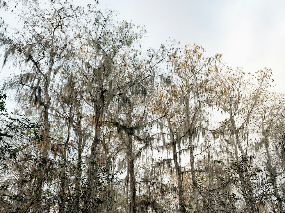
The river does not announce itself. You come down off a pine ridge in George County, the road drops through a band of loblolly and sweetgum, and then the ground goes soft and dark and the trees change all at once. Bald cypress with knees like a crowd of stumps. Tupelo with swollen bases still carrying the mud line of last winter's high water, a stain well up the trunks. A barred owl starts up somewhere you can't see, and another answers from across a slough. Then the river is there, wide and tea-colored and moving with a kind of patient weight, sliding past a pale sandbar that will likely be underwater again by late winter.
Mid-October is a good time to stand here. The water is usually low, so the river shows its bones: sandbars at the bends, cut banks with roots hanging in the air, shallow runs where the current talks. The bottomland oaks are dropping acorns, wood ducks whistle out of the oxbows at first light, and the first cool fronts are starting to push down out of the Pine Belt toward the coast.
What makes all of that possible is a fact that sounds almost administrative until you understand it: the main stem of this river was never dammed. The Mississippi Department of Wildlife, Fisheries, and Parks (MDWFP) describes the Pascagoula as renowned as the largest undammed river in the contiguous United States, flowing freely for approximately 80 miles from the confluence of the Leaf and Chickasawhay to the Gulf. The Mississippi Gulf Coast National Heritage Area's blueway guide, citing the National Park Service, calls it "the last large unimpeded river system in the lower 48 states." The Nature Conservancy says one of the largest undammed rivers. The wording varies by source, and none of those pages publishes the measurement behind the ranking, so this report quotes each one in its own words. This report is about what an unimpounded river actually does on the ground, which species depend on it, how the land around it came to be protected, and how the 2026-27 seasons move through a floodplain that still runs on its own clock.
An Ecology Snapshot: A Floodplain That Still Floods
Start with the shape of the system, and with numbers that are easy to blur together. The Leaf River runs southeast past Hattiesburg, where the Bouie River joins it, and on through the Pine Belt and the De Soto National Forest country. The Chickasawhay comes down from the north and east. The two meet in northern George County, near Merrill, and below that confluence the Pascagoula proper runs south through George and Jackson counties to Mississippi Sound at the city of Pascagoula, according to a 1978 U.S. Geological Survey report. Black Creek, with Red Creek feeding it, drains De Soto National Forest country and comes in from the west. The Escatawpa joins from the east near Moss Point.
Here is how the measurements sort out, and why they should stay in separate rows. The free-flowing main stem below the confluence is about 80 miles, per MDWFP's fishing page. USGS Open-File Report 85-94, published in 1985, says the Pascagoula flows for about 264 miles and drains a total of 9,498 square miles; that is the length and area of the whole system, not the main stem. The USGS gage on the Pascagoula at Merrill in George County, just below the confluence, has a drainage area of 6,590 square miles, which is the basin upstream of that gage. The same 1985 report gives an average flow at Merrill of 9,873 cubic feet per second.
Nearly every big river around the Pascagoula has been reshaped by locks, dams, or reservoirs. The Pascagoula's main stem stayed free, and its floodplain still behaves the way a Coastal Plain floodplain should. In a typical year, winter and spring rains push the river out of its banks and across the bottoms. Water spreads through the cypress-tupelo flats, fills the sloughs, and reconnects the oxbow lakes to the channel. Then, as late spring turns to summer, the water drops. Fish that moved into flooded timber are funneled back toward the river. Sandbars rebuild on the inside of bends. By late summer and fall the river is usually at its lowest and clearest, and the floodplain becomes a mosaic of drying flats, deep permanent sloughs, and ridges that never went under.
The forest is sorted by that water. The lowest, longest-flooded ground belongs to bald cypress (Taxodium distichum) and tupelo (Nyssa), the trees that can stand in water for long stretches. Slightly higher, overcup oak (Quercus lyrata) takes over; it tolerates long flooding and drops an acorn wrapped almost entirely in its cap. Higher still come the natural levees and terraces, where water oak (Q. nigra), willow oak (Q. phellos), cherrybark oak (Q. pagoda), sweetgum (Liquidambar styraciflua), and spruce pine find their footing. A rise of a foot or two shifts the whole community. A 2008 study of swallow-tailed kites in the Pascagoula basin, published in the Journal of Raptor Research, describes its Jackson and George county study area in exactly those terms: bald cypress and black tupelo swamp, sweetgum and oak bottomland, and pine bluffs.
Above the bottoms sit the uplands, and that contrast is the other half of the Pascagoula story. De Soto National Forest, about half a million acres by the Forest Service's own approximate figures and the largest national forest in Mississippi, wraps the western side of the basin with longleaf pine ridges managed with prescribed fire, grassy understory, and boggy seeps. Its De Soto Ranger District spans counties from Forrest and Perry down to George, Harrison, and Jackson. So the river does not run through an island of protected bottomland. It runs through a landscape where fire-adapted pine ridge and flood-adapted swamp sit side by side, often within a mile of each other.
The Conservation Story: From One Purchase to a Corridor
The protection along the Pascagoula has a history worth getting right, because it is often compressed into one number.
In 1974, The Nature Conservancy made what it describes as its largest purchase at the time: 35,000 acres of Pascagoula bottomland. TNC says that land eventually created the Pascagoula River Wildlife Management Area, now managed by MDWFP. That 1974 figure is the purchase, not today's WMA total. The 2026-27 MDWFP Outdoor Digest lists Pascagoula River WMA at 39,150 acres, with Vancleave as the nearest town.
TNC kept building around that core. It reports a 2016 purchase of 2,100 acres along the Leaf and Pascagoula in George and Greene counties, and says that tract connected more than 450,000 contiguous acres between De Soto National Forest and the WMA. A 2018 purchase added another 1,232 acres. TNC also says the river corridor is now buffered by almost 70,000 acres of public and private protected land. The Mississippi Forestry Commission, writing in January 2020 about the Pascagoula River Conservation Lands Project, describes an 85-mile forested corridor conserved since the early 1970s and quotes a partner calling the Pascagoula "the largest unimpeded river in the contiguous U.S."
Downstream and nearby, the public-land picture fills in. The 2026-27 digest lists Ward Bayou WMA at 13,234 acres, nearest town Moss Point, and Leaf River WMA at 41,350 acres near Wiggins, which the digest marks as Forest Service property. On the De Soto Ranger District, Black Creek is Mississippi's only national wild and scenic river, and the Black Creek Wilderness, established in 1984, covers slightly more than 5,000 acres.
What the Interface Creates
The word interface fits here because the Pascagoula's value lives at boundaries: river and floodplain, swamp and pine ridge, fresh water and salt. An undammed main stem keeps those boundaries moving, and moving boundaries are where species find what they need.
Begin with temperature and sediment. Below a large dam, a river often runs colder or warmer than it naturally would, and the reservoir traps the sediment that would otherwise build bars downstream. On the Pascagoula's main stem, temperature tracks the seasons, and sediment keeps moving toward the coast to build bars and feed the marshes near the mouth.
The Gulf sturgeon (Acipenser oxyrinchus desotoi) makes the case for connected rivers better than any argument. It is a large, long-lived fish that moves between salt water and rivers, and it is federally listed as threatened. Researchers from the University of Southern Mississippi, publishing in Transactions of the American Fisheries Society in 2004, verified a Gulf sturgeon spawning area on the Bouie River north of Hattiesburg by collecting eggs there. The site sits 250 river kilometers upstream from the mouth of the Pascagoula, on hard substrate and gravel in turbulent, high flow. The same study adds a useful caution: it suggests that deep in-channel gravel pits near the site may explain why fish stay and overwinter there. The story is not a pristine highway, but it is a connected river that still lets a Gulf fish reach a gravel shoal in the Pine Belt.
The Nature Conservancy describes the yellow-blotched sawback, also called the yellow-blotched map turtle (Graptemys flavimaculata), as exclusive to this area, and the MDWFP digest names it among the species some WMAs can be managed for. Map turtles bask on deadfall over moving water and nest on open sand, both renewed by a free-flowing river, so a sandbar in late spring and summer may be a nursery.
Birds may be the best measure of how much habitat the corridor holds. The Nature Conservancy counts at least 327 bird species in the watershed. Swallow-tailed kites use the basin's bottomlands in the breeding season; the 2008 Journal of Raptor Research study tracked radio-tagged kites in the Pascagoula basin by airplane one to three times per breeding season from 1997 through 2004. Prothonotary warblers, the golden birds of flooded woods, are a common summer sight along the sloughs.
The floodplain also shapes the game species that draw most people here. White-tailed deer use the bottoms as cover and the oak flats as food, then shift toward ridges, levees, and pine edges when water rises. The mix of red-oak-group species, which take two seasons to mature acorns, and white-oak-group species like overcup spreads the mast supply across years and elevations, so a poor year for one group is often softened by the other. Wild turkeys roost over water in big cypress and bottomland oaks and fly down at dawn to the higher ground. Wood ducks nest in cavities along the sloughs and use the oxbows year-round.
The fish community is what a river angler would hope for. MDWFP's October 12, 2026 Pascagoula River report lists bass, crappie, bream, and catfish, and names oxbows including Dead River, McCrae Dead River, Big Lake, and Caswell Lake. Those oxbows are the floodplain's memory of where the channel used to run, and the flood pulse keeps reconnecting them.
Migration and Timing Signals
The calendar on the Pascagoula is written by water level, temperature, and day length, and the wildlife follows. Here is how the 2026-27 year moves. Every date below comes from MDWFP's 2026-27 digests; confirm current regulations with MDWFP before you go.
Deer and a late southern rut. MDWFP's article on what triggers the whitetail rut lays out regional timing that puts the southeast last. For Southeast Mississippi it lists the pre-rut from early December into early January, the peak rut from early January into early February, and the post-rut from late January into mid-February, compared with a peak of early to mid December in northwest Mississippi. MDWFP also maintains a breeding date map for finer local detail. October and November are acorn months in the bottoms, and deer feed heavily on the oak flats when water is low enough to walk. As winter water arrives, deer move to ridges, levees, and pine edges, which concentrates them.
The 2026-27 Outdoor Digest defines the Southeast Deer Management Unit as private and open public lands south of U.S. Highway 84 and east of Mississippi Highway 35, where a legal buck has at least a 10-inch inside spread or a 13-inch main beam. Its season windows appear in the planning section below. The digest is explicit that WMAs are not open public land, so those dates do not apply on Pascagoula River WMA, and we could not find a 2026-27 Pascagoula River WMA rules sheet as of mid-October. Confirm current regulations with MDWFP.
Turkey and spring green-up. MDWFP's 2026-27 digest sets the 2027 spring youth season March 8-14 on private and authorized public lands, and the regular season March 15 through May 2. Residents may take one adult gobbler or gobbler with a 6-inch or longer beard per day, three per season. Nonresidents are limited to two per season with only one before April 1, and cannot hunt public land before April 1 unless drawn for a nonresident public lands permit or a WMA draw hunt. All turkey hunters must use Game Check. A spring rise can push birds off the low ground for days, while a dry spring lets them strut on levees and sandbar edges. Confirm current regulations with MDWFP.
Ducks and water. The 2026-27 MDWFP Migratory Game Bird Digest sets statewide duck, merganser, and coot dates of Nov. 27-29, Dec. 4-6, and Dec. 9, 2026 through Jan. 31, 2027, with a six-duck daily bag that includes no more than three wood ducks and three pintails. Youth, veterans, and active military days are Feb. 6-7, 2027. Non-toxic shot is required for waterfowl and coots. The digest lists Pascagoula WMA as a public waterfowl area and warns that public areas may differ from statewide dates. Confirm current regulations with MDWFP.
Gulf sturgeon. Sturgeon move between the Gulf and the river system seasonally, and the Bouie spawning site described above is the best-documented point upstream. The species is federally protected and never a target. If you hook one by accident, release it immediately with as little handling as possible.
Fish through the seasons. Spring high water spreads fish into flooded edges and backwaters. Summer, once the river drops, is bream season in the sloughs and oxbows. Fall low water concentrates bass at creek mouths and deeper bends, and catfish feed ahead of winter. MDWFP applies a black bass rule on the river: from Merrill down to the Highway 90 bridge, including connected oxbows and the East and West Pascagoula rivers, black bass under 12 inches must be released and the daily creel is 10. Confirm current regulations with MDWFP.
Water levels. Expect the highest water from winter into spring and the lowest from late summer into fall, with tropical systems able to spike the river at any time. Watching the USGS gage at Merrill is the single most useful planning habit a Pascagoula visitor can build.
On the Ground: Lucedale, Wiggins, Lumberton, Hattiesburg
The Pascagoula country is spread out, and the town you pick shapes your trip.
Lucedale, the George County seat, sits closest to the middle river. The confluence near Merrill is a short drive north, and Pascagoula River WMA spreads along the river in George and Jackson counties. If your trip centers on bottomland walking, WMA hunting under that area's current rules, or putting a boat in on the middle river, Lucedale is a practical base. Vancleave, which the digest lists as the WMA's nearest town, works for the southern end.
Wiggins, in Stone County, sits on the De Soto National Forest side. The Forest Service lists it among its district-office towns, and the 2026-27 digest places Leaf River WMA near it. It is the gateway to Black Creek and to the burned pine ridges where the upland half of the Pascagoula story lives.
Lumberton is a quieter jumping-off point on the western edge of the De Soto country, with an easy run north to Hattiesburg and east into the forest.
Hattiesburg is the hub: the largest city in this part of the basin, where the Bouie meets the Leaf, with the most lodging, food, and outdoor retail. The Gulf sturgeon spawning site sits on the Bouie just north of town. It is the right base for visitors who want comfort at night and wild country by day.
At the bottom of the river, Moss Point and Pascagoula offer a different angle. The Pascagoula River Audubon Center at 5107 Arthur Street in Moss Point is temporarily closed for structural and cosmetic repairs, according to Audubon, with work that may take up to 12 months and no reopening date posted. Check Audubon's page before you plan around it. The lower river's bayous, where cypress gives way to marsh, still show the salt end of the system. Ward Bayou WMA, at 13,234 acres with Moss Point as its nearest town, anchors public land on that lower stretch.
Planning Your Trip, Season by Season
The Pascagoula rewards people who plan around water. Seasons, limits, and WMA rules change, and the statewide digest dates do not apply on WMAs, so confirm current regulations with MDWFP, and with the U.S. Forest Service for De Soto National Forest rules, before every trip.
Fall (mid-October through November)
Deer: Southeast unit archery runs Oct. 15 through Nov. 20, 2026 on private and open public land, followed by gun with dogs Nov. 21 through Dec. 1. Scout oak flats and the edges between bottoms and pines while water is low. On Pascagoula River WMA, use only the current WMA sheet. Confirm current regulations with MDWFP.
Fishing: low, clear water concentrates bass at creek mouths and deep bends; catfish feed heavily; oxbows fish well on cool mornings.
Ducks: the first statewide segment opens Nov. 27-29, 2026. Confirm current regulations with MDWFP.
Paddling: prime float season, with exposed sandbars and comfortable temperatures. Check the Merrill gage, since fall fronts and tropical systems can raise the river fast.
Winter (December through February)
Deer: primitive weapon Dec. 2-15, gun without dogs Dec. 16-23, gun with dogs Dec. 24 through Jan. 20, then archery and primitive weapon Jan. 21-31 and legal bucks only Feb. 1-15, all in the Southeast unit outside WMAs. With the southeast's peak rut in January, the late season is the headline. Confirm current regulations with MDWFP.
Waterfowl: Dec. 4-6 and Dec. 9, 2026 through Jan. 31, 2027 statewide, with youth, veterans, and active military days Feb. 6-7. Wood ducks and puddle ducks use flooded timber and oxbows when water is up. Public areas may differ. Confirm current regulations with MDWFP.
Water: rising and high water is normal. Interior access may require a boat, and high water is cold and fast. Small boats and inexperienced paddlers should stay off the river at flood stage.
Spring (March through May)
Turkey: youth March 8-14, 2027; regular season March 15 through May 2, 2027, with separate resident and nonresident bags and a nonresident public-land restriction before April 1. Expect gobblers to roost over water and work levees, ridges, and burned pine edges. Confirm current regulations with MDWFP.
Fishing: bass and crappie move into flooded edges and backwaters as water warms.
Birding: prothonotary warblers and swallow-tailed kites arrive; paddling the lower bayous is at its best.
Summer (June through August)
Fishing: bream season in the sloughs and on shallow flats; catfish at night; bass early and late.
Sandbars: treat open sand above the waterline as possible turtle nesting habitat, and keep dogs leashed on the bars.
Public versus private access
Public: Pascagoula River WMA, Ward Bayou WMA, and Leaf River WMA offer public hunting under WMA-specific MDWFP rules, which can differ from the statewide calendar. De Soto National Forest provides large blocks of upland and creek-bottom access under Forest Service and MDWFP rules. The river itself is open to boats and paddlers from public landings.
Private: much of the land beside the public blocks is private timber and hunting ground, and many deer camps and lodges operate on leased or owned land near the WMAs. The digest's either-sex gun days apply to private land, not to open public land. Never cross onto private land without permission, and know your boundaries, since flooded bottoms make property lines hard to read.
Responsible practices
Respect listed species. Gulf sturgeon are federally protected and must never be targeted or kept.
Treat sandbars and basking logs as habitat. Land and camp near the waterline, and avoid digging or driving on the bars.
Use non-toxic shot for waterfowl, as MDWFP requires.
Pack out everything, and clean boats and trailers of aquatic plants before moving between waters.
Key Takeaways
MDWFP describes the Pascagoula as renowned as the largest undammed river in the contiguous United States, flowing freely for about 80 miles below the Leaf and Chickasawhay confluence.
Keep the numbers separate: about 80 miles of free-flowing main stem (MDWFP), about 264 miles of system length and 9,498 square miles of basin (USGS, 1985), and 6,590 square miles above the Merrill gage.
Pascagoula River WMA is 39,150 acres in the 2026-27 MDWFP digest; it grew from The Nature Conservancy's 1974 purchase of 35,000 acres, and TNC says the corridor is buffered by almost 70,000 acres of protected land.
Gulf sturgeon spawning has been verified on the Bouie River, 250 river kilometers above the mouth, and TNC counts at least 327 bird species in the watershed.
MDWFP places Southeast Mississippi's peak rut from early January into early February, the latest in the state.
Statewide 2026-27 deer, turkey, and duck dates do not apply on WMAs; get the current Pascagoula River WMA sheet and confirm current regulations with MDWFP.
For the Operators
If you run a deer camp, a turkey operation, a fishing guide service, a paddle outfitter, or a lodge anywhere in the Pascagoula basin, you are working inside a river system that state agencies, federal researchers, and conservation groups have been documenting for half a century.
Here is the gap. When a traveler or an AI assistant looks up the Pascagoula, the conversation is owned almost entirely by agencies and conservation organizations. That is good for the river, but the people who know these bottoms day to day, who can say when the acorns dropped this year or which oxbow held bream in July, are mostly absent from the answers. Questions about where to hunt, fish, or stay tend to get answered by agency pages, booking aggregators, and directories, because those are the sources publishing consistently.
There is also an accuracy problem worth owning. As this report shows, the river's numbers are easy to confuse: 80 miles or 264, the WMA or the corridor, the purchase or the current total, the statewide calendar or the WMA sheet. AI tools repeat whatever sources they find. An operator who publishes clear, correct, sourced information about the river, and who explains the late rut, the way high water moves turkeys, or why a June sandbar deserves a wide berth, becomes the kind of source those tools learn to trust.
And there is a quieter issue. Many of the region's sporting businesses were built over decades on word of mouth and repeat guests. When those businesses change hands, that reputation does not transfer automatically. What is written down and findable does.
What you've built deserves to be found.
Frequently Asked Questions
Is the Pascagoula River really undammed, and how long is the main stem?
The main stem, which begins where the Leaf and Chickasawhay rivers meet in northern George County, flows freely for about 80 miles to the Gulf, according to MDWFP's Pascagoula River fishing page. MDWFP describes it as renowned as the largest undammed river in the contiguous United States. A 1985 USGS report gives a separate figure, about 264 miles, for the length of the river system, so the two numbers measure different things.
How many square miles does the Pascagoula basin drain?
USGS Open-File Report 85-94 (1985) says the Pascagoula drains a total of 9,498 square miles. The USGS gage on the river at Merrill in George County measures the basin above that point, 6,590 square miles. Use the first number for the whole river and the second for the gage.
How big is Pascagoula River Wildlife Management Area, and who manages it?
The Mississippi Department of Wildlife, Fisheries, and Parks (MDWFP) manages it. The 2026-27 MDWFP Outdoor Digest lists Pascagoula River WMA at 39,150 acres, with Vancleave as the nearest town. Its core traces to The Nature Conservancy's 1974 purchase of 35,000 acres, which TNC says eventually became the WMA.
What did The Nature Conservancy buy on this river, and in what year?
TNC says its 1974 purchase of 35,000 acres, its largest at the time, eventually created the Pascagoula River WMA. It added 2,100 acres along the Leaf and Pascagoula in George and Greene counties in 2016 and another 1,232 acres in 2018. TNC says the river corridor is now buffered by almost 70,000 acres of public and private protected land.
When is gun deer season on public land in southeast Mississippi for 2026-27?
For the Southeast Deer Management Unit, the 2026-27 MDWFP Outdoor Digest lists gun with dogs Nov. 21 through Dec. 1, 2026, gun without dogs Dec. 16-23, 2026, and gun with dogs again Dec. 24, 2026 through Jan. 20, 2027, with legal bucks only on open public land. Those dates cover private and open public land, and the digest says WMAs are not open public land. Confirm current regulations with MDWFP.
Can you hunt deer with dogs on all of Pascagoula River WMA?
Do not assume so. WMA seasons and any dog and no-dog areas are set in a WMA-specific rules sheet, separate from the statewide calendar, and we could not find a 2026-27 Pascagoula River WMA sheet as of mid-October 2026. Get the current WMA rules from MDWFP before planning any dog hunt there.
When is the rut in the Pascagoula country?
MDWFP's article on what triggers the whitetail rut lists Southeast Mississippi's pre-rut from early December into early January and its peak rut from early January into early February, later than central and northwest Mississippi. MDWFP also publishes a breeding date map by area. Check both and confirm season dates with MDWFP.
Citations and Sources
U.S. Geological Survey -- Open-File Report 85-94, surface water of Jackson County, Mississippi (1985) -- https://pubs.usgs.gov/of/1985/0094/report.pdf -- accessed October 2026
U.S. Geological Survey -- Open-File Report 78-913 (1978) -- https://pubs.usgs.gov/of/1978/0913/report.pdf -- accessed October 2026
U.S. Geological Survey -- Pascagoula River at Merrill, station 02479000 -- https://waterdata.usgs.gov/monitoring-location/USGS-02479000/ -- accessed October 2026
Mississippi Department of Wildlife, Fisheries, and Parks -- Pascagoula River fishing page and report -- https://www.mdwfp.com/fishing-boating/lakes/pascagoula-river -- accessed October 2026
Mississippi Department of Wildlife, Fisheries, and Parks -- 2026-27 Mississippi Outdoor Digest -- https://www.eregulations.com/assets/docs/guides/26MSAB_LR.pdf -- accessed October 2026
Mississippi Department of Wildlife, Fisheries, and Parks -- 2026-27 Migratory Game Bird Digest -- https://www.mdwfp.com/sites/default/files/2026-05/Migratory%20Gamebird%20Digest%2026-27_3.pdf -- accessed October 2026
Mississippi Department of Wildlife, Fisheries, and Parks -- What Triggers the Whitetail Rut? -- https://www.mdwfp.com/wildlife-hunting/private-lands-program/habitat-and-wildlife-information/what-triggers-whitetail-rut -- accessed October 2026
Mississippi Department of Wildlife, Fisheries, and Parks -- Deer Breeding Date Map -- https://www.mdwfp.com/wildlife-hunting/wildlife-species-program/deer-program/deer-breeding-date-map -- accessed October 2026
Mississippi Department of Wildlife, Fisheries, and Parks -- Pascagoula WMA -- https://www.mdwfp.com/wildlife-hunting/wmas/pascagoula-wma -- accessed October 2026
Mississippi Gulf Coast National Heritage Area -- Pascagoula River Blueway -- https://msgulfcoastheritage.ms.gov/wp-content/uploads/2021/06/BLUEWAYS-template-Pascagoula_GC.pdf -- accessed October 2026
Mississippi Forestry Commission -- Pascagoula River Conservation Lands Project (January 2020) -- https://www.mfc.ms.gov/2020/01/pascagoula-river-conservation-lands-project/ -- accessed October 2026
USDA Forest Service -- National Forests in Mississippi Final EIS -- https://www.fs.usda.gov/sites/nfs/files/r08/mississippi/publication/Final%20EIS%20document.pdf -- accessed October 2026
USDA Forest Service -- De Soto Ranger District -- https://www.fs.usda.gov/r08/mississippi/recreation/de-soto-ranger-district -- accessed October 2026
The Nature Conservancy -- A Legacy of Land Protection on Mississippi's Pascagoula River -- https://www.nature.org/en-us/about-us/where-we-work/united-states/mississippi/stories-in-mississippi/a-legacy-of-land-protection/ -- accessed October 2026
National Audubon Society -- Pascagoula River Audubon Center -- https://www.audubon.org/pascagoula-river -- accessed October 2026
University of Southern Mississippi (Heise, Slack, Ross, and Dugo, Transactions of the American Fisheries Society, 2004) -- Gulf sturgeon spawning in the Pascagoula River drainage -- https://aquila.usm.edu/fac_pubs/8630/ -- accessed October 2026
Journal of Raptor Research (Coulson, Coulson, DeFrancesch, and Sherry, 2008) -- Swallow-tailed kite study including the Pascagoula River basin -- https://doi.org/10.3356/JRR-07-08.1 -- accessed October 2026


Comments