
Marketing a Big Bend Coast Operation: Scallop, Redfish, and the Coast the Condos Couldn't Reach
Updated: Jun 12
By Jacob Mishalanie and Thomas Garner, Co-Founders
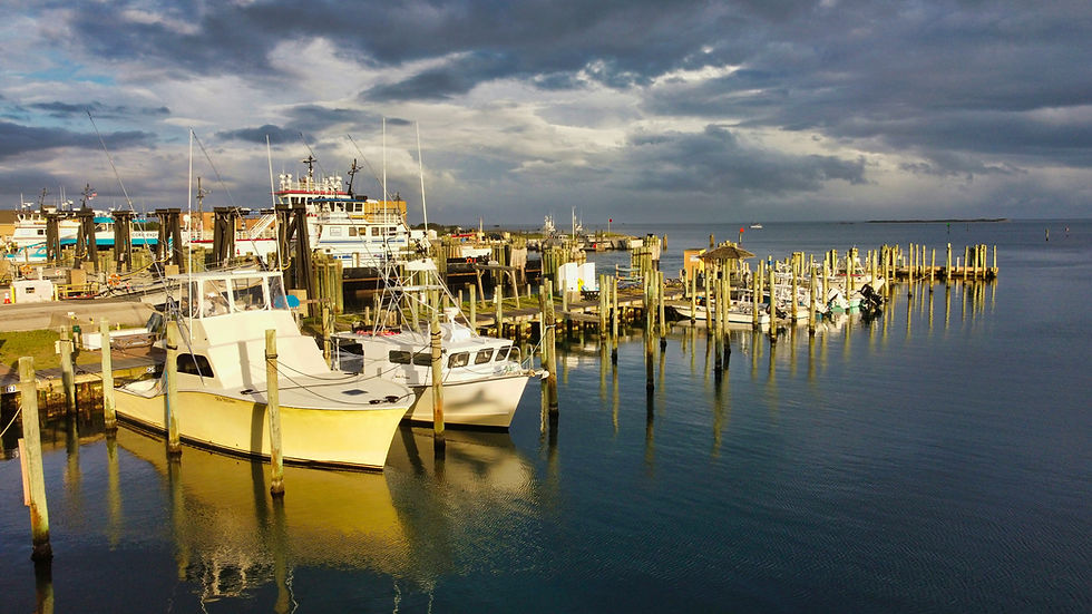
Mid-July, four feet of water over a turtle-grass flat off Keaton Beach, mask down - and a kid pulls his first bay scallop off the blade by hand, the shell clapping shut on his fingers. The boat behind him is a Sea Hag rental. The captain holding the dive flag has run this same flat since before Idalia took the first roof off the marina. There are no condos on the horizon - just salt marsh, the cabbage palm hammocks of the Lower Suwannee NWR to the south, and the brick of the St. Marks NWR lighthouse (1831) to the north. That morning is the Big Bend Coast in one frame. The captain who ran it does not appear in the top ten Google results for 'Big Bend scallop guide.'
This is the Pine and Marsh Big Bend marketing playbook, drawn from our 09-series Florida field briefs and our 2,206-outfitter Southeast audit. If you would like a direct read on your Big Bend operation before you finish reading, the audit conversation is a short call away.
The Big Bend is the undeveloped elbow of the Florida Gulf, running from St. Marks down through Steinhatchee, Keaton Beach, Horseshoe Beach, Suwannee, and Cedar Key - no barrier islands, no high-rises, just spring-fed rivers and seagrass. Sea Hag Marina, Steinhatchee River Inn, the St. Marks NWR (one of the oldest National Wildlife Refuges in the system, established 1931), Lower Suwannee NWR, and the Cedar Key clam aquaculture economy anchor a working-coast tradition that the rest of Florida paved over fifty years ago. The captains here have a structural scarcity advantage they cannot replicate further south - and a marketing problem, exposed sharply by Idalia and Helene, that compounds every year they don't address it.
The Coast the Condos Couldn't Reach
The corridor's moat is geology - a shallow, marsh-fringed bottom that ran every condo developer off the map. From Pasco County north to Apalachee Bay, the Big Bend is the lightly developed elbow of the Florida Gulf where peninsular Florida turns into the Panhandle. There are no barrier islands, no high-rise build-out, just spring-fed rivers - Suwannee, Steinhatchee, Econfina, Aucilla, St. Marks, Wakulla - draining into the Gulf without interruption.
The country knows the Big Bend as the place where the scallop season opens. The captains who have figured it out know it as the Florida coast that physically cannot be paved over, and as the structural-scarcity hedge against the rest of the state densifying. That structural scarcity is the central marketing argument, and it should headline every Big Bend operator's content strategy.
The Habitat, Mapped the Way Operators Should Publish It
The habitat reads like a layered map most operators have never put on a website.
Big Bend Seagrasses Aquatic Preserve
The Big Bend Seagrasses Aquatic Preserve runs the entire arc - among the largest seagrass preserves in the lower 48 - and frames the redfish, trout, and flounder fishery year-round. St. Marks NWR (approximately 70,000 acres, established 1931) anchors the north end; Lower Suwannee NWR (approximately 54,000 acres) and Cedar Keys NWR's offshore islands bracket the south.
Anchor Towns and Marinas
Anchor towns run north-to-south: St. Marks, Keaton Beach, Steinhatchee, Horseshoe Beach, Suwannee, Cedar Key, Yankeetown. Sea Hag Marina is the Steinhatchee aggregator and owns 'Steinhatchee scallop charter' outright in organic search. Cedar Key layers a globally significant clam-aquaculture economy on top of the inshore guide stack - the largest farmed-clam producer in Florida, by a wide margin.
Scallop Season: The Signature Vertical
Florida Bay scallop (Argopecten irradians) season is the defining annual event on this coast. FWC sets zone-by-zone openers with the Big Bend zones generally running late June through September, varying by zone and year. The primary harvest zones include Homosassa, Crystal River, Steinhatchee, Keaton Beach, and St. Marks. Peak search volume hits in late June and early July as families from across the Southeast plan their annual scallop trips. The entire Big Bend scallop fishery is a regulated, quota-managed recreational harvest - no commercial scallop operations - which concentrates all the customer-acquisition opportunity in the charter and rental boat sector. A scallop-by-week calendar with real photos and real zone-level catch reporting is the single highest-leverage content piece a Big Bend operator can publish.
Idalia and Helene Rebuild
Hurricane Idalia (Cat 3 Keaton Beach landfall, August 2023) and Helene (September 2024) thinned the active-operator count and reshaped the marina map fourteen months apart. The recovery is real but not finished, and the editorial demand for an operator-credible status hub is as high as it has been on this coast since the early-2000s grouper-rule reset.
Inshore Fishing: The Year-Round Foundation
Redfish (red drum) are the anchor species on the Big Bend grass flats, available year-round with a strong September through November run as fish stage up on the seagrass edges. FWC slot limit is 18 to 27 inches in the Atlantic/Gulf zone with a one-fish-per-person bag limit. Speckled seatrout overlap most of the calendar with seasonal closures that vary by FWC zone. Flounder gigging anchors the night-fishing economy from September through November, with the Steinhatchee River mouth and Cedar Key cuts running strong traditional gigging pressure.
Snook is the emerging story. Documented northward range expansion driven by warmer Gulf surface temperatures is pushing snook into the Big Bend mouth zones - St. Marks, Steinhatchee, and Suwannee River outlets - at a rate that has pushed FWC to revisit zone-specific snook management. Any operator publishing a dedicated snook range expansion piece with real catch-position data will own that search surface for years.
Homosassa and Crystal River: The Manatee Layer
Just south of the core Big Bend arc, Homosassa and Crystal River add a manatee eco-tourism overlay that reframes the marketing posture entirely. Kings Bay (Crystal River) and the Homosassa River springs host the largest concentrations of West Indian manatees in the US during the winter months, protected under FWS Crystal River NWR and Homosassa Springs Wildlife State Park. FWS manatee protection zones restrict vessel speed and activity in designated areas - a regulatory layer that any operator running trips in these waters must understand and communicate in their content.
Snook in the spring heads at the Crystal River and Homosassa are a trophy-class fishery that almost no operator explicitly markets. The combination of manatee ecotourism in winter and premium snook-in-spring and summer fishing is a bundled marketing opportunity with no direct competitor in the state.
The Suwannee River Mouth and Cedar Key Corridor
The Suwannee River empties into the Gulf of Mexico through the Lower Suwannee NWR (54,000 acres, designated 1979), one of the least-visited NWR units on the Gulf Coast. The tidal zone from the Suwannee mouth south through Cedar Key carries redfish, trout, black drum, and sheepshead across a mixed bottom of oyster reef, seagrass, and open sand. Cedar Key's world-class farmed-clam aquaculture - the largest in the state - creates a visual and narrative backdrop that differentiates this fishery from every other inshore saltwater market in Florida.
Cedar Keys NWR encompasses the offshore shell mound islands that produced most of the nineteenth-century shellfish harvest along this coast. The islands' anchor permit and tripletail fishing are not currently marketed by any charter with dedicated content.
St. Marks NWR and the Public Lands Layer
St. Marks National Wildlife Refuge (70,000 acres, established 1931) is one of the oldest NWR units in the Southeast and anchors the northern end of the Big Bend arc. The St. Mark's lighthouse (1831) is the visual icon of the coast. The refuge hosts one of the highest concentrations of overwintering waterfowl and monarch butterflies in the Southeast, and the impounded freshwater units carry largemouth bass and crappie. The Apalachee Bay flats immediately north and east of the refuge mouth are productive for redfish and trout but carry almost no dedicated operator content.
Offshore Access: Grouper and Snapper
Steinhatchee and Horseshoe Beach are the primary offshore launch points for federal-water grouper and snapper trips on the Big Bend. The offshore shelf extends gradually, 50 to 60 nautical miles to reach the 100-foot contour where gag grouper historically concentrate. NOAA Fisheries SEDAR 72 gag grouper rebuilding plan has progressively compressed federal-water seasons, routing more demand inshore onto the redfish and trout flats. Any operator who publishes a clear SEDAR 72 explainer - what it means for federal-water seasons, what the adapted inshore product looks like - captures both the research phase and the intent-to-book phase for displaced offshore anglers.
The Commercial Operator Layer: Thin, Family-Owned, Aging
Across the 2,206 outfitters Pine and Marsh have audited, the mean digital-health score is 5.57 out of 10. Florida sits at 5.67 out of 10 with 27.8 percent AI high-visibility share. Roughly 80 percent of the audited operations have no structured data beyond CMS defaults, 85 percent have no dedicated FAQ page, and email newsletters appear on fewer than 40 percent of operator sites.
The Big Bend is among Florida's least-saturated saltwater outfitter markets. Sub-200 individual inshore guides cover the entire arc - Mosquito Lagoon alone supports a comparable density. Two major hurricanes in 14 months further thinned the active operator count. The Pine and Marsh Succession and Digital Cliff Watchlist explicitly flags Big Bend and Forgotten Coast skiff and oyster-flat guides - Steinhatchee, Cedar Key - as a class-level pattern: multi-generation operations, redfish and trout and scallop halos, principal-age and digital-thinness. The brand that survives a transition is the brand that already lives in writing.
Digital Health and the Aggregator Interception Problem
The Pine and Marsh Aggregator Interception Index names Sea Hag Marina (Steinhatchee), Steinhatchee River Inn, Homosassa Riverside Resort and Marina, and the St. Marks NWR halo as the Big Bend marina-and-refuge intercept stack - the marina ranking above the captain on every 'Steinhatchee charter' or 'Big Bend scallop' query. Visit Natural North Florida, and Steinhatchee.com outranks captains on every generic query. The dock is the brand.
The Pine and Marsh AI SEO Whitespace Inventory specifically calls out a 'Scallop-by-week hub' and a 'Big Bend flats explainer' as departure-point content that the operators do not yet own. It also flags the 'Snook Range Expansion - Big Bend Frontier' climate-watch hub and the 'Idalia Recovery - Big Bend Charter, Scallop, Redfish Status' hurricane-recovery hub. Each of those is a pillar piece any one captain on this coast could publish in 30 days and own for 18 months.
The Regulatory Layer
Content on the Big Bend must be built on a solid regulatory foundation. The key frameworks: FWC scallop harvest regulations (zone-specific, annually revisited); FWS manatee protection zones at Crystal River and Homosassa (speed restrictions, no-entry zones); FDEP Big Bend Seagrasses Aquatic Preserve (no-motor zones, anchoring restrictions); NOAA Fisheries SEDAR 72 gag grouper rebuilding plan (federal-water season compression); and FWC slot-and-bag rules for redfish, trout, flounder, and snook. An operator who publishes clean, regularly updated regulatory content in plain language earns search authority that no aggregator platform can match.
What to Publish on the Big Bend, in order to
1. The FWC scallop-zone calendar. By zone, by year, by week. Running list of openers and closers, with real photos and real catch reporting from inside each zone. Updated annually.
2. The Idalia and Helene recovery status hub. What is open, what is rebuilt, and what is still down? Links to Sea Hag, Cedar Key Marina, Keaton Beach, and Horseshoe Beach. The first operator to publish this professionally captures the post-storm search surface.
3. The SEDAR 72 gag grouper explainer. Why federal water is increasingly closed, why that pushes demand inshore, and what the operator's adapted product looks like.
4. The Big Bend flats explainer. Big Bend Seagrasses Aquatic Preserve, redfish year-round, trout migration patterns, and flounder gigging culture.
5. The Cedar Key clam plus redfish bundle. A globally significant aquaculture economy nobody is selling as part of the sporting trip.
6. The snook range expansion frontier piece. A climate-watch piece tracking the documented northward pulse of snook into the Big Bend mouth zones.
The First-Mover Content Opportunity
The foundation cluster Pine and Marsh runs for Big Bend operators is the same one that built Black's Camp's effective monopoly on Santee-Cooper catfish AI citations: GBP, schema, FAQ, 5 to 10 schema-marked pillar pieces, 10 to 15 authoritative inbound links, 18 months of disciplined maintenance. With sub-200 captains on the entire arc, the leverage is structurally higher here than almost anywhere else on the Florida saltwater map. The first operator who publishes a credible Idalia and Helene recovery status hub, a real scallop-by-week calendar, and a working FWC slot-and-bag explainer for redfish and trout will compound through the rebuild while the rest of the coast continues feeding Sea Hag and Steinhatchee.com on autopilot.
Frequently Asked Questions
What makes the Big Bend coast distinctive to market?
It is the coast the condos could not reach -- an undeveloped Gulf coast with year-round inshore redfish, summer scalloping, and the Homosassa and Crystal River manatee layer.
Why is scalloping a marketing opportunity?
Summer bay scalloping is a family-friendly, seasonal draw that brings a different audience, so content marketing it captures demand beyond core anglers.
How is the undeveloped character a content moat?
The unspoiled, condos-couldn't-reach coast is an authentic story that differentiates the area, so publishing it builds the operation's authority.
How do public lands factor in?
St. Marks NWR and the Suwannee and Cedar Key corridor are part of the story, so publishing access and habitat content helps planning visitors and demonstrates expertise.
How do aggregators affect Big Bend operators?
They intercept discovery, especially with a thin, aging family-owned operator layer, so direct content and a booking funnel are needed to recapture bookings.
What should a Big Bend operator publish?
Inshore and scallop-season content, the undeveloped-coast story, public-lands and offshore access, the regulatory layer, and structured data, so the operation is the source search and AI engines cite.
Work with Pine and Marsh
Pine and Marsh is a small, owner-operated marketing agency built specifically for the Southeastern outdoor industry - eleven states, ten verticals, two co-founders on every engagement. Our research baseline is a 2,206-outfitter Southeast audit and the 09-series field-brief library, with a dedicated Big Bend Coast brief feeding directly into this playbook.
For Big Bend operators, the engagement starts with a Pine and Marsh Big Bend Audit - a full read on where your operation sits against this playbook. We map your existing AI surface, GBP depth, schema layer, FAQ coverage, and editorial cadence against Sea Hag Marina, Steinhatchee River Inn, Visit Natural North Florida, Steinhatchee.com, FishingBooker, and the St. Marks, Lower Suwannee, and Cedar Keys NWR halo. Output is a prioritized 90-day publishing plan, a 12 to 18-month pillar build, and a working list of inbound-link targets specific to the Big Bend.
The two-storm rebuild on the Big Bend has reset the marina map and halved the operator count in 14 months. Engagements are owner-operated, capped, and built to compound. Jacob and Thomas do the work directly, and the deliverables are designed to travel through the next succession with the operator who owns them.
If you would like a direct read on where your Big Bend operation sits against this playbook, the conversation is a short call away.
About the Authors
Jacob Mishalanie is a co-founder of Pine and Marsh and a lifelong outdoorsman, gun enthusiast, and nationally traveled hunter and angler. His career covers large-scale live production and on-property creative direction across the United States.
Thomas Garner is co-founder of Pine and Marsh and a Southeastern digital marketing operator with nearly a decade of analytics, SEO, and AI search experience for outdoor and tourism businesses across the eleven states the agency serves.
Pine and Marsh is a small, owner-operated marketing agency built for the Southeastern outdoor industry - eleven states, ten verticals, two co-founders on every engagement. Research baseline: 2,206-outfitter Southeast audit and a 09-series field-brief library covering operator-level digital health across every region we work.
Sources: Pine and Marsh Big Bend Coast sub-regional brief, FWC scallop-zone records, USFWS St. Marks and Lower Suwannee NWR records, NOAA SEDAR 72 gag grouper assessment, FWC Idalia and Helene operator-status reporting, and the Pine and Marsh Aggregator Interception Index.


Comments