
Marketing the Cossatot River: Technical Whitewater and Trophy Smallmouth in the Ouachitas
The Caddo called it "skull crusher." The French explorers who named the Cossatot River understood exactly what they were describing -- a stretch of whitewater where the bedrock drops 33 feet in one-third of a mile, creating the most technically demanding rapids in Arkansas. But the Cossatot is not just a whitewater story. Below those Class IV-V falls, the river settles into clear Ouachita Mountain pools holding trophy smallmouth bass that virtually no one outside Polk County knows about. This is a river defined by a seasonal paradox: the whitewater audience arrives in winter and early spring when rain pushes the falls to runnable levels, while the fishing audience arrives in late spring through fall when the water drops and the smallmouth move into feeding lies. Two completely different markets. Two completely different seasons. Almost zero overlap. For outdoor brands, outfitters, and tourism organizations marketing the Cossatot, that paradox is not a limitation—it is an opportunity.
The Cossatot River and the Ouachita Mountains
The Cossatot River flows approximately 26 miles through the Ouachita Mountains of western Arkansas before emptying into Gillham Lake. The river passes through Polk and Howard counties, with the town of Mena (population roughly 5,600) serving as the primary gateway community and Wickes (population approximately 700) located closer to the river's lower reaches. The Cossatot holds Wild and Scenic River designation, and the corridor is managed jointly by Arkansas State Parks through the Cossatot River State Park-Natural Area and by the USDA Forest Service through the Ouachita National Forest.
The geological context matters for marketing because the Ouachita Mountains are fundamentally different from the Ozarks, which dominate Arkansas's outdoor tourism. The Ozarks are built on karst limestone -- caves, springs, and gentle bluffs shaped by dissolution. The Ouachitas are folded metamorphic ridges running east to west, a pattern unique in the central United States. This east-west folding creates the jagged bedrock formations that give the Cossatot its character. The rock is harder, the terrain more rugged, and the river corridor more dramatic than anything in the Ozark Plateau to the north.
That geological distinction is an underused marketing asset. Most visitors to Arkansas associate the state with the Ozarks, the Buffalo National River, and Blanchard Springs Cavern. The Ouachita Mountains offer a completely different landscape, and the Cossatot is the most dramatic expression of that difference. Any content strategy for Cossatot-area businesses should emphasize this distinction rather than letting the river get lumped into generic "Arkansas outdoors" messaging.
The Cossatot Falls section is the defining feature. Over approximately one-third of a mile, the river drops 33 feet through a series of ledges, chutes, and hydraulics that create Class IV-V rapids at high water. This is not a river that gradually builds difficulty. The falls section is a concentrated, technical gauntlet that has earned a reputation as the most challenging whitewater run in the state. At normal flows, much of this section is exposed rock. At flood stage, it becomes genuinely dangerous. That volatility is central to the Cossatot's identity and to how it should be marketed.
The Seasonal Paradox -- Whitewater and Fishing in Inverse
The Cossatot is rain-dependent. Unlike tailwater rivers fed by dam releases on predictable schedules, the Cossatot rises and falls with rainfall in the Ouachita watershed. This creates a seasonal pattern that defines every marketing decision for businesses on this river.
From January through April, winter and early spring rains push the Cossatot to runnable levels. The falls section becomes navigable for expert paddlers when flows reach sufficient volume, typically after sustained rainfall events. This is the whitewater window. The water is cold, the air temperatures are low, and the audience is a small community of skilled kayakers who monitor gauge readings obsessively and drive hours on short notice when conditions align. This is not a casual float trip market. This is a technical paddling market that values difficulty, risk assessment, and river reading skills.
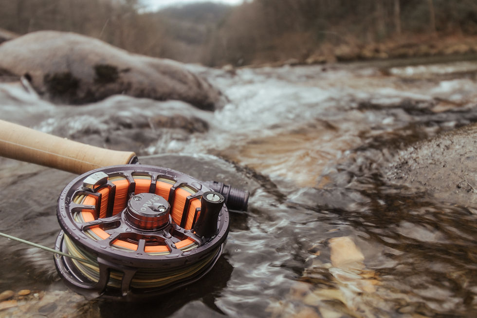
From May through October, the dynamic reverses completely. Rainfall decreases, the river drops to base flow, and the falls section becomes a series of dry ledges and shallow pools. But the lower sections of the Cossatot -- below the falls, where the gradient eases, and the river widens into deeper pools -- become excellent smallmouth bass habitat. The clear water, rocky substrate, and lack of fishing pressure create conditions where trophy smallmouth in the four- to five-pound range hold in predictable lies. Wade fishing dominates because the water is too low and the bottom too rocky for drift boats in most sections.
This seasonal paradox means the Cossatot effectively serves two completely different audiences with almost no overlap in timing or demographics. The whitewater audience is young to middle-aged, technically skilled, gear-intensive, and driven by conditions rather than convenience. The fishing audience is broader in age range, focused on solitude and trophy potential, and looking for reliable access to uncrowded water. A marketing strategy that treats these as a single audience will fail. A strategy that acknowledges the paradox and builds separate content tracks for each season will capture both markets.
The monthly breakdown is straightforward. January and February bring the highest probability of runnable flows in the falls section, though water temperatures make this an expert-only proposition. March and April offer the best combination of adequate flow and slightly warmer conditions, making this the peak whitewater window. May marks the transition -- flows drop, water warms, and smallmouth begin actively feeding. June through September is prime fishing season, with early-morning and late-evening sessions producing the best results. October offers a brief overlap window where late-season rains can occasionally push flows up while water temperatures remain comfortable, but this is unreliable.
The Smallmouth Fishery Below the Falls
The smallmouth bass fishery on the Cossatot River is one of the most under-marketed fishing opportunities in Arkansas. Trophy smallmouth reaching four to five pounds inhabit the pools and runs below the falls section, feeding in clear Ouachita Mountain water over rocky substrate that provides ideal habitat structure. Spotted bass, rock bass, longear sunfish, and channel catfish round out the species mix, but smallmouth are the primary draw for anglers who know the river.
The fishing pressure on the Cossatot is remarkably low. There is no fishing guide service operating on this river. FishingBooker, the largest online fishing guide marketplace, shows zero listings for the Cossatot. No dedicated fishing content exists for the river in any meaningful volume. The anglers who fish the Cossatot are almost exclusively local residents of Polk and Howard counties or regional bass anglers who have discovered the water through word of mouth.
This absence of commercial fishing infrastructure represents both a challenge and an opportunity. The challenge is that there is no existing market to tap into -- no guide reviews to appear alongside, no booking platforms driving traffic, no fishing media coverage generating awareness. The opportunity is that the first businesses to create quality fishing content for the Cossatot will own those search results entirely. There is virtually no competition for terms like Cossatot River smallmouth fishing, Cossatot River wade fishing, or Cossatot River bass fishing.
Wade fishing is the dominant method of access. The river's low summer flows make boat access impractical in most sections, and the rocky substrate rewards anglers willing to walk the river. This positions the Cossatot as a destination for anglers who value the physical experience of wading -- a growing segment of the fly-fishing and ultralight spinning communities that overlaps with the broader outdoor adventure market.
The clear water of the Ouachita Mountain streams adds a visual element that translates well to content creation. Sight fishing for smallmouth in clear pools is inherently photogenic, and the dramatic rock formations provide a backdrop that differentiates Cossatot fishing content from the muddy-water bass fishing that dominates social media in the South. Any brand creating fishing content for the Cossatot should lean heavily into the water's visual quality and the rugged Ouachita setting.
The Outfitter Market -- Fewest Operators of Any Arkansas Water
The Cossatot River has the fewest commercial operators of any water body in this Arkansas research series. The technical difficulty of the whitewater section, the rain-dependent flow regime, and the remote location combine to limit commercial outfitting in ways that do not apply to more accessible rivers like the Buffalo, the Mulberry, or the Spring River.
Cossatot River State Park-Natural Area operates guided kayak tours and snorkeling tours on calmer sections of the river. These are interpretive programs designed to introduce visitors to the river ecosystem, not commercial adventure outfitting for the falls section. The state park programs focus on ecology, geology, and natural history, positioning the Cossatot as an educational destination rather than an adrenaline destination. This interpretive framing is valuable for family and nature tourism marketing but does not serve the expert paddling community.
Sugar Creek Lodging offers kayak rentals and cabin accommodations near the river. Notably, Sugar Creek holds the premium domain cossatotriver.com, which gives them a significant organic search advantage for any branded river query. This domain authority means that any competing content strategy must either outperform cossatotriver.com on specific long-tail queries or build topical authority through volume and depth that a single-property website cannot match.
There is no commercial whitewater guiding operation for the Cossatot Falls section. The technical difficulty of the rapids, combined with the unpredictable flow regime, makes commercial guiding logistically difficult and liability-intensive. The paddlers who run the falls are experienced kayakers who make independent decisions based on their own skill assessments and real-time gauge readings. This is fundamentally different from the guided raft trip model that works on rivers like the Ocoee or the Nantahala.
There is no fishing guide service on the Cossatot at all. No fly fishing outfitter, no bass guide, no wade fishing guide operates commercially on this water. For comparison, nearby rivers in the Ozark region support multiple guide services. The Cossatot's fishing potential exists entirely outside the commercial guiding economy.
Independent expert kayakers create the most visible Cossatot content, primarily through YouTube videos of falls runs. These videos regularly accumulate 10,000 to 50,000 or more views, driven by the dramatic nature of the rapids and the run's badge-of-honor reputation. This user-generated content is the primary driver of awareness of the Cossatot's whitewater reputation and represents an organic marketing channel that no commercial operator currently leverages.
Digital Visibility and the Expert Paddler Community
The digital landscape for Cossatot River queries is dominated by institutional content. Arkansas State Parks, the USDA Forest Service, and regional tourism portals like Visit Mena and Visit Ouachitas hold the top positions for most informational queries. Sugar Creek Lodging's cossatotriver.com domain captures branded queries effectively. There is very little commercial content competing for Cossatot-related search terms beyond these institutional and single-operator sources.
The expert paddler community drives awareness of the Cossatot through channels that do not appear in traditional search analytics. Whitewater kayaking forums, private Facebook groups, and YouTube channels create a parallel information ecosystem in which the Cossatot's reputation as a must-run creek exists entirely outside SEO-visible content. Paddlers share gauge readings, trip reports, and video footage within these communities, building the river's reputation through peer validation rather than commercial marketing.
YouTube is the most significant content platform for the Cossatot. Falls run videos consistently generate strong view counts because the content is inherently dramatic -- steep drops, technical lines, and the visual intensity of Class IV-V whitewater in a narrow bedrock gorge. These videos serve as both entertainment and scouting tools for paddlers considering their own runs. The creators are not commercial operators but individual paddlers documenting their experiences, which gives the content an authenticity that commercial marketing cannot replicate.
Fishing-related queries for the Cossatot return almost nothing. The river does not appear on major fishing content platforms, fishing guide directories, or angling media outlets in any meaningful way. This represents a content vacuum that is unusual for a river with legitimate trophy smallmouth potential. The first entity to create comprehensive, well-optimized fishing content for the Cossatot will face essentially zero competition in organic search.
For tourism organizations and outfitters, the strategic implication is clear. The whitewater market is already aware of the Cossatot through community channels but is underserved by commercial content that could convert awareness into bookings for lodging, gear rental, and ancillary services. The fishing market is almost entirely unaware of the Cossatot's potential and represents a greenfield content opportunity. A dual-track content strategy addressing both audiences in their respective seasons is the highest-value approach.
Content Gaps That Define the Opportunity
The content gaps around the Cossatot River are extensive and represent significant organic search opportunities for businesses willing to create quality, comprehensive content. Each gap listed below represents a topic where no adequate content currently exists, meaning the first well-executed piece will likely capture the top position with minimal competition.
Cossatot Falls whitewater guide -- No comprehensive guide exists that covers the falls section, rapid by rapid, including put-in and take-out logistics, gauge-reading interpretation, difficulty ratings at various flow levels, and safety considerations. Expert paddlers piece this information together from community forums and YouTube videos, but no single authoritative resource exists.
Smallmouth bass fishing below the falls -- As discussed above, zero dedicated fishing content exists for the Cossatot. A comprehensive guide covering access points, seasonal patterns, productive techniques, and species information would own this topic entirely.
Water level guidance and gauge interpretation -- The rain-dependent nature of the Cossatot makes gauge reading a critical skill for both paddlers and anglers. A guide explaining what different flow levels mean for different activities, how to interpret USGS gauge data, and what rainfall patterns produce runnable conditions would serve both audiences.
Cossatot vs. Mulberry River comparison -- The Mulberry is the other significant whitewater river in Arkansas, and paddlers frequently compare the two. A detailed comparison covering difficulty, flow reliability, season length, access, and overall character would capture high-intent search traffic from paddlers planning trips in Arkansas.
Cossatot River State Park visitor guide -- While the state park has its own website, a comprehensive visitor guide from a marketing perspective -- covering what to expect, how to plan a visit, what gear to bring, and how to combine the park visit with other Ouachita activities -- would serve the family and nature tourism audience.
Rapid-by-rapid breakdown of the falls section -- Expert paddlers want detailed information about individual rapids, including entry lines, hazards, and difficulty ratings at various flows. This type of granular content is highly valued in the paddling community and generates strong engagement.
Fishing below whitewater sections -- A broader content piece about the phenomenon of excellent fishing habitat below technical whitewater sections, using the Cossatot as the primary example, would capture long-tail search traffic and establish topical authority.
Ouachita Mountains vs. Ozarks distinction -- An educational piece explaining the geological, ecological, and recreational differences between the Ouachita Mountains and the Ozarks would serve visitors planning Arkansas trips and position the Cossatot within its proper geographic context.
Mena weekend trip itinerary -- Mena serves as the gateway to the Cossatot, and a comprehensive weekend itinerary combining river activities with the Talimena National Scenic Byway, Queen Wilhelmina State Park, and local dining would serve the trip-planning audience that drives accommodation bookings.
Cossatot safety guide -- The river's "skull crusher" reputation creates a natural entry point for safety content covering hazard identification, rescue considerations, minimum skill requirements for the falls section, and general cold-water safety for winter paddling.
Winter paddling preparation -- The Cossatot's peak whitewater season occurs in the coldest months. Content covering cold-water gear, hypothermia prevention, and winter-specific paddling logistics would serve the whitewater audience and demonstrate expertise.
Cossatot River snorkeling -- The state park offers guided snorkeling tours, but no independent content covers snorkeling on the Cossatot. The clear Ouachita water and diverse aquatic life make this an unusual and marketable activity.
Ouachita Mountain geology and the Cossatot corridor -- The folded metamorphic geology of the Ouachitas is visually dramatic and scientifically interesting. Educational geology content tied to specific river features would serve the nature tourism and educational travel audiences.
Cossatot River area lodging guide -- Accommodation options near the Cossatot are limited and not well documented online. A comprehensive lodging guide covering cabins, campgrounds, and Mena-area hotels would capture high-commercial-intent search traffic.
Work with Pine & Marsh
Pine & Marsh is a southeastern outdoor marketing agency that builds content strategies, brand identities, and digital visibility for outdoor recreation businesses. We work with outfitters, lodges, state tourism organizations, and outdoor brands across the South, including operators in Arkansas's river corridors. If you manage a business on or near the Cossatot River and want to build the kind of content infrastructure that captures both the whitewater and fishing audiences this river supports, we should talk. Our work is grounded in the specific competitive dynamics and seasonal patterns that define each waterway—not in generic outdoor marketing templates. Reach out through our website at pineandmarsh.com to start a conversation about your Cossatot River marketing strategy.
Frequently Asked Questions
What class rapids are on the Cossatot River?
The Cossatot River ranges from Class II-III in its general sections to Class IV-V in the falls section at high water. The falls section drops 33 feet in approximately one-third of a mile, creating the most technically demanding whitewater in Arkansas. Difficulty is directly tied to water level -- at low flows, the falls section is exposed rock and unrunnable. At high flows after sustained rainfall, the rapids reach their maximum difficulty. The rest of the river above and below the falls runs Class II-III, which is manageable for intermediate paddlers with moving-water experience. The critical distinction for marketing purposes is that the difficulty of the falls section varies dramatically with conditions, making gauge-reading content extremely valuable.
When is the best time to kayak the Cossatot River?
The best time to kayak the Cossatot Falls section is January through April, when winter and early spring rains push flows to runnable levels. March and April typically offer the best combination of adequate water and slightly warmer temperatures. However, the Cossatot is rain-dependent, meaning there is no guaranteed runnable window—paddlers must monitor USGS gauge readings and be prepared to drive on short notice when conditions align. For the calmer sections outside the falls, the state park offers guided kayak tours during warmer months when flows are lower, and the experience is more accessible. The rain-dependent nature of the whitewater season is a key marketing consideration, as it narrows the window for commercial programming.
Is there smallmouth bass fishing on the Cossatot River?
Yes, the Cossatot River holds trophy smallmouth bass in the four- to five-pound range, primarily in the pools and runs below the falls section. The smallmouth fishery is best from May through October when water levels drop, and fish concentrate in deeper pools. Spotted bass, rock bass, longear sunfish, and channel catfish are also present. Wade fishing is the primary access method due to low summer flows. Despite the quality of the fishery, the Cossatot receives almost zero fishing pressure from outside the immediate local area. No fishing guide service operates on the river, and there is no meaningful fishing content online, making this a significant untapped marketing opportunity.
Are there fishing guides on the Cossatot River?
No. As of this writing, there is no fishing guide service operating commercially on the Cossatot River. FishingBooker shows zero listings, and no independent guide operations appear in search results for Cossatot fishing guides. This is unusual for a river with legitimate trophy smallmouth potential and represents a gap in the market. For outfitters or guides considering launching a Cossatot fishing operation, the absence of competition means low customer acquisition costs through organic search, but it also means building awareness from scratch since no existing market infrastructure drives fishing traffic to the river.
How is the Cossatot River different from the Mulberry River?
The Cossatot and Mulberry are both rain-dependent Arkansas whitewater rivers, but they differ in several important ways. The Cossatot's falls section is significantly more difficult (Class IV-V vs. the Mulberry's Class II-III), making the Cossatot a destination for expert paddlers rather than the broader recreational market the Mulberry serves. The Cossatot is in the Ouachita Mountains with folded metamorphic geology, while the Mulberry is in the Ozarks with limestone karst geology, creating visually and experientially distinct river corridors. The Cossatot has far fewer commercial operators, while the Mulberry supports multiple outfitters. For marketing purposes, these rivers serve different audience segments with different skill levels and expectations.
What makes the Ouachita Mountains different from the Ozarks?
The Ouachita Mountains and the Ozarks are geologically distinct mountain systems that happen to occupy neighboring regions of Arkansas and Oklahoma. The Ozarks are built on karst limestone, characterized by caves, springs, bluffs, and dissolution-carved valleys. The Ouachitas are folded metamorphic ridges running east to west -- a structural pattern unique in the central United States. This east-west folding creates harder, more angular rock formations and a more rugged terrain character. The Cossatot River's dramatic falls section is a direct expression of Ouachita geology. For outdoor brands, this geological distinction provides a clear differentiation strategy: the Ouachitas are not the Ozarks, and marketing should emphasize that difference rather than blending the two.
What is Cossatot River State Park-Natural Area?
Cossatot River State Park-Natural Area is an Arkansas State Park that protects a corridor along the Cossatot River, including the famous falls section. The park offers guided kayak tours on calmer stretches of the river, guided snorkeling tours, hiking trails, and interpretive programming focused on the river's ecology and geology. The park's programs are educational and nature-focused rather than commercial adventure outfitting—they introduce visitors to the river ecosystem rather than guiding them through the falls. For tourism marketing, the state park provides a family-friendly, accessible entry point to the Cossatot that complements the falls section's reputation as a paddler's paradise.
Can you swim or snorkel in the Cossatot River?
Yes. The Cossatot River State Park-Natural Area offers guided snorkeling tours that take visitors into the river's clear pools to observe aquatic life. The Ouachita Mountain water clarity makes snorkeling a viable and unusual recreational activity. Swimming holes exist in various sections of the river, particularly during the summer's low water levels. However, the falls section should be avoided for swimming due to the hydraulic hazards present even at moderate flows. Snorkeling content represents a content gap -- there is no independent coverage of Cossatot snorkeling outside the state park's own programming descriptions, making this an opportunity for content creators.
Where do you stay when visiting the Cossatot River?
Lodging options near the Cossatot River include Sugar Creek Lodging, which offers cabin accommodations near the river along with kayak rentals. The town of Mena, approximately 30 minutes from the river corridor, serves as the primary gateway community and offers additional hotel and motel options. Cossatot River State Park-Natural Area has limited camping facilities. The broader Ouachita region includes Queen Wilhelmina State Park on Rich Mountain, which offers lodge rooms along the Talimena National Scenic Byway. Lodging inventory near the Cossatot is more limited than in more developed tourist corridors, and a comprehensive lodging guide is one of the identified content gaps for this river.
What is the Talimena National Scenic Byway?
The Talimena National Scenic Byway is a 54-mile driving route that follows the crest of the Ouachita Mountains between Mena, Arkansas, and Talihina, Oklahoma. The byway offers panoramic views of the Ouachita ridge-and-valley landscape and passes through Queen Wilhelmina State Park at its highest point. For Cossatot River marketing, the Talimena Byway is a critical complementary attraction that extends the visitor experience beyond the river itself. A weekend trip itinerary combining the Cossatot with the byway drive creates a more complete destination package that justifies overnight stays and increases economic impact for local businesses.
How do you check water levels on the Cossatot River?
Water levels on the Cossatot River are monitored through USGS stream gauges that report real-time flow data. Paddlers and anglers can check current conditions through the USGS National Water Information System website or through third-party apps that aggregate gauge data. For the whitewater audience, understanding which flow levels correspond to runnable conditions in the falls section is essential -- this knowledge currently lives in paddling community forums rather than in any published guide. For the fishing audience, low and stable flows indicate the best conditions. A comprehensive gauge interpretation guide for the Cossatot, covering what different readings mean for different activities, represents one of the highest-value content opportunities for any business marketing this river.


Comments