
Louisiana Coastal Marsh Waterfowl: Land Loss, Salinity Intrusion, and the Survival of a Flyway

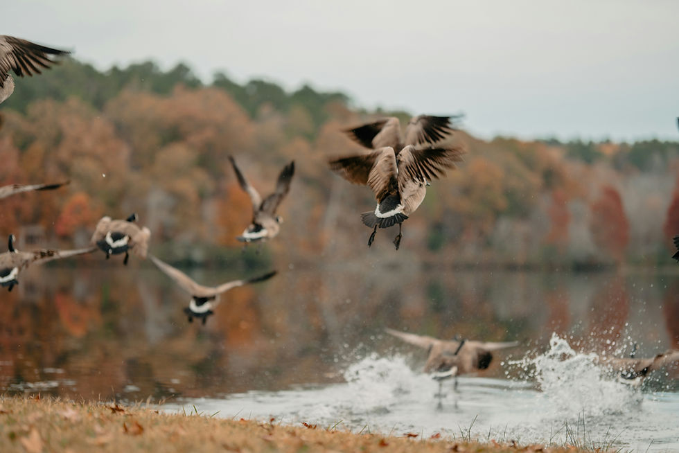
Every winter, cold fronts push south out of the Dakotas and the Canadian prairies, and somewhere south of Missouri the ducks funnel into a narrowing corridor that ends at the Louisiana coast. There is no other place quite like it: three million acres of marsh, built by ten thousand years of river sediment and longshore drift, holding more wintering waterfowl than any comparable landscape in North America. Gadwall raft in the intermediate marsh at first light. Pintail work the wet prairies of the Chenier Plain. Specklebellies drop into flooded rice stubble outside Kaplan and Gueydan. And in the marsh grass itself, year-round, a duck found nowhere else in its full life cycle -- the mottled duck -- nests, broods, and winters without ever leaving the coast. This landscape is also disappearing. Since 1932, Louisiana has lost roughly 2,000 square miles of coastal marsh, an area that gives a rough sense of scale by comparison to a small state, and the state continues to lose marsh every year to a compounding set of forces: subsidence, saltwater intrusion, storm surge, and a river that no longer builds the land it once did. This is not a distant environmental abstraction. It is a habitat crisis playing out beneath the boots of every duck hunter who has watched a blind site, a bayou, or an island vanish within a single decade, with consequences that reach the entire Mississippi Flyway.
A Coastline Built by a River That No Longer Builds It
Louisiana's coastal marsh exists in two distinct forms. The Chenier Plain, stretching across Cameron and Vermilion parishes in the southwest, was built by longshore sediment transport into a landscape of oak-topped ridges, called cheniers, interspersed with wet prairie and marsh. The Deltaic Plain, running east through the Terrebonne-Lafourche system into Barataria and Plaquemines, was built directly from Mississippi River sediment deposited over thousands of years of shifting delta lobes. Both systems depend, in different ways, on a functioning connection between river and marsh. That connection has been severed for most of the river's length since the early twentieth century.
The Mississippi River is leveed for flood control along nearly its entire lower course. The levees serve their intended purpose, protecting New Orleans, Baton Rouge, and the industrial corridor between them from catastrophic flooding. But they also carry the river's sediment load past the delta and off the edge of the continental shelf into deep water, where it does no work building marsh. Before the levee system was completed, seasonal river floods routinely overtopped the banks and spread sediment and fresh water across the delta plain, replenishing marsh elevation as fast as natural subsidence lowered it. That process has stopped across most of the deltaic coast. The Atchafalaya River, which still delivers freshwater and sediment to its own delta near Morgan City, is one of the only parts of the Louisiana coast actually gaining land, and it stands as a natural demonstration of what the rest of the coast has lost.
Subsidence is the second driver, and it operates independently of the levees, though the two are connected. The organic peat and river-deposited sediment that built the marsh over millennia compact under their own weight over time. Without new sediment layered on top, the marsh surface sinks relative to sea level, a slow and largely invisible process until the marsh drops below the tidal range and drowns. Oil and gas canal networks compound the problem: tens of thousands of miles of canals were dredged across the coastal marsh over the twentieth century for pipeline access and navigation, and each canal is a straight conduit for saline Gulf water to move inland, accelerating the death of freshwater vegetation along its banks and widening with every tide and storm.
Louisiana has lost approximately 2,000 square miles of coastal marsh since 1932, roughly comparable in area to a state like Delaware. Loss rates have varied significantly by period. Historical peak loss during the 1970s and 1980s, when canal dredging for oil and gas exploration was most intensive, reached an estimated 32 square miles per year in some USGS assessments. A 2017 USGS reassessment found the rate had slowed to approximately 10.9 square miles per year, reflecting reduced dredging activity and some restoration gains, though other CPRA-referenced estimates for more recent years and storm-affected periods put ongoing loss closer to the 25 to 35 square mile range depending on the years and methodology included. The range itself is instructive: Louisiana's land-loss rate is not a fixed number but a moving target driven by storm frequency, restoration investment, and measurement methodology, and readers should treat any single figure as a snapshot rather than a constant. At current trajectories, CPRA and USGS projections suggest the coastal zone as mapped in 1956 could lose more than 2,500 square miles by 2050.
The Salinity Gradient and What It Means for Ducks
Louisiana's coastal marsh is organized along a four-zone salinity gradient running from the freshwater interior to the saline Gulf edge, and this gradient is the single most important organizing principle for understanding how land loss translates into habitat loss for waterfowl. Freshwater marsh, with salinity typically below 0.5 parts per thousand, sits farthest inland and supports three-square bulrush, maidencane, and cattail. This zone is the primary habitat for mottled duck brood-rearing and the freshwater invertebrate communities that provide protein for nesting hens.
Intermediate marsh, from 0.5 to 5 ppt, supports marshhay cordgrass, roseau cane, and three-square bulrush, and functions as the primary nesting and wintering zone for marsh ducks. Mottled duck nesting density is highest here and in brackish marsh, where dense emergent cover occurs within 30 to 70 centimeters of permanent water, and gadwall and teal concentrate in this zone through the winter. Brackish marsh, from 5 to 18 ppt, supports saltmeadow cordgrass and black needlerush and provides wintering habitat for gadwall, pintail, and wigeon. Saline marsh, above 18 ppt, is dominated by smooth cordgrass and needlerush and functions primarily as nursery habitat for juvenile speckled trout and red drum rather than as prime duck habitat.
Saltwater intrusion pushes this entire gradient inland. As sea level rises and canal networks funnel saline water into the marsh interior, freshwater vegetation dies when salinity exceeds its tolerance, and it is replaced by more salt-tolerant species or, when the peat substrate can no longer support rooted growth at all, converts directly to open water. The practical effect for waterfowl is a contraction of exactly the zones that matter most: freshwater and intermediate marsh, which support mottled duck nesting and the moist-soil seed and invertebrate production that fuel wintering dabbling ducks, are disproportionately affected because they are converted first, either to brackish conditions or to open water outright.
The same gradient also links waterfowl habitat directly to the coast's inshore fisheries, and this connection is not incidental. The intermediate-to-brackish marsh that concentrates wintering gadwall and teal produces the same dense invertebrate and small-crustacean communities that speckled trout and red drum depend on as juveniles move from saline nursery habitat toward the marsh edge in fall. Submerged aquatic vegetation such as widgeon grass and shoal grass, which provides the primary food source for gadwall and wigeon, requires stable salinity and clear water to grow; saltwater intrusion and the turbidity generated by eroding marsh edges reduce that vegetation's coverage at the same time they reduce nesting cover, so a single hydrological disruption degrades duck food and fish nursery habitat together rather than one at the expense of the other.
This shift also plays out in plant communities. Interior fresh marsh dominated by maidencane and other soft-stemmed emergent vegetation gradually gives way to Spartina cordgrass species as salinity rises, a shift that reduces the density and diversity of moist-soil seed production dabbling ducks rely on for carbohydrate-rich winter forage. The die-off of roseau cane across much of the eastern coastal marsh since 2016, driven by an introduced scale insect combined with salt stress and hurricane damage, illustrates the same dynamic from a different angle: roseau's dense root system had stabilized soft marsh substrate, and its loss has accelerated erosion in affected areas even though roseau itself was not preferred duck habitat.
The Mottled Duck: A Bird With Nowhere Else to Go
Every migratory duck species that winters in Louisiana has an alternative. If the Louisiana coast degrades, gadwall and pintail and teal can, in theory, winter elsewhere along the Gulf or in Texas, even if at reduced body condition. The mottled duck has no such option. Anas fulvigula is the only truly non-migratory, resident dabbling duck in the Gulf Coast marsh system. It breeds, raises its brood, and winters in place across coastal Louisiana and Texas, completing its entire annual cycle on a single landscape. No other North American duck species carries this degree of dependence on one stretch of coast.
That dependence has become a liability. The combined Gulf Coast mottled duck population, spanning Texas, Louisiana, and Mississippi, is estimated at roughly 500,000 to 800,000 birds, though survey methodology for a resident, non-migratory species is difficult and the range carries real uncertainty. What is not in question is the trend. Louisiana Department of Wildlife and Fisheries surveys, conducted five times per year, have shown a sustained decline over many years, with the West Gulf Coast population down an estimated 65 percent since 2009. The coast-wide September 2025 survey estimate of approximately 10,000 mottled ducks was the lowest September count on record.
The mechanism connects directly back to habitat. Mottled ducks require dense emergent vegetation within 30 to 70 centimeters of permanent water for nesting, a condition met almost exclusively in intermediate and brackish marsh. As saltwater intrusion converts that vegetation to more salt-tolerant species or to open water, the acreage of usable nesting habitat contracts. Cameron and Vermilion parishes, the primary mottled duck breeding areas, sit directly in the path of Gulf storms; Hurricane Laura's 15-to-20-foot surge in 2020 damaged an estimated 50,000 to 80,000 acres of outer coastal marsh there during the breeding season, and Hurricane Delta struck the same area weeks later, compounding the disruption. A second, compounding threat comes from hybridization with feral mallards released into coastal habitat, a documented and progressive problem tracked in peer-reviewed literature and managed as a priority concern by the Gulf Coast Joint Venture.
In response to the sustained decline, LDWF closed mottled duck harvest for the first 15 days of the 2025-26 regular season and set a one-bird daily limit for the remainder of the season, a regulatory tightening that reflects how seriously state biologists are treating the population trajectory. As an indicator species, the mottled duck functions as a real-time gauge of intermediate marsh health in a way migratory species cannot, because its entire life history is written on this one landscape.
Predation compounds the habitat problem rather than acting independently of it. Raccoons are the most significant nest predator for ground-nesting mottled ducks, and as vegetated marsh converts to open water, the remaining nesting cover is squeezed onto a shrinking number of patches. That concentration effect can make predator search more efficient even if the raccoon population itself has not grown, raising the per-nest predation rate on the marsh that remains. American alligators, the coastal marsh's apex predator, take nesting hens and broods opportunistically as well, and bald eagles, which have recovered substantially across the state, increasingly concentrate around waterfowl staging areas. None of these predator relationships are new to the marsh ecosystem; what has changed is the amount of usable habitat available to absorb the pressure.
A Bottleneck at the End of a Continental Corridor
Louisiana's coastal marsh sits at the geographic terminus of the Mississippi Flyway, where waterfowl originating across millions of square miles of Prairie Pothole breeding habitat in the northern United States and Canadian prairies funnel southward and converge with the eastern edge of the Central Flyway at the Gulf of Mexico. As birds move south along this corridor, the available habitat narrows. By the time ducks reach the coast, the entire wintering population is compressed into a relatively narrow band of marsh, rice prairie, and associated wetland. The Gulf Coast supports peak numbers of more than seven million wintering ducks, and Louisiana alone accounts for more than five million of those birds -- a concentration that gives the state's wetlands outsized importance relative to their acreage.
This bottleneck geometry means habitat loss in Louisiana carries a magnified continental effect that habitat loss on the breeding grounds does not. The Prairie Pothole Region is vast, and localized wetland loss there can often be absorbed without forcing major population redistribution. The wintering grounds are geographically constrained by comparison, and there is no equivalent alternative: the combination of mild winter climate, position at the convergence of two flyways, a four-zone salinity gradient that supports a full range of species, and abundant natural and agricultural forage does not exist anywhere else on the continent. When marsh converts to open water in Louisiana, the lost carrying capacity cannot simply be made up somewhere else.
The chain of consequences runs from the coast back to the breeding grounds. Fewer wintering acres concentrate more birds onto the remaining marsh, increasing competition for food and shelter and potentially lowering body condition. Hens that winter on high-quality food resources typically depart for the Prairie Pothole Region in better physiological condition, which correlates with earlier nest initiation, larger clutch size, and higher nesting success once they arrive on the breeding grounds. In this sense, marsh loss along the Louisiana coast has measurable, if indirect, consequences for duck production a thousand miles to the north the following spring. Coastal wetlands here provide wintering habitat for an estimated 20 percent of the nation's waterfowl, with roughly 40 percent of all North American migrating waterfowl and shorebirds using the Mississippi Flyway route through this coast in some part of their annual cycle.
Restoration at the Scale of the Problem
Addressing land loss at a scale that matches the crisis has been the guiding logic of Louisiana's coastal restoration program for two decades. The Coastal Protection and Restoration Authority's Coastal Master Plan, most recently updated in 2023, is a 50-year, 50-billion-dollar framework combining structural projects such as levees and surge barriers with restoration projects including dredged-sediment marsh creation, oyster reef restoration, and river sediment diversions. It represents the state's primary tool for slowing, and in targeted areas reversing, the loss trajectory described above.
The most consequential single project in that plan is the Mid-Barataria Sediment Diversion, designed to reconnect the Mississippi River to the Barataria Basin by controlled breach, moving sediment-laden river water into the basin at flows up to 75,000 cubic feet per second during high-river periods. The underlying logic mirrors the natural process the levees eliminated: deliver river sediment directly to a subsiding, eroding basin so the marsh can rebuild rather than simply be shored up after the fact. Project design and environmental review materials describe a multi-decade marsh-building trajectory and also flag near-term tradeoffs, since the added freshwater and turbidity are expected to depress brown shrimp and oyster production in parts of Barataria Basin during the years immediately following diversion, even as marsh acreage and habitat for freshwater and intermediate-marsh species should gradually increase over the long term. As of this writing, the project has faced permitting, funding, and legal challenges that have affected its construction schedule, and its current status should be confirmed directly with CPRA before citing it as an active or completed project.
Beyond the Master Plan, the Coastal Wetlands Planning, Protection and Restoration Act of 1990, commonly known as the Breaux Act, has authorized 234 coastal restoration projects benefiting an estimated 100,000 acres since its inception, managed by a task force of federal agencies and the state. The Deepwater Horizon oil spill settlement directed approximately 8.8 billion dollars in RESTORE Act funding to Gulf states, with Louisiana receiving the largest share, much of it channeled into coastal wetland restoration that overlaps directly with waterfowl habitat objectives. Ducks Unlimited, operating through the Gulf Coast Joint Venture established in 1988 under the North American Waterfowl Management Plan, maintains a habitat objective of at least 2.1 million acres of coastal wetland in active conservation management across the five-state Gulf Coast Joint Venture area, with the mottled duck designated a high-priority species for targeted conservation. None of these efforts individually reverses the land-loss trend on their own; together, they represent the scale of institutional response a crisis of this size has required.
Key Takeaways
Louisiana's coastal marsh has lost roughly 2,000 square miles since 1932, driven by a compound set of causes: Mississippi River levees that divert sediment away from the delta, subsidence of unreplenished peat, oil and gas canal networks that channel saltwater inland, and storm surge from hurricanes including Katrina, Laura, Delta, and Ida. Annual loss-rate figures vary by source and period, from a 2017 USGS estimate of about 10.9 square miles per year to other assessments citing 25 to 35 square miles per year in more recent or storm-affected periods; treat any single number as an estimate, not a constant.
The four-zone salinity gradient, from freshwater to saline marsh, determines which duck species use which parts of the coast. Saltwater intrusion pushes this gradient inland, converting the freshwater and intermediate marsh that mottled duck, gadwall, teal, and pintail depend on into brackish habitat or open water, with a documented shift in plant communities toward more salt-tolerant cordgrass species.
The mottled duck, the only fully non-migratory dabbling duck on the Gulf Coast, is the clearest indicator of this decline: its West Gulf Coast population is down an estimated 65 percent since 2009, prompting a partial harvest closure for 2025-26. Because Louisiana sits at the terminus of the Mississippi Flyway and hosts more than five million wintering ducks in an average year, marsh loss here has consequences for continental duck production that reach the Prairie Pothole breeding grounds, even as the Coastal Master Plan and projects like Mid-Barataria Sediment Diversion attempt to rebuild marsh at a comparable scale.
Citations and Sources
This article draws on federal and state agency data, peer-reviewed waterfowl and coastal-geology research, and joint venture conservation planning documents; given how quickly survey figures, harvest regulations, and project construction status change, readers should confirm current details directly with the agencies below before citing specific numbers.
Agencies and research
The Louisiana Department of Wildlife and Fisheries (LDWF) conducts mottled duck and waterfowl aerial surveys and sets state harvest regulations. The Coastal Protection and Restoration Authority (CPRA) administers the Coastal Master Plan and the Mid-Barataria Sediment Diversion project. The U.S. Geological Survey (USGS) produces the National Assessment of Shoreline Change and historical land-loss documentation, including post-Katrina marsh conversion analysis. The U.S. Fish and Wildlife Service (USFWS) conducts the annual Breeding Population and Habitat Survey, sets waterfowl harvest frameworks through Adaptive Harvest Management, and manages Sabine, Lacassine, and Cameron Prairie National Wildlife Refuges. The U.S. Army Corps of Engineers (USACE) manages navigation and flood-control infrastructure across the coastal zone. Ducks Unlimited and the Gulf Coast Joint Venture coordinate habitat conservation planning, including mottled duck priority conservation. The Mississippi Flyway Council coordinates waterfowl management across fourteen states, and the RESTORE Council administers Deepwater Horizon settlement funding directed to coastal restoration.
Peer-reviewed literature
Sourcing includes the CPRA Coastal Master Plan (2023 update), USGS Open-File Report 2006-1052 on Katrina-related marsh conversion, USGS shoreline change assessments including the 2017 update on Louisiana wetland loss rates, USFWS Waterfowl Population Status and Breeding Population and Habitat Survey reports for 2024 and 2025, LDWF hunting regulations and mottled duck survey data, Gulf Coast Joint Venture Implementation Plan documentation, and peer-reviewed research on mottled duck and mallard hybridization, including Williams (2005, Wilson Bulletin) and Bielefeld et al. (2010, Waterbirds).
Confidence note: figures describing the two-system marsh geography (Chenier Plain, Deltaic Plain), the four-zone salinity gradient, mottled duck population decline and hybridization threat, and the Mid-Barataria Sediment Diversion's basic design are well corroborated across CPRA, USGS, USFWS, and GCJV sources. The annual land-loss rate is the figure with the widest spread across sources: a 2017 USGS reassessment cited approximately 10.9 square miles per year, while other CPRA-linked estimates for different periods cite 25 to 35 square miles per year; this article presents both to avoid overstating a false precision, and readers relying on a specific current rate should confirm it directly against the most recent CPRA or USGS release. The 2,000-square-mile cumulative loss since 1932 and the projection of over 2,500 square miles lost by 2050 are consistently cited across CPRA and USGS materials. The comparison of total lost acreage to the size of Delaware is a commonly used descriptive comparison rather than a precise agency-published equivalence and should be read as illustrative. The Mid-Barataria Sediment Diversion's construction status has been affected by funding, permitting, and legal disputes since the project was authorized, and its current build status should be verified directly with CPRA before republishing or updating this piece, since that status is likely to have changed by the time this is read.
Explore More
For more on the flyway-scale context and the wider Louisiana coastal landscape behind this crisis, see these related field reports.


Comments