
The Mississippi Flyway: Waterfowl Migration Ecology, Habitat, and Continental Significance
Updated: Jun 19
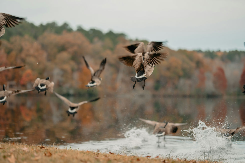
The Mississippi Flyway is the most important waterfowl migration corridor in the Western Hemisphere. Stretching from the Arctic tundra and prairie pothole breeding grounds of Canada and the northern Great Plains south through the Great Lakes staging areas to the Gulf Coast wintering grounds, it handles an estimated 40 percent of North America's duck and goose migration -- more waterfowl than any other flyway on the continent. The lower Mississippi Alluvial Valley, the Louisiana coastal marshes, and the Arkansas rice prairies form the southern terminus of this corridor, and together they constitute the most significant complex of wintering waterfowl habitat in the temperate world.
This report treats the Mississippi Flyway as an ecological system -- the breeding-ground dynamics that produce the birds, the migration corridors that deliver them south, and the wintering habitats that sustain them through the cold months. It is designed to be the definitive synthesis of flyway waterfowl ecology in the Southeast, aggregating the continental population data, habitat associations, and conservation challenges that define the current era. The flyway's future is not guaranteed. Louisiana has lost nearly 2,000 square miles of coastal wetland since the 1930s; the alluvial aquifer that sustains the Arkansas rice fields is declining; and the climate-driven shift in migration timing is redistributing birds northward, reducing peak concentrations on the traditional wintering grounds. Understanding the flyway means understanding all of this at once.
Flyway Structure: Breeding Grounds to Wintering Grounds
The Mississippi Flyway is not a single path but a funnel. Birds breed across a vast arc from the Arctic coast of Canada through the prairie pothole region of the Dakotas and southern Manitoba, Saskatchewan, and Alberta, and through the boreal forests of Ontario, Quebec, and the Maritimes. As autumn advances, they converge southward through progressively narrower staging and migration corridors until they reach the Gulf Coast, where the funnel opens onto the wintering grounds.
The prairie pothole region -- the glaciated grasslands of the northern Great Plains, pockmarked with millions of small, shallow wetlands left by the retreating ice sheets -- is the engine that produces the majority of the flyway's dabbling ducks. Over 50 percent of the continent's ducks are produced in this region. The annual USFWS Waterfowl Breeding Population and Habitat Survey monitors conditions there each May, and the two numbers that drive flyway management are the breeding population estimate and the pond count. The 2024 BPHS estimated a total of 29.7 million breeding ducks in the traditional survey area -- above the long-term average of 26.1 million -- but a pond count of only 3.9 million, below the long-term average of 5.4 million. Below-average pond counts reduce the amount of wetland habitat available on the breeding grounds, increasing competition for nest sites and potentially reducing per-pair productivity.
The Great Lakes region serves as the primary fall staging area for the eastern arm of the flyway. Mallards, gadwall, canvasbacks, and other species stage on the large lakes and marshes of Minnesota, Wisconsin, Michigan, and Ontario before cold fronts push them south. The Tennessee River valley -- including Wheeler NWR in Alabama -- functions as a secondary staging corridor for birds moving south through the interior, funneled by the valley's topography.
The Cold-Front Trigger: How Weather Moves Birds
Waterfowl migration through the Mississippi Flyway is driven by weather, not by a calendar. The cold-front trigger mechanism is well documented: overnight temperatures dropping below roughly 25 degrees Fahrenheit in the staging areas precipitate southward movement through the flyway. Mallards staging in the Missouri-Illinois corridor in October and November push into Arkansas and Louisiana after cold fronts drive temperatures into the twenties across Missouri and Kentucky.
This weather-driven migration means the timing of peak waterfowl arrival on the southeastern wintering grounds varies by weeks from year to year. In mild autumns, birds linger on northern staging areas into December. In early cold years, significant flights may reach the Gulf Coast by early November. The interaction of weather patterns and migration timing produces the year-to-year variation in duck numbers that hunters and managers both track.
Published peer-reviewed research documents a shift in migration timing of approximately 12 to 18 days later since 1970 among North American waterfowl. A 2022 study in PLOS ONE examining waterfowl migration phenologies in central North America found that 67 percent of significant changes in autumn peak timing indicated delays as temperatures increased. The geographic distribution of mallard band recoveries shifted northward by 180 kilometers between 1960 and 2019. For the southeastern wintering grounds, this shift means that peak mallard arrival has moved from the traditional Thanksgiving-week window toward mid-December through the first week of January -- a temporal redistribution of birds that reduces peak concentrations on the traditional Gulf Coast wintering grounds.
The Wintering Habitat Hierarchy
Bottomland hardwood wetlands of the Mississippi Alluvial Valley. The flooded bottomland hardwood forests of the lower Mississippi Valley -- from southern Illinois through the Arkansas and Mississippi deltas to the Louisiana coastal zone -- are the most important wintering habitat for mallards in North America. The ecological mechanism is the acorn: red oak species (willow oak, Nuttall oak, water oak, cherrybark oak) produce the hard mast that mallards consume in flooded timber at depths of 12 to 18 inches. A mallard tips up in shallow water over a flooded oak flat, consuming acorns at the substrate surface -- a foraging behavior that has defined the species' relationship with the MAV for millennia.
Greentree reservoirs -- managed impoundments that flood standing bottomland hardwood in fall and winter -- replicate this natural dynamic on a controlled schedule. The management involves filling the reservoir as acorn drop progresses, targeting 12 to 18 inches of flooding depth for peak mallard feeding, and drawing the water down in late winter to prevent the root-oxygen deprivation that kills the oaks. At Bayou Meto WMA in Arkansas, chronic overflooding caused red oak mortality, prompting a comprehensive management correction beginning in 2021—water levels were reduced from 179 to 178.5 feet MSL, with 2,872 acres of bottomland treated and regeneration gaps created. This management philosophy shift -- from maximizing flood duration to balancing shorter floods with tree health -- is now being replicated at green tree reservoirs across the region.
Arkansas Grand Prairie rice fields. Following the loss of roughly 80 percent of the MAV's original bottomland hardwood to agricultural clearing, flooded rice fields have become surrogate wetlands of continental significance. Arkansas planted approximately 1,430,506 acres of rice in 2024, and the post-harvest flooded stubble provides concentrated carbohydrate energy for wintering ducks. The AGFC Waterfowl Rice Incentive Conservation Enhancement (WRICE) program enrolled 50 fields totaling approximately 3,330 acres for the 2025-26 season, paying private rice farmers to leave harvested rice flooded for waterfowl.
The Grand Prairie's Stuttgart silt loam -- designated as Arkansas's official state soil in 1997 -- creates the physical foundation for this surrogate wetland. The soil's low permeability holds surface water at precisely the 8- to 18-inch depths that dabbling ducks require. But the Mississippi River Valley Alluvial Aquifer that irrigates the rice is experiencing sustained depletion: the 2024 Arkansas Department of Agriculture groundwater report found that 75 percent of monitored wells declined, with an average change of -1.35 feet, and characterized withdrawals as unsustainable. As pumping costs rise, some producers shift from rice to soybeans or corn -- crops that are not flooded after harvest and generate substantially less waterfowl habitat.
Louisiana coastal marshes. Louisiana holds roughly 40 percent of the coastal wetlands in the contiguous United States, and these marshes -- fresh, intermediate, and brackish -- are the most important coastal wintering habitat in the flyway. The salinity gradient from freshwater inland to saltwater at the coast creates a series of ecological zones that different waterfowl species exploit: gadwall and mottled duck use the fresh and intermediate marsh, pintail work the rice prairies and coastal flats, and diving ducks use the deeper open water of the bays and sounds.
Louisiana has lost nearly 2,000 square miles of coastal wetland since the 1930s. Current loss equals approximately 10.9 square miles per year -- roughly one football field of marsh every 83 seconds. The loss converts fresh marsh to open saltwater, reducing the winter carrying capacity for the species that depend on the vegetated wetland. CPRA's 2023 Coastal Master Plan dedicates $25 billion to 65 restoration projects -- marsh creation, sediment diversions, ridge restoration, and hydrologic restoration -- projected to restore and maintain over 300 square miles. The ecological stakes for the flyway are direct: every acre of Louisiana marsh that converts to open water is an acre of wintering habitat removed from the continental waterfowl carrying capacity.
Managed moist-soil impoundments. The national wildlife refuges and state WMAs of the lower Mississippi Valley manage thousands of acres of moist-soil impoundments -- shallow wetlands drawn down in summer to grow native seed-producing plants (smartweed, barnyard grass, millet, spike rush) and reflooded in fall to make the seed crop available to waterfowl. A well-managed moist-soil unit can produce over 2,500 pounds of seed per acre annually. The drawdown phase also generates dense populations of aquatic invertebrates -- chironomid larvae, amphipods, aquatic snails -- that provide the protein female ducks need for egg production. Wheeler NWR in Alabama, Cache River NWR in Arkansas, and the Delta NWR complex in Louisiana are among the most intensively managed moist-soil systems in the flyway.
Species Groups as Functional Ecological Units
Dabbling ducks. Mallard (7.2 million continental, 2024 BPHS) is the ecological and cultural anchor of the Mississippi Flyway. Gadwall (3.9 million) use flooded agricultural fields and moist-soil units at slightly shallower depths. Blue-winged teal (7.4 million, the most abundant dabbler after the mallard on the 2024 survey) migrate earliest, passing through in September. Green-winged teal (3.7 million) arrive later and persist through winter. Northern pintail (2.5 million, far below the NAWMP objective of 5.5 million) remains a species of significant continental conservation concern, managed under increasingly restrictive harvest frameworks.
Diving ducks. Canvasback, redhead, ring-necked duck, lesser scaup, and ruddy duck use the deeper open-water habitats of the flyway -- the large reservoirs, river pools, and coastal bays where they dive for aquatic invertebrates, tubers of submersed aquatic vegetation, and small mollusks. Canvasback migration routes through the Great Lakes corridor to the Gulf Coast, and the species' dependence on submersed aquatic vegetation (particularly wild celery) makes it an indicator of aquatic habitat quality in the staging and wintering areas.
Geese. Greater white-fronted goose (the specklebelly, midcontinent population roughly 700,000-900,000) and snow goose (exceeding 10 million continentally, managed under a Special Conservation Order since 1999 that allows extended seasons and electronic callers in response to overabundant population levels) use the flyway's agricultural fields and coastal marshes. Canada geese include both migratory populations from boreal breeding grounds and non-migratory resident populations. The snow goose population explosion has placed destructive grazing pressure on Arctic breeding habitat, prompting the conservation-order harvest that is itself one of the most unusual management actions in North American waterfowl history.
Wood duck. The wood duck is the most abundant breeding waterfowl species in the Southeast and the only dabbling duck for which the southeastern United States is the primary breeding range. Unlike the migratory species above, wood ducks are year-round residents, nesting in tree cavities in the bottomland hardwood forests. Nest-box programs operated by state agencies, conservation organizations, and private landowners across the region supplement natural cavity availability and have contributed to the species' strong population status.
Adaptive Harvest Management: How Breeding Surveys Drive Regulations
The regulatory framework governing waterfowl harvest in the Mississippi Flyway is the Adaptive Harvest Management (AHM) system, formally implemented by the U.S. Fish and Wildlife Service in 1995. AHM explicitly recognizes that the consequences of hunting regulations cannot be predicted with certainty and provides a structured framework for making objective harvest decisions under that uncertainty.
Each spring, the USFWS Breeding Population and Habitat Survey generates estimates of breeding populations and pond counts on the prairie pothole breeding grounds. These estimates feed into population models that predict fall flight size, which in turn determines the season-framework options available to the flyway states. The USFWS sets the maximum season length, bag limit, and framework dates; the Mississippi Flyway Council (composed of state wildlife agency directors from the flyway's member states) coordinates regulatory recommendations; and individual states set specific season dates and bag limits within the approved federal frameworks.
The AHM system's strength lies in linking real-time population data to harvest regulation through a transparent, model-based process. Its limitation is that it manages harvest based primarily on breeding-ground conditions -- the May survey -- while the wintering-ground habitat conditions that determine how well those birds survive the winter and return to breed are addressed through a separate, less directly regulatory mechanism: habitat conservation funded through the North American Waterfowl Management Plan's Joint Venture structure.
The North American Waterfowl Management Plan and Joint Ventures
The North American Waterfowl Management Plan (NAWMP), signed in 1986 by the United States and Canada and later joined by Mexico, is the continental framework for waterfowl habitat conservation. NAWMP operates through a system of Joint Ventures—regional partnerships among federal, state, and private organizations that coordinate habitat conservation within defined geographic areas.
The Lower Mississippi Valley Joint Venture and the Gulf Coast Joint Venture are the two Joint Ventures most directly responsible for wintering waterfowl habitat in the Southeast. These partnerships coordinate the acquisition, restoration, and management of bottomland hardwood wetlands, coastal marshes, rice-field habitat, and moist-soil impoundments across the lower flyway. Ducks Unlimited, the largest private waterfowl conservation organization, has invested billions in habitat work across the Mississippi Flyway, with a focus on the MAV bottomlands and Louisiana coastal marsh that represent the flyway's most critical and most threatened wintering habitat.
The Federal Duck Stamp, required of all waterfowl hunters age 16 or older at a cost of $25, has generated over one billion dollars in wetland conservation investment since 1934, with 98 percent of revenue directed to conservation. Non-toxic shot has been required for all waterfowl hunting since 1991. These are the regulatory and funding pillars that sustain the flyway's conservation infrastructure.
The Four Food Systems of the MAV
The lower Mississippi Alluvial Valley stacks four distinct waterfowl food systems within a compact footprint, all operating simultaneously during the November-through-January wintering period -- a redundancy that buffers the landscape's carrying capacity against the failure of any single food source.
Flooded rice stubble provides concentrated carbohydrate energy. Greentree reservoirs flood mature bottomland hardwood to provide acorn-rich foraging habitat -- mallards prefer acorns of willow oak and Nuttall oak over overcup oak, partly because overcup acorns are too large for a duck to swallow whole. Moist-soil management units produce over 2,500 pounds of native wetland seed per acre annually, along with dense invertebrate communities concentrated during fall reflooding. Agricultural waste grain in open fields -- soybeans, corn, green browse -- provides supplemental foraging for geese and late-season ducks.
This four-system redundancy is what makes the MAV the single most important mallard wintering ground on the continent. No other landscape in the flyway offers this combination of flooded timber, rice, moist-soil, and agricultural grain within commuting distance of roosting and escape habitat.
HPAI and the Disease Landscape
Highly pathogenic avian influenza (HPAI H5N1) has been confirmed in wild waterfowl across North America since 2022, fundamentally altering the disease landscape of the flyway. HPAI viruses have adapted to wild birds -- particularly waterfowl and gulls -- and are now maintained and dispersed by wild bird populations largely independent of poultry. In Arkansas, nine cases were detected in commercial and backyard poultry flocks between October 2025 and early 2026, concentrated in counties across the Grand Prairie and Delta region.
The concentration of tens of thousands of waterfowl on wintering grounds -- Wheeler NWR hosting 60,000 ducks and 20,000 cranes simultaneously, the Grand Prairie holding millions of mallards across the flooded-rice landscape -- creates conditions in which the risk of disease transmission is elevated. USDA APHIS and USFWS conduct active wild-bird surveillance, and handling guidance for hunter-harvested birds has been updated to reflect the ongoing risk. No hunting closures have resulted from HPAI detections in the Southeast, but the disease represents a new, persistent variable in flyway management.
The Mottled Duck: The Flyway's Only Non-Migratory Dabbler
The mottled duck (Anas fulvigula) is the Mississippi Flyway's only non-migratory dabbling duck -- a year-round resident of the Gulf Coast marshes from western Florida through Louisiana to Texas. Unlike the migratory mallard, gadwall, and pintail that arrive in winter and depart in spring, the mottled duck breeds, nests, and winters entirely within the coastal marsh. This residency makes it uniquely vulnerable to coastal land loss: every acre of fresh or intermediate marsh that converts to open saltwater is a permanent reduction in mottled duck habitat, with no alternative range to absorb the displaced population.
Mottled duck populations have declined in Louisiana, driven by habitat loss, hybridization with mallards (feral and released mallards interbreed with mottled ducks, producing fertile hybrids that dilute the mottled duck gene pool), and the cumulative degradation of the coastal marsh system. The species is a direct ecological indicator of Gulf Coast marsh health: where the mottled duck thrives, the marsh is intact; where it declines, the marsh is degrading.
The Sandhill Crane: The Flyway's Other Spectacle
The Mississippi Flyway carries more than waterfowl. The Eastern Population of sandhill cranes -- now over 90,000 birds -- migrates from Great Lakes breeding grounds to wintering sites concentrated at Wheeler NWR in Alabama (15,000-20,000 birds, 15-25% of the population) and peninsular Florida. Wheeler also hosts up to 21 of the 64 endangered whooping cranes in the Eastern Migratory Population. The crane recovery at Wheeler -- from 3 individuals in 1995 to 20,000 by 2017 -- is one of the most dramatic wildlife trajectories in the modern Southeast.
The Wintering-Ground Nutrition Pipeline
The nutritional condition in which waterfowl leave the wintering grounds directly affects reproductive success on the breeding grounds. Female mallards that winter in high-quality habitat arrive on the prairies with larger lipid reserves, produce more eggs, and sustain incubation more effectively. The protein content of invertebrates in moist-soil impoundments far exceeds that of grain, making these wetlands disproportionately important for females building reproductive reserves. A well-managed impoundment in the MAV is not just feeding local ducks -- it is contributing to the reproductive capital the prairie potholes will draw on the following spring.
The Atlantic Flyway Overlap
The southeastern states straddle both the Mississippi and Atlantic flyways. Virginia's Eastern Shore, the Chesapeake Bay, and the North Carolina coast are Atlantic Flyway wintering grounds carrying brant, black ducks, and sea ducks. South Carolina's ACE Basin -- with 200-year-old tidal rice impoundments that manage water for pintail, gadwall, and wood duck -- operates within the Atlantic Flyway, using a management tradition with no Mississippi Flyway analog. A hunter in the Carolinas may encounter mallards from the Mississippi Flyway's prairies mixing with black ducks from the Atlantic Flyway's boreal breeding populations.
Sediment Diversions: Louisiana's $3 Billion Bet
The Mid-Barataria Sediment Diversion -- the largest project in Louisiana's 2023 Coastal Master Plan, exceeding $3 billion -- is a controlled breach in the Mississippi River levee that allows sediment-laden river water to rebuild marsh through the same geological process that created the delta. The ecological implications for waterfowl are complex: introducing fresh river water into an increasingly saline basin will benefit freshwater marsh dabblers (gadwall, blue-winged teal) but may temporarily displace brackish-adapted species and disrupt the shrimp nursery habitat that overlaps with the diversion footprint.
The diversion is a generational bet: that long-term marsh-building will outweigh short-term disruption, and that hundreds of square miles of new marsh over 50 years will sustain the coastal wintering habitat the flyway depends on. The alternative -- continued loss at 10.9 square miles per year, progressive conversion to open saltwater -- represents the loss of the flyway's most important coastal wintering ground within a human lifetime.
The Mottled Duck: The Flyway's Resident Sentinel
The mottled duck is the Mississippi Flyway's only non-migratory dabbling duck -- a year-round resident of Gulf Coast marshes from Florida to Texas. Unlike migratory species, the mottled duck breeds, nests, and winters entirely within the coastal marsh. This makes it uniquely vulnerable to coastal land loss: every acre converted to open saltwater is permanent habitat reduction with no alternative range. Mottled duck populations in Louisiana have declined due to habitat loss and hybridization with feral mallards, which dilutes the gene pool. The species is a direct indicator of Gulf Coast marsh health.
The Flyway's Future
Three trends shape the flyway's trajectory. On the breeding grounds, prairie pothole drainage continues -- the 2024 pond count of 3.9 million is below the 5.4 million average. Along the migration corridor, the 12- to 18-day timing shift since 1970 redistributes birds northward, reducing peak southern concentrations. On the wintering grounds, Louisiana's coastal loss, Arkansas's aquifer depletion, and pressure from Sunbelt development reduce the habitat base.
The conservation infrastructure -- the NWR system, the Joint Ventures, the WRICE program, the $25 billion Coastal Master Plan, the Federal Duck Stamp's $1 billion-plus legacy -- represents the most significant investment in flyway-scale habitat conservation in history. Whether it is sufficient to sustain the most important waterfowl corridor in the Western Hemisphere is the defining conservation question of the next generation.
Species-Specific Migration Corridors
Not all waterfowl use the Mississippi Flyway the same way. Mallards follow the broadest corridor, staging across the Missouri-Illinois-Indiana zone and pushing south through the MAV in response to cold fronts. Northern pintail follow a more western track, concentrated in the rice prairies of Arkansas and Louisiana and the coastal flats of the western Gulf -- a corridor that overlaps with the Central Flyway and makes pintail management a multi-flyway challenge. Canvasback migrate through the Great Lakes corridor, staging on the large lakes of Minnesota, Wisconsin, and Michigan before continuing to Gulf Coast wintering areas where submersed aquatic vegetation provides the tubers and vegetation they dive for.
Blue-winged teal are the earliest migrants, moving south in September -- weeks before the main dabbling-duck flight -- and continuing through Central America into South America in some cases. They are the most tropical of the North American dabblers, and their early departure and late return bracket the waterfowl season on both ends. Green-winged teal migrate later and are among the last dabblers to leave the wintering grounds in spring. Greater white-fronted geese (specklebellies) precede the main mallard flight, arriving in Arkansas in late October and building through November on the agricultural fields of the Grand Prairie.
Snow geese -- exceeding 10 million birds continentally, a population so large that it is actively degrading its Arctic breeding habitat -- follow a broad corridor through the flyway, concentrating in enormous flocks on agricultural fields and coastal marshes from the Missouri Bootheel through the Arkansas Delta to the Louisiana rice prairies and chenier plain. The USFWS Special Conservation Order, authorized in 1999, allows extended seasons, unplugged shotguns, and electronic callers specifically to reduce snow goose numbers -- one of the most unusual management actions in North American waterfowl history, designed to save the Arctic tundra from overgrazing by a species whose population growth has outstripped the carrying capacity of its own breeding grounds.
The Greentree Reservoir: Engineering and Ecological Science
The green tree reservoir is the most sophisticated managed waterfowl habitat type in the Mississippi Flyway -- a standing bottomland hardwood forest deliberately flooded in fall and winter to make the acorn crop available to ducks at optimal feeding depths. The management requires precise water-level control: too shallow (below 8 inches), and dabbling ducks cannot tip up effectively to reach acorns on the substrate; too deep (above 24 inches), and the oaks' root systems are oxygen-deprived for too long, eventually killing the trees that produce the food.
The target flooding depth for peak mallard use is 12 to 18 inches -- shallow enough that a tipping mallard can reach the bottom, deep enough that the flooded forest floor provides the structure and cover that ducks require. Water is typically introduced in October, as acorn drop begins, and maintained through January, with a drawdown in late February to allow the root systems to breathe before the growing season. The timing of the drawdown is the critical management decision: too early, and the habitat is unavailable during the late-season cold fronts that concentrate the most birds; too late, and the prolonged flooding stresses the oaks.
The consequences of getting this balance wrong are visible across the MAV. At Bayou Meto WMA in Arkansas, decades of chronic overflooding caused red oak mortality, prompting a comprehensive management correction beginning in 2021. AGFC reduced intentional flooding from 179 to 178.5 feet MSL, and contractors worked on 2,872 acres of bottomland hardwoods in the Upper Vallier and Government Cypress sections, removing stressed and dying trees and creating regeneration gaps centered around existing seed sources. Timber harvest on 612 of 665 planned acres in the Government Cypress Greentree Reservoir concluded in November 2024.
The management philosophy shift -- from maximizing flood duration for waterfowl toward balancing shorter floods with tree health -- represents an acknowledgment that the long-term productivity of greentree reservoirs depends on maintaining the oak overstory that produces the food. The food is the point. An overflooded green-tree reservoir that kills its oaks is a self-defeating management system -- it maximizes duck use in the short term while destroying the habitat that makes that use possible. Red oaks at other Arkansas WMAs, including Dagmar and Bayou DeView, are showing signs of recovery following similar management shifts.
The Green-Timber Tradition: Arkansas and the MAV
Green-timber waterfowl hunting -- wading or standing in flooded bottomland hardwood among the trees, calling mallards into the openings between the trunks -- is the defining hunting tradition of the Mississippi Flyway's southern terminus. The practice originated in the naturally flooded bottomland forests of the Arkansas and Mississippi deltas, where winter rain and river overflow created the conditions that ducks exploited long before anyone built a levee or a water-control structure.
The green-timber tradition carries an ecological intimacy that no other form of waterfowl hunting replicates. The hunter is standing in the habitat, surrounded by the oaks that produced the acorns, and by the water the ducks are feeding in. The calling -- the highball, the comeback, the feed chatter -- is conducted at close range in a confined acoustic space where the timber absorbs and redirects sound. The decoys are often minimal or absent because the flooded timber itself is the attractant. And the shooting is at birds threading through the canopy overhead, dropping through gaps between the trees into the openings where the hunter is standing.
This tradition extends to the Jackson Purchase counties of far-western Kentucky, where the greentree reservoir WMAs of Ballard, Boatwright, and Doug Travis hold the same flooded-timber waterfowl hunting in the Mississippi River bottoms. The Grand Prairie, the White River NWR and Cache River NWR corridors, and the Bayou Meto WMA in Arkansas are the epicenter of the green-timber tradition, but the ecological principle -- flooding mature hardwood to concentrate ducks on the acorn crop -- operates across the entire lower MAV.
The Landscape Connectivity Requirement
The Mississippi Flyway's wintering habitat functions as an integrated system only because its components remain connected at the landscape scale. Mallards on the Grand Prairie routinely fly 5 to 15 miles between overnight roosts in flooded timber and daytime feeding sites in agricultural fields. Geese and cranes commute between refuge impoundments and surrounding private farmland, extending the effective foraging range beyond any single management unit. The daily movement patterns that sustain these concentrations depend on the spatial configuration of habitat types -- roost timber, feeding fields, moist-soil units, and open-water escape habitat-- all within commuting distance of one another.
Habitat fragmentation -- through urbanization, conversion of bottomland to pasture, loss of private impoundments when Wetland Reserve Easements expire, or the subdivision of large agricultural tracts into smaller parcels with different management objectives -- could disrupt these movement patterns. The spatial architecture of the wintering landscape matters as much as the total acreage. A thousand acres of flooded timber that is 30 miles from the nearest agricultural feeding field is ecologically different from the same acreage embedded in a matrix of rice, soybeans, and moist-soil impoundments. Conservation planning for the flyway must account for landscape connectivity, not just habitat quantity.
The monitoring infrastructure that tracks these dynamics -- the USFWS midwinter waterfowl surveys, the state-agency aerial surveys, the BPHS breeding-ground counts, and the band-recovery data that map individual bird movements across the flyway -- constitutes the most comprehensive wildlife-monitoring system applied to any species group in North America. The data exists to manage the flyway. The question is whether the political will, funding, and land-use decisions match the scale of the system described by the data.
Full Citations and Sources
The following agencies, institutions, and research inform the ecological and population context in this report.
Government and agency sources
U.S. Fish and Wildlife Service -- Breeding Population and Habitat Survey (2024: 29.7M ducks, 3.9M ponds), Adaptive Harvest Management framework, flyway frameworks
USFWS Migratory Bird Program -- Mississippi and Atlantic Flyway Council coordination, species management plans
Louisiana Coastal Protection and Restoration Authority (CPRA) -- 2,000 sq mi lost since 1930s, 10.9 sq mi/year current loss, 2023 Master Plan ($25B, 65 projects, 300+ sq mi restoration target)
Arkansas Game and Fish Commission -- WRICE program (50 fields, 3,330 acres, 2025-26), Grand Prairie waterfowl management, Bayou Meto WMA greentree correction
Arkansas Department of Agriculture -- 2024 groundwater report (75% of wells declining, avg -1.35 ft, unsustainable)
USDA NASS -- Arkansas rice planted acreage (1,430,506 acres, 2024)
USDA APHIS -- HPAI H5N1 detections in Arkansas and across the flyway
All 11 southeastern state wildlife agencies -- waterfowl season frameworks and harvest data
Research, conservation, and institutional sources
North American Waterfowl Management Plan -- continental habitat conservation framework, Joint Venture structure
Lower Mississippi Valley Joint Venture and Gulf Coast Joint Venture -- regional habitat partnerships
Ducks Unlimited -- MAV bottomland and Louisiana coastal marsh habitat investment
Delta Waterfowl -- breeding-ground research and habitat conservation
PLOS ONE (2022) -- waterfowl migration phenology shifts (12-18 days later since 1970, 67% of changes = delays, 180 km northward redistribution)
Peer-reviewed ecology -- MAV acorn and aquatic invertebrate biomass study (2024), greentree reservoir management
Federal Duck Stamp Program -- $1B+ in wetland conservation since 1934
Confidence note: Population estimates cited in this report reflect the 2024 USFWS Breeding Population and Habitat Survey. Coastal land-loss figures reflect CPRA and USGS published data. Aquifer depletion data are based on the 2024 Arkansas Department of Agriculture groundwater monitoring report. All figures are subject to annual revision. Season frameworks, bag limits, and regulatory details change every year; confirm with the relevant state agency before planning.
Explore More
This is the fourth post in Pine & Marsh's ecology blog series. These companion pieces go deeper into the flyway's wintering habitats and species:
The Ecology of the American Southeast: Habitats, Species Richness, and Biogeographic Significance
Whitetail Deer of the Southeast: Life History, Habitat, and Population Ecology
Wild Turkey Biology and Population Ecology: A Southeast Field Synthesis
The Mississippi Delta: Flooded Rice, Greentree Reservoirs, and the Flyway
Wheeler NWR: 35,000 Acres and the Southeast's Premier Crane Wintering Ground
The ACE Basin: Conservation Moat and the Lowcountry's Waterfowl Heartland


Comments