
The Alabama Outdoor Field Report: Black Belt Whitetail, Gulf Coast Inshore, and the Range of a Single State
Updated: Jun 12

Most outdoor states have an identity you can hold in one hand. Alabama does not. Drive a single tank of fuel from the chalk prairies of the central tier to the surf at Dauphin Island, and you cross five distinct sporting ecologies, each with its own soil, its own water, its own season, and its own quarry. The Black Belt grows trophy whitetail on the same calcium-rich marl that once grew cotton. The Mobile-Tensaw Delta, the second-largest river delta on the U.S. Gulf Coast, pushes redfish and speckled trout up into brackish marsh that E.O. Wilson called America's Amazon. The Tennessee River impoundments in the north anchor one of the most-televised bass fisheries in the country and funnel Mississippi Flyway ducks down a 200-mile valley corridor. The national forests of the interior hold the only year-round trout water in the state below Smith Lake Dam. And the Gulf estuary ties it all to saltwater.
This is a Field Report, not a brochure. Every claim below is grounded in a named source, and the sources are gathered at the end of each section and again, in detail, at the foot of the page. Where the public record runs out, we say so. The point is to map what Alabama's landscape actually produces and why a state this varied has, against all logic, stayed one of the most operator-invisible sporting markets in the Southeast.
1. Five Sporting States in One
Alabama's range is not a marketing line; it is a function of geology. The state sits at the seam where the southern Appalachians dissolve into the Gulf Coastal Plain, and that seam runs diagonally across the map. North of it, you get ridge-and-valley sandstone, Cumberland Plateau canyon country, and the Tennessee River's impounded lakes. South of it, you get the Black Belt's Cretaceous chalk, then pine flatwoods, then the delta and the bays. A whitetail hunter in Wilcox County and an inshore captain on Mobile Bay are working the same state and effectively different continents.
The five ecologies, in brief: the Black Belt chalk prairie, a band of calcareous montmorillonitic soils running west-to-east across the central counties, producing above-average whitetail body and antler condition and the upland edge of the old quail belt; the Mobile-Tensaw Delta and Mobile Bay, roughly 260,000 acres of brackish distributary marsh feeding inshore redfish, spotted seatrout, and southern flounder; the Tennessee River impoundments, Pickwick, Wilson, Wheeler, and Guntersville, holding trophy smallmouth in the tailrace pools and diver-duck spillover off Wheeler National Wildlife Refuge; the Talladega and Bankhead national forests, holding public-land whitetail and turkey plus the Sipsey Fork tailwater, the only year-round trout fishery in Alabama; and the Gulf Coast estuary supporting inshore and nearshore fishing off Dauphin Island and the Bon Secour shoreline.
Hold those five in mind. Everything that follows explains why each one exists, when it fires, and what it means for the operators who work it.
2. Ecology Snapshot: Soil Belts, Watersheds, and the Gulf Interface
The soil belts. Alabama's defining ecological feature is the Black Belt, a crescent of dark, calcareous prairie soil weathered from the Selma Chalk, an Upper Cretaceous marl deposited when a shallow sea covered the region. These montmorillonitic, high-calcium clays run west to east through Dallas, Wilcox, Lowndes, Marengo, Perry, and Hale counties at the state's core. The same fertility that made the belt a cotton kingdom now underwrites its wildlife: forage grown on calcium- and phosphorus-rich soils supports above-average body condition in white-tailed deer. North of the belt, the soils turn acidic and sandstone-derived across the Cumberland Plateau and the Appalachian fold belt; south of it, they grade into the pine flatwoods and finally the coastal marsh.
The watersheds. Three major river systems organize the state. The Tennessee River loops through the north for roughly 200 miles in a U-shape, entering at Pickwick, bending south through Wilson and Wheeler, east to Guntersville, and back out toward Nickajack. The Coosa runs about 280 miles from the Georgia line to its meeting with the Tallapoosa near Wetumpka, where the two form the Alabama River; the Coosa chain is Alabama Power impoundments end to end -- Weiss, Neely Henry, Logan Martin, Lay, Mitchell, Jordan -- with the unimpounded Wetumpka shoals below Jordan Dam holding the Coosa shoal bass, the only black-bass species named for an Alabama river. The Cahaba, the longest substantially free-flowing river in the state at roughly 190 miles, crosses three physiographic provinces and carries over 130 native fish species and about 33 native mussels, including the federally listed Cahaba shiner.
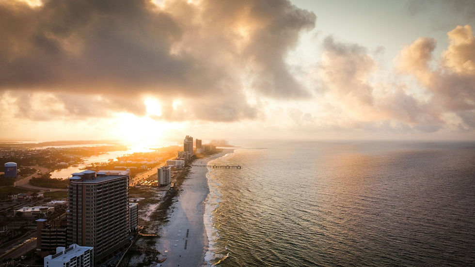
The Gulf interface. At the bottom of the map, the Alabama River and the Tombigbee converge to form the Mobile-Tensaw Delta, draining a basin of roughly 44,000 square miles before fanning into Mobile Bay through five major distributaries: the Mobile, Tensaw, Apalachee, Blakeley, and Spanish rivers. The Cochrane Bridge on US-90/98 marks the state fresh/saltwater jurisdiction line. Salinity here swings seasonally from near-zero to roughly 18 ppt, and that gradient is the engine of the inshore fishery: red drum, spotted seatrout, and southern flounder all use the brackish edge at different points in the year.
The longleaf and quail edge. Overlaying the soils is the ghost of the longleaf pine ecosystem, which once covered most of the Coastal Plain and now occupies less than 3% of its historical range. Where it persists or is being restored -- the Oakmulgee Ranger District of the Talladega National Forest, the Conecuh National Forest in the south, and the Red Hills slice along the Alabama-Florida line -- the fire-maintained pine-wiregrass savanna is among the most productive turkey-brood and bobwhite-quail habitat in the Southeast. The Oakmulgee Wild Bobwhite Restoration Initiative is a flagship example. The Black Belt's northern fringe, where chalk-transition soils meet that savanna, is the upland edge of the old quail belt.
The takeaway. Five soils, three rivers, one bay, and a fire-dependent pine layer on top. The interfaces between them -- chalk meeting pine, tailwater meeting reservoir, river meeting salt, savanna meeting prairie -- are where the sport is made.
3. What the Interface Creates
Black Belt chalk and whitetail genetics. The Selma Chalk story is fundamentally a mineral story. White-tailed deer antlers are roughly 22 percent calcium and 11 percent phosphorus by dry weight, and a landscape whose soils and forage run high in both minerals removes a nutritional ceiling that limits deer in poorer country. Alabama's statewide herd is estimated at roughly 1.5 million animals, and the 2024-25 reported harvest was 201,124 deer. The Black Belt's core counties -- Dallas, Wilcox, Lowndes, Marengo, Perry, Hale -- are the heart of the state's trophy reputation, and at least one operation, Alabama River Lodge, has documented practicing Boone-and-Crockett-class herd management on belt ground. What the chalk does not do is create deer out of nothing; it raises the nutritional plane so that good genetics and good age structure can express. That distinction matters for honest marketing.
A note on the predator and disease picture. Two pressures shape the herd's edges. Coyote predation on fawns has been documented at 50 to 80 percent mortality in some Southeastern studies, a recruitment drag that good habitat partially offsets. And Chronic Wasting Disease was first confirmed in Alabama in January 2022 in Lauderdale County, in the northwest corner, roughly 150 to 200 miles from the Black Belt; it had not been confirmed in the belt as of 2024. Any north-Alabama deer content must address the CWD management zone and carcass-transport rules; Black Belt content should note the disease exists in-state without overstating belt risk.
Wheeler's sanctuary and the spillover effect. Wheeler National Wildlife Refuge, established in 1938 as the first refuge ever superimposed on a TVA impoundment, is a 35,000-acre wintering engine on the easternmost edge of the Mississippi Flyway. In peak winter, it can hold upwards of 60,000 ducks and 9,000 geese alongside 15,000 to 20,000 sandhill cranes and a fraction of the roughly 64-bird Eastern Migratory whooping crane population. A 335-acre sanctuary closed to entry from November 15 through February 28 protects the core concentration. The machinery behind the spectacle is a cooperative farming program that plants 3,000 to 3,900 acres a year, with 16 managed impoundments operated by 20 water-control structures. Because general-public waterfowl hunting on the refuge is restricted to special youth, veteran, and active-military days, hunting pressure concentrates on adjacent leases and WMAs such as Swan Creek and Mallard Fox Creek, where the refuge functions as a sanctuary reservoir that birds spill out of. The spectacle is real; the open-access hunting is not.
The Sipsey tailwater and a rare Southern trout. Below Lewis Smith Dam, cold releases from the depths of the roughly 21,200-acre Smith Lake create the Sipsey Fork tailwater: stocked rainbows with holdover browns, the only year-round trout water in the state. Smith Lake itself reaches depths of nearly 522 feet, among the deepest and clearest reservoirs in the South, with a blueback herring forage base that has fostered a striper and spotted bass fishery. The tailwater is small, but it is genuine destination water, and almost no operator publishes on it.
Tailrace smallmouth and a river's own bass. The Tennessee River's value is not only its televised largemouth tournaments. The Pickwick and Wilson tailrace pools carry a regionally celebrated smallmouth fishery -- Wilson Lake sits roughly 140 feet below Wheeler Dam, among the deepest reservoirs east of the Rockies, and the cold, oxygenated tailrace water holds smallmouth and winter sauger and walleye. To the east, the Coosa offers the inverse: a warmwater shoal fishery for the Coosa shoal bass on the unimpounded Wetumpka shoals, one of the few Southeastern rivers with a black-bass species of its own. Two different bass stories, both under-published, in one state.
The delta gradient. In the Mobile-Tensaw, the interface is salinity itself. The seasonal push of salt up the distributaries and the freshwater pulse pushing back down after rain set where redfish stage, when speckled trout move, and when the autumn flounder run concentrates fish at the passes. The Mobile Harbor deepening project, which deepens the ship channel from 45 to 54 feet, is a live saltwater-intrusion question for the system, and Mobile Bay's summer jubilees -- nearshore hypoxia events that drive fish and crustaceans to the shallows -- are a documented expression of the same low-oxygen dynamics.
The pattern. In each case, the productive thing happens at a boundary. That is the unifying ecological lesson of the state.
4. Migration and Timing Signals
The Black Belt rut. Alabama runs one of the latest whitetail ruts in the continental United States. In the state's Zone C, which covers much of the Black Belt, peak breeding falls in mid-January. Archery opens around October 15 and runs to roughly February 10; gun season opens in late November; there are no antler restrictions and a two-doe daily limit in much of the zone. For hunters and outfitters used to a November rut farther north, the January peak is a genuine planning signal: the best Black Belt rut hunting overlaps the post-Christmas window when most of the country has already hung up the bow.
The spring turkey window. Eastern wild turkey breeding in Alabama runs from late March through May, with peak activity in mid-April and gobbling driven up by lengthening days from late January onward. The state has tightened its framework in step with a multi-state decline in the Southeast: the spring bag limit was cut from five birds to four in 2019, then to three with a one-bird-per-day limit effective in 2022. Public-land gobblers on the Talladega ridge-and-valley country and the Bankhead's Sipsey Wilderness edge fish the same calendar, with terrain making the hunting harder, not the timing different.
The Mississippi Flyway clock. Wheeler's waterfowl follow the broad flyway calendar. Green-winged teal can arrive in numbers by late September; dabbling ducks build through October and November; diving ducks peak in December and January as northern water freezes. The TVA winter drawdown -- beginning after Labor Day and reaching the winter minimum pool of 550.5 feet on Wheeler Reservoir by about January 1 -- progressively exposes mudflats exactly as the birds arrive, which is the mechanical reason the refuge concentrates birds when it does. Sandhill cranes begin arriving in late November and peak in early January. Alabama opened its first modern sandhill crane season in December 2019, the first in 103 years, with a limited, random-draw permit system and a mandatory whooping-crane identification test, a regulatory complexity unique in the state's bird management.
The Gulf inshore species clock. On the coast, autumn, roughly September through November, is the peak multi-species window in the delta and bay: bull redfish aggregate, and the southern flounder run concentrates fish heading for the passes. Spotted seatrout fish the marsh edge through the warm months and pull to deeper holes in cold snaps. Slot limits and seasons for all three primary inshore species are set by the state and must be confirmed against the current regulations before any trip is planned.
The bass and trout windows. Largemouth on the Tennessee River chain run year-round with a March-to-May spawn peak; smallmouth in the Pickwick and Wilson tailrace pools fish hardest in cooler water; sauger and walleye stack below Wheeler and Wilson dams from roughly December through February. On the Coosa, Weiss Lake's crappie peak runs February through April. The Sipsey Fork trout fishery, fed by cold dam releases, holds through the summer when the rest of the state's water is too warm for trout, which is precisely what makes it rare.
The upshot. Alabama has no single season. It has a near-continuous rotation. A well-positioned operator or lodge can sell something from September flounder through the January rut and crane spectacle into spring turkey, and the bass spawn, without a true dead month
.
5. On the Ground: Basecamps Across the State
Selma and Demopolis (Black Belt). These are the natural hubs for chalk-prairie whitetail. Selma sits on the Alabama River in Dallas County at the belt's core; Demopolis anchors the western belt where the Tombigbee and Black Warrior meet. From either, a hunter is within a short drive of the Dallas-Wilcox-Marengo-Perry core. Old Cahawba, the state's former capital and now an archaeological district, sits where the Cahaba meets the Alabama near Selma, a marker of how deep the human history runs on this ground.
Decatur (Tennessee Valley). Decatur, population 57,938, sits on Wheeler Reservoir adjacent to the refuge and roughly 30 miles from Huntsville. It is the base camp for the crane-and-waterfowl spectacle and for the Wheeler and Wilson bass and sauger water. The Festival of the Cranes, held the second week of January, is the public face of the refuge and a ready-made shoulder-season hook for any northern-Alabama operator.
Mobile and Dauphin Island (Gulf Coast). Mobile is the gateway to the delta and the bay; Dauphin Island is the barrier-island jumping-off point for inshore and nearshore water. From a single outboard tank out of the lower delta, a captain can touch multiple sporting verticals, which is exactly what the delta deep-dive makes. The Dauphin Island Sea Lab anchors the region's marine science and is the right institutional reference for bay ecology.
Talladega and the interior forests. The town of Talladega and the broader Cheaha highlands provide access to the Talladega National Forest's ridge-and-valley turkey and deer country, including Cheaha Mountain at 2,407 feet, the state's highest point. To the northwest, the Bankhead National Forest and the Sipsey Wilderness, the first wilderness designated east of the Mississippi at about 25,500 acres, frame the Sipsey Fork trout water below Smith Dam. These are public-land base camps for the do-it-yourself crowd, and they are nearly absent from the commercial-operator map.
Wetumpka and the Coosa-Tallapoosa fork. At the southern end of the Coosa chain, Wetumpka sits at the fall line where the river runs unimpounded toward its meeting with the Tallapoosa. It is the basecamp for the shoal-bass fishery and the Fort Toulouse-Kowaliga historical corridor, a warmwater fly destination with the editorial halo already in place and almost no operator publishing under it.
The geography is the product. Five-plus base camps, as many different trips, one license.
6. Planning Your Trip: Vertical by Vertical
The table below summarizes the core ecologies, their anchor waters or grounds, the peak window, and the primary public source to verify current regulations. All seasons, slot limits, and bag limits reset annually and must be confirmed against current-season ADCNR and USFWS publications before booking or publishing.
Vertical | Anchor | Peak Window | Verify With |
Black Belt whitetail | Dallas/Wilcox/Marengo core | Mid-Jan rut (Zone C); archery Oct 15-Feb 10 | ADCNR (outdooralabama.com) |
Inshore saltwater | Mobile-Tensaw Delta / Mobile Bay | Sep-Nov multi-species peak | ADCNR Marine Resources |
Tennessee River bass | Pickwick/Wilson/Wheeler/Guntersville | Mar-May spawn; smallmouth in cool water | ADCNR; TVA lake levels |
Waterfowl & cranes | Wheeler NWR + adjacent WMAs | Dec-Jan peak | USFWS Wheeler; ADCNR seasons |
Spring turkey | Talladega / Bankhead public land | Late Mar-May; mid-Apr peak | ADCNR; USFS WMAs |
Year-round trout | Sipsey Fork below Smith Dam | Year-round (cold releases) | ALDCNR stocking; USFS Bankhead |
Table compiled from the ADCNR, USFWS, USFS, and TVA sources listed in the full citations at the foot of this report. Confirm all current-season dates and limits before relying on them.
7. Key Takeaways
Alabama is five sporting states in one. Chalk-prairie whitetail, delta and bay inshore, Tennessee River bass, Wheeler waterfowl and cranes, and interior-forest public land plus the Sipsey trout tailwater, all reachable across a single state on one license.
Geology drives the trophy reputation. The Selma Chalk's calcium- and phosphorus-rich soils raise the nutritional plane for Black Belt deer; the chalk does not make antlers on its own, but it removes a ceiling.
Boundaries make the sport. Tailrace meeting reservoir, river meeting salt, sanctuary meeting open ground, savanna meeting prairie: the productive zones are interfaces.
The calendar barely rests. September flounder, the January Black Belt rut, the January crane peak, spring turkey, the March-May bass spawn, and year-round Sipsey trout give the state a near-continuous season.
Verification is non-negotiable. Seasons, slot limits, bag limits, and crane-permit allocations reset annually. Every regulatory figure here must be re-confirmed against current ADCNR and USFWS publications before it is acted on or published.
The market is physically owned and digitally empty. Across the state's verticals, the operators who hold the ground hold almost none of the search.
8. For the Operators
Three dynamics define the Alabama opportunity, and they are specific.
Black Belt whitetail outfitters: a succession cliff. Many of the belt's whitetail operations are legacy businesses, twenty years and more of lease relationships, herd management, and repeat clients, carried on a thin digital presence, often a Facebook page and a word-of-mouth network. That is durable until the founder steps back. The reputation lives in one person's head and one person's contacts, and it does not survive a transition unless someone converts it into a publishing asset that outlives the handoff. The deer are real; the digital equity is not yet built.
Mobile inshore captains: aggregator saturation. On the coast, the inshore market is mediated by booking aggregators -- BookYourHunt, FishingBooker, Captain Experiences -- that intercept the search and rent the relationship back to the captain. A captain who never publishes under their own name surrenders the inquiry layer by default, and the editorial halo, the delta's America's Amazon fame, attaches to magazines and the listing services rather than to any working operator.
Talladega and Bankhead: operator-invisible public land. The interior forests are AI-famous as hiking and wilderness destinations, yet operator-invisible to the sporting crowd. The Sipsey Fork is the only year-round trout water in Alabama, and our research flags it as a content-arbitrage gap so wide that almost no operator publishes on it. The public-land waterfowl, deer, and turkey crowds arrive through generic search and government pages, not through a named operator.
The data behind the gap. Across 2,206 outfitters audited in the Southeast, the mean digital-health score is 5.57 of 10; Alabama sits at the bottom of that table at 4.76, the lowest in the dataset, with AI high-visibility share at 19.9 percent. Roughly 80 percent of audited operators use no schema beyond CMS defaults, about 85 percent have no FAQ page, and fewer than 40 percent run an email newsletter. The Cahaba alone -- 190 free-flowing miles, federally listed endemics, an annual lily bloom, and a national wildlife refuge -- is the largest editorial-versus-commercial asymmetry in the state, with essentially no operator publishing on any of it.
The through-line. The operators who own this ground physically do not own it online. The aggregators, the magazines, and the agency pages do. The work is to become the digital face of a market you already hold in the field: to claim and structure the Google Business Profile, layer the right schema, answer the questions every traveler is already asking an AI assistant, and publish the durable, sourced editorial that earns the citation. What you've built deserves to be found.
9. Full Citations and Sources
The complete source list for this report, with what each source supports and its confidence level. Confidence terms: verified means confirmed from a named primary or institutional source; reported means an attributed secondary source, plausible but unconfirmed; speculative means inference from analogous systems; data gap means information sought but not available in accessible public sources. All regulatory figures reset annually and must be re-confirmed before publication or booking.
Government and agency sources
Alabama Department of Conservation and Natural Resources (ADCNR / Wildlife and Freshwater Fisheries, outdooralabama.com) -- statewide deer herd estimate (~1.5 million, approximate); 2024-25 reported harvest of 201,124 (verified); Zone C mid-January rut and season framework, archery Oct 15-Feb 10, late-November gun opener, no antler restrictions, two-doe daily limit (verified, confirm current season); spring turkey bag-limit reductions to four (2019) and three with one-per-day (2022) (reported); marine inshore regulations for red drum, spotted seatrout, southern flounder (current slot limits a data gap); Sipsey Fork trout stocking (verified); first modern sandhill crane season, December 2019, draw permit and ID test (verified); first Alabama CWD case, Lauderdale County, January 2022 (verified).
U.S. Fish and Wildlife Service (fws.gov/refuge/wheeler) and the Wheeler NWR Comprehensive Conservation Plan -- 1938 establishment as the first refuge on a TVA impoundment; 35,000 acres; easternmost Mississippi Flyway position; peak counts (~60,000 ducks, ~9,000 geese, 15,000-20,000 sandhill cranes); 335-acre sanctuary closure Nov 15-Feb 28; cooperative farming of 3,000-3,900 acres; 16 impoundments and 20 water-control structures; special youth/veteran/active-military hunting framework (all verified). Also, Bon Secour NWR and Cahaba River NWR.
U.S. Forest Service -- Talladega National Forest (Cheaha and Oakmulgee districts) and William B. Bankhead National Forest; Oakmulgee longleaf restoration; Sipsey Wilderness (reported/verified).
U.S. Army Corps of Engineers, Mobile District -- Mobile-Tensaw Delta hydrology; five distributaries (Mobile, Tensaw, Apalachee, Blakeley, Spanish); ~44,000-square-mile drainage; Mobile Harbor deepening from 45 to 54 feet (verified).
Tennessee Valley Authority (tva.com) -- Tennessee River U-shaped course; Wheeler Reservoir winter minimum pool of 550.5 feet; post-Labor-Day drawdown calendar; impoundment operations (verified).
U.S. Census Bureau (2020) -- Decatur population 57,938 (verified).
Research, conservation, and institutional sources
Tall Timbers Research Station, with USFS and Quail Forever -- Black Belt and longleaf quail ecology, prescribed fire, and the Oakmulgee Wild Bobwhite Restoration Initiative (reported).
The Nature Conservancy, Alabama -- Cahaba River and Mobile-Tensaw Delta as flagship conservation projects; most-biodiverse-river framing (verified).
Forever Wild Land Trust -- public land and access in the Mobile-Tensaw Delta, including the Bartram Canoe Trail (reported).
International Crane Foundation (savingcranes.org, February 2026) -- ~64-bird Eastern Migratory whooping crane population; Whooping Crane Eastern Partnership history since 1999 (verified).
Ducks Unlimited -- documented conservation project at Wheeler NWR (reported).
Longleaf Alliance and America's Longleaf Restoration Initiative -- longleaf range under three percent of historical extent; pine-savanna habitat work on the Oakmulgee and in the Conecuh (reported).
Dauphin Island Sea Lab -- Mobile Bay ecology and summer jubilee hypoxia events (verified).
Auburn University extension -- appropriate state research partner for cervid and habitat science.
Alabama Birding Trails (2024) -- Wheeler waterfowl and sandhill crane counts and arrival timing (verified).
Kilgo and colleagues -- Southeastern coyote fawn predation studies: 50-80% mortality in some systems (verified in the literature).
Secondary, taxonomic, and internal sources
Black-bass taxonomy -- Coosa shoal bass (Micropterus coosae) as the only black-bass species named for an Alabama river (verified).
Cervid antler chemistry -- antlers ~22% calcium and ~11% phosphorus by dry weight; soil-to-forage-to-condition pathway (verified in general; Black Belt-specific application reported).
Ben Raines (2020) and APT documentary work -- E.O. Wilson's America's Amazon attribution for the Mobile-Tensaw Delta (verified attribution).
Alabama Power -- Smith Lake area (~21,200 acres), depths near 522 feet, blueback-herring forage base (reported).
Alabama River Lodge -- documented Boone-and-Crockett-class herd management on Black Belt ground (reported).
NPR (2019) -- coverage of Alabama's reinstated sandhill crane season (verified).
Pine & Marsh internal audit corpus -- 2,206-outfitter digital-health dataset (Alabama lowest at 4.76 of 10; 19.9% AI high-visibility share; schema, FAQ, and newsletter adoption rates); sub-regional and vertical research briefs underpinning the Tennessee River, Coosa, Bankhead, Cahaba, and Gulf Coast sections (reported, internal).
Confidence note: where a figure is tagged reported or where a data gap exists -- particularly current-season inshore slot limits, county-level harvest, fawn survival, and precise Zone C breeding dates -- treat the number as directional and verify against the cited agency before relying on it.
10. Explore More
Go deeper on each of the ecologies in our sub-regional Field Reports and the Alabama state marketing guide:
The Alabama Black Belt: A Sporting Deep-Dive on Chalk-Soil Country
Marketing an Alabama Black Belt Whitetail Outfitter: The Full Playbook
The Mobile-Tensaw Delta: One Guide Per 21,000 Acres of America's Amazon
Talladega National Forest: Two Districts, Two Stories -- Cheaha and Oakmulgee
Alabama Sporting Country: A State-Wide Outfitter Market Deep-Dive
Marketing a Sporting Operation in Alabama: The Full State Guide
What you've built deserves to be found. If you operate in any of these ecologies and want to be the named, AI-cited authority for the water and ground you already work, that is the conversation we want to have.


Comments