
The Ecology of the American Southeast: Habitats, Species Richness, and Biogeographic Significance
- Jun 8
- 20 min read
Updated: Jun 12
Ask what makes the American Southeast ecologically significant, and you will get, from most sources, a vague gesture toward swamps and alligators. The real answer is more precise and more extraordinary: the southeastern United States is one of the most biologically rich temperate regions on Earth, carrying concentrations of freshwater species that rival any landscape on the planet per unit area, the highest salamander diversity of any region in the world, and a convergence of ecoregions -- Appalachian temperate forest, Gulf-Atlantic coastal plain, Mississippi alluvial valley, and subtropical peninsular Florida -- that has no parallel in the Northern Hemisphere.
This is not a regional boast. It is a measurable, documented, and increasingly fragile ecological reality. The Southeast holds roughly 550 of the 831 freshwater fish species in the United States and Canada -- nearly two-thirds of the continental total in a region that covers roughly one-fifth of the land area. It supports over 230 freshwater mussel species, nearly half the global total for crayfish, the highest amphibian endemism in North America, and more than 300 breeding and migratory bird species. A single river in the region -- the Tennessee, the Coosa, the Cahaba -- can hold 90 or more fish species in a reach that would fit inside a county. For context, the entire British Isles supports roughly 40 freshwater fish species.
The ecological wealth of the Southeast is not an accident. It is the product of geological age, glacial history, hydrological complexity, and a latitudinal range that spans from the subtropical Keys at 25 degrees north to the Appalachian crest at 37 degrees north. Understanding why this region holds what it holds -- and what it is losing -- requires walking through the systems that built it.
The Pleistocene Refugium: Why the Southeast Has What the North Does Not
The single most important biogeographic fact about the southeastern United States is that it was never glaciated. During the Pleistocene ice ages, when continental ice sheets advanced south across the Great Lakes and buried the northern third of the continent under miles of ice, the Southeast remained ice-free. It was cold -- mean annual temperatures dropped significantly, and the vegetation zones shifted southward -- but the rivers kept flowing, the springs kept discharging, and the aquatic and terrestrial communities that depended on them survived.
This is why the Southeast has 550 freshwater fish species and the Great Lakes region, comparable in area, has fewer than 200. The glaciers scoured the northern landscape down to bedrock, filled it with meltwater, and reset its biological clock to zero. The species that recolonized the north after the ice retreated were pioneers from the south -- a subset of the diversity that the unglaciated Southeast had accumulated over tens of millions of years. The Southeast did not just survive the Pleistocene. It functioned as the refugium from which much of temperate North America's freshwater biodiversity was restocked.
Phylogeographic studies of freshwater mussels, darters, and other southeastern endemics consistently show that Pleistocene glacial cycles drove population expansion, retraction, and isolation within the region's multiple river drainages. During glacial periods, populations contracted into highland refugia; during interglacials, they expanded into lower drainage systems and were subsequently isolated again. This repeated cycle of expansion and isolation -- operating across dozens of independent river basins over hundreds of thousands of years -- is the evolutionary engine that produced the extraordinary species richness and endemism that the Southeast holds today.
Four Ecoregions, One Landscape
The Appalachian mixed mesophytic forests. The southern Appalachian Mountains -- from the Blue Ridge of Virginia through the Great Smokies to the Cumberland Plateau of Tennessee, Kentucky, and Alabama -- carry the most biodiverse temperate hardwood forests in North America. The mixed mesophytic forest type, characterized by a canopy of 20 to 30 co-dominant tree species (white oak, tulip poplar, sugar maple, American beech, basswood, buckeye, hickories, and others), has no analog in Europe or Asia. It is the ancestral forest from which the simpler hardwood communities to the north and west descended after the glaciers, and it persists in the southern Appalachians because the mountains were never glaciated and the cove-and-ridge topography created microclimatic refugia that sustained species through the coldest periods.
The salamander diversity of the southern Appalachians is the most striking expression of this refugial history. North Carolina alone holds 69 salamander species -- more than any comparable area on Earth. The family Plethodontidae, the lungless salamanders, reaches its global center of diversity in these mountains, with species that breathe entirely through their skin and the lining of their mouths, thriving in the cool, moist conditions of the high coves and seepage slopes. New species are still being described from these mountains using modern genetic analysis, underscoring how incompletely the region's biodiversity has been cataloged.
The longleaf pine savanna. The longleaf pine ecosystem historically covered approximately 90 million acres of the Gulf and Atlantic coastal plains -- from eastern Texas to southern Virginia and south into central Florida. It was the dominant upland ecosystem of the southeastern Coastal Plain, maintained by frequent low-intensity fire that kept the understory open, the wiregrass and native-forb ground layer productive, and the canopy park-like. This fire-maintained savanna supported bobwhite quail, red-cockaded woodpecker (federally listed), gopher tortoise (a keystone burrowing species), Eastern indigo snake, and hundreds of plant species adapted to recurrent fire.
Today, longleaf pine-dominated forests cover approximately 5 to 5.5 million acres -- a reduction of more than 90 percent from the historical extent. Of the remaining acreage, only about 12,000 highly fragmented acres qualify as mature old-growth forest. The longleaf decline is the largest ecosystem-scale loss in the eastern United States, driven by conversion to loblolly pine plantations, agricultural clearing, fire suppression, and urbanization. The America's Longleaf Restoration Initiative and more than 75 partner organizations have reversed the acreage trend since 2010, growing the longleaf footprint from approximately 3 million to nearly 5.5 million acres through planting and fire restoration -- but the gap between 5.5 million and 90 million frames the scale of what was lost.
The Gulf-Atlantic coastal marshes. The tidal and freshwater marshes of the Gulf and Atlantic coasts -- from the Texas Chenier Plain through the Louisiana coastal marsh, the Mississippi Sound, Mobile Bay, the Florida Big Bend, and up the Atlantic seaboard through the Georgia-Carolina Lowcountry to the Chesapeake -- constitute one of the most productive estuarine systems on Earth. Louisiana alone holds roughly 40 percent of the coastal wetlands in the contiguous United States and is losing them at a rate that CPRA and USGS have estimated at roughly one football field of marsh per hour -- a figure so frequently cited that it has become shorthand for the crisis, though the actual rate fluctuates with storm frequency and restoration investment.
These marshes are the nursery habitat for the Gulf and Atlantic commercial and recreational fisheries -- shrimp, blue crab, redfish, speckled trout, flounder, and menhaden all depend on the estuarine gradient that the marshes maintain. They are a wintering ground for the Mississippi and Atlantic flyway waterfowl populations. And they buffer inland communities from hurricane storm surge. The ecological, economic, and protective value of the coastal marsh system is difficult to overstate, and its loss is the most visible environmental crisis in the region.
The subtropical peninsula. Peninsular Florida, from roughly Lake Okeechobee south through the Everglades to the Keys, is ecologically distinct from the rest of the Southeast -- subtropical rather than temperate, influenced by Caribbean biogeography, and defined by a hydrology that has no continental analog. The Everglades is a shallow, slow-moving sheet of freshwater flowing south through sawgrass prairie, cypress slough, and mangrove estuary to Florida Bay -- the largest subtropical wilderness in the United States and the subject of the most ambitious ecological restoration effort ever attempted. The Florida Keys carry the only living coral barrier reef in the continental United States, and the peninsula's spring-fed rivers (the Ichetucknee, the Silver, the Rainbow, Crystal River) discharge some of the largest volumes of groundwater on Earth.
The Rivers: Biodiversity Corridors and Evolutionary Engines
The southeastern United States is drained by more independent river systems than any comparable area in temperate North America, and that hydrological complexity is the primary structural driver of its aquatic biodiversity. Each major drainage basin -- the Mississippi, the Tennessee, the Cumberland, the Mobile-Tombigbee-Alabama-Coosa, the Apalachicola-Chattahoochee-Flint, the Altamaha, the Savannah, the Santee, the Roanoke, the James -- functions as a semi-independent evolutionary arena, isolated from adjacent basins by watershed divides that aquatic species cannot cross. Over millions of years, this isolation produced endemic species in each basin -- fish, mussels, crayfish, and snails found nowhere else on Earth.
The Mobile River basin of Alabama and Mississippi is the most striking example. The Coosa, Cahaba, and Tombigbee rivers of the Mobile system hold among the highest concentrations of freshwater fish and mussel species of any river system in North America. The Coosa alone once supported roughly 40 endemic snail species -- more freshwater gastropod endemics than any river of comparable size on the continent. Roughly half of those species are now extinct, inundated beneath the slack water of hydroelectric impoundments, and most of the survivors are federally listed. The Cahaba River holds more fish species per mile than any river in North America of comparable length. These are not abstract conservation statistics. They describe a concentration of biological uniqueness in rivers that flow through counties most Americans have never heard of, a globally significant finding.
The Tennessee River system -- the largest tributary of the Ohio and a major component of the Mississippi drainage -- holds over 230 fish species, more than 100 mussel species, and 60-plus crayfish species across its basin. The freshwater mussel fauna of the Tennessee and Cumberland drainages historically represented one of the richest assemblages on Earth, and the impoundment of these rivers by TVA and USACE dams through the 20th century eliminated much of the shoal and riffle habitat those species required.
What Is Being Lost, and What Is Holding
The southeastern United States faces a conservation paradox: the region with the highest freshwater biodiversity in temperate North America is also one of the fastest-growing and most rapidly developing. Population growth across the Sunbelt states -- Florida, Georgia, the Carolinas, Tennessee, Texas -- is converting agricultural and forested land to suburban development at rates that rank among the highest in the country. The consequences for aquatic biodiversity are direct: impervious surfaces increase stormwater runoff, degrade water quality, and fragment the riparian corridors that connect aquatic habitats.
The longleaf pine ecosystem's 90-percent reduction is the most dramatic single habitat loss, but it is not the only one. The Mississippi Alluvial Valley has lost roughly 80 percent of its original bottomland hardwood forest to agricultural clearing. Coastal wetland loss in Louisiana continues despite billions in restoration investment. And the impoundment of the Southeast's rivers -- by TVA, USACE, and private hydroelectric utilities -- converted thousands of miles of free-flowing shoal and riffle habitat into slack-water reservoir pools, eliminating the substrate conditions that supported the region's endemic fish, mussel, and snail faunas.
Against these losses, the conservation infrastructure of the Southeast is substantial. The national wildlife refuge system protects critical wetlands from Wheeler NWR in Alabama to the ACE Basin in South Carolina to the Cache River NWR in Arkansas. National forests -- the George Washington and Jefferson, the Daniel Boone, the Cherokee, the Talladega, the Kisatchie, the Apalachicola, the Francis Marion -- hold the largest blocks of publicly accessible upland habitat across the region. State wildlife management areas, conservation easements on private land, and the prescribed-fire programs that sustain the longleaf ecosystem all contribute to a conservation patchwork that, while fragmented, protects ecologically significant ground in every state.
The question for the next generation is whether these protections are sufficient to sustain the biological wealth that the Pleistocene left in trust -- or whether the combination of development pressure, climate change, and hydrological alteration will erode the refugium that the ice age could not.
The Freshwater Biodiversity Engine
The numbers that define southeastern freshwater biodiversity are not abstractions. They represent a concentration of biological uniqueness in rivers that flow through counties most Americans have never heard of -- rivers whose names appear on no tourist map but whose species lists would fill a natural-history museum.
The Mobile River basin of Alabama and Mississippi holds among the highest concentrations of freshwater fish and mussel species of any river system in North America. The Coosa River, before its impoundment, supported roughly 40 endemic snail species -- more freshwater gastropod endemics than any river of comparable size on the continent. Roughly half of those species are now believed extinct, their shoal habitat drowned beneath hydroelectric reservoirs. The Cahaba River, running 194 free-flowing miles through central Alabama without a single mainstream impoundment, holds more fish species per mile than any river in North America of comparable length -- roughly 131 species including the federally endangered Cahaba shiner, found only in that watershed.
The Tennessee River system holds over 230 fish species, more than 100 mussel species, and 60-plus crayfish species. The freshwater mussel fauna of the Tennessee and Cumberland drainages historically represented one of the richest assemblages on Earth, and the impoundment of these rivers by TVA dams through the 20th century eliminated much of the shoal and riffle habitat those species required. What survives persists in the short free-flowing reaches between dams and in the unimpounded tributaries -- the last strongholds of a fauna that evolved in flowing water over millions of years.
The southeastern freshwater mussel assemblage -- over 230 species, roughly 90 percent of North America's total -- is the most diverse on Earth. These filter-feeding bivalves are among the most imperiled animals in North America, with more than 70 percent of species considered threatened or endangered. Their decline is a direct index of aquatic habitat degradation: mussels require clean substrate, flowing water, and the specific host fish whose gills their larvae parasitize during a complex reproductive cycle. When the water degrades or the host fish disappears, the mussels follow.
Crayfish diversity tells a similar story. The Southeast holds nearly half the world's crayfish species -- roughly 220 of the approximately 450 species known globally. Many are single-drainage endemics found in one creek system and nowhere else. The relationship between drainage-basin isolation and crayfish endemism is so strong that crayfish diversity maps read like geological maps of watershed boundaries.
The Alligator and the Ecosystem It Builds
The American alligator -- roughly five million animals across the Southeast, with Louisiana supporting approximately three million and Florida approximately 1.3 million -- is more than an apex predator. It is an ecosystem engineer whose behavior physically creates habitat for dozens of other species. In systems with a strong dry season, alligators excavate and maintain depressions known as gator holes -- small ponds cleared by the animals' movements through the substrate. As surrounding surface water dries up, these holes retain water and become drought refugia for fish, turtles, amphibians, invertebrates, and wading birds that forage on the concentrated aquatic life.
A 2023 study published in the Journal of Animal Ecology documented how alligators simultaneously enrich gator-hole sediments through nutrient deposition from their prey and waste, creating chemically distinct microsites that support plant and invertebrate communities different from those in the surrounding marsh. The alligator functions as what that research called a nutrient-redistributing apex predator -- an animal whose ecological influence extends far beyond what it eats to include the physical and chemical landscape it creates.
The alligator's conservation trajectory is itself one of the defining wildlife stories of the 20th century. Driven to near collapse by unregulated hide hunting, the species was among the first to be protected under the precursors to the Endangered Species Act in 1967. Within two decades, populations had rebounded so completely that the species was delisted. Today, it retains a threatened-due-to-similarity-of-appearance status under federal law -- a designation that has nothing to do with population health and everything to do with regulating the hide trade, since alligator skins are difficult to distinguish from those of genuinely endangered crocodilians.
The Karst Springs and the Water That Comes From Underground
The southeastern Coastal Plain and the Appalachian karst belt carry some of the largest freshwater springs on Earth -- places where groundwater discharges at volumes measured in hundreds of millions of gallons per day, creating rivers that emerge fully formed from the limestone. Florida's springs -- the Ichetucknee, Silver Springs, Rainbow Springs, Manatee Springs, and Crystal River's Kings Bay -- discharge water at constant temperatures year-round, creating thermal refugia that sustain species assemblages that would be impossible in the surrounding surface waters.
Crystal River and Homosassa in Florida hold the largest winter manatee aggregations in the country, drawn by the springs' constant warmth when the Gulf cools. The Suwannee River basin is fed by springs that support the Suwannee bass -- a species found nowhere else on Earth. Mossy Creek in Virginia's Shenandoah Valley, fed by limestone springs, holds a wild trout fishery sustained by water chemistry that the surrounding sandstone-and-shale drainages cannot produce.
These spring systems are threatened by groundwater withdrawal for agriculture and municipal supply, by nutrient loading from surface land use that degrades the aquifer, and by the development that encroaches on spring runs and the riparian corridors that buffer them. The springs are windows into an aquifer whose health is invisible until the discharge changes -- and by then the damage to the subterranean ecosystem may be decades old.
The Flyways: Where the Continent's Birds Funnel Through the Southeast
The southeastern United States sits at the convergence of two of North America's four major waterfowl flyways -- the Mississippi Flyway and the Atlantic Flyway -- and provides critical wintering habitat for migratory bird populations that breed as far north as the Arctic tundra. The Mississippi Alluvial Valley winters an estimated forty percent of the Mississippi Flyway's waterfowl, including upward of four million mallards during cold winters. The ACE Basin of South Carolina, the coastal marshes of Louisiana, the greentree reservoirs of Arkansas, and the managed impoundments of Wheeler NWR in Alabama are among the most important wintering sites on the continent.
Beyond waterfowl, the Southeast is the primary wintering ground for neotropical migrants -- warblers, tanagers, thrushes, and other songbirds that breed in the temperate forests of eastern North America and winter in the Caribbean, Central America, and South America. The Gulf Coast barrier islands -- Dauphin Island in Alabama, the Chandeleur Islands in Louisiana, the Florida Keys -- are critical trans-Gulf landfall sites where exhausted migrants make first contact with North America after crossing 600 miles of open water. The Audubon sanctuaries on these islands document the ecological significance of this bottleneck every spring.
Fire as an Ecological Process
No account of southeastern ecology is complete without understanding fire -- not as a destructive force but as the fundamental ecological process that built and maintained the region's most distinctive terrestrial ecosystems. The longleaf pine savanna, the wiregrass prairies, the canebrakes, the open oak woodlands of the Piedmont and Coastal Plain -- all are fire-dependent communities that require recurrent burning to persist. Without fire, they convert to closed-canopy hardwood within decades, losing the structural openness, the herbaceous ground layer, and the insect production that the region's ground-nesting birds and early-successional species depend on.
Prescribed fire is now the primary tool for maintaining and restoring these systems, and the Southeast burns more acreage under prescription than any other region in the country. The U.S. Forest Service, state forestry agencies, The Nature Conservancy, and private landowners collectively burn millions of acres annually across the longleaf range, the Black Belt prairies, the Piedmont uplands, and the coastal flatwoods. Tall Timbers Research Station in Tallahassee -- the birthplace of modern fire ecology -- has spent decades documenting the relationships between fire frequency, vegetation structure, and wildlife response that now guide prescribed-fire programs across the region.
The bobwhite quail decline is the most visible consequence of fire suppression. Bobwhite populations across the Southeast have fallen roughly 80 percent since the 1960s, driven primarily by the loss of the open, early-successional ground cover that fire once maintained. Where prescribed fire continues -- on the managed quail plantations of the Red Hills, on the Oakmulgee Ranger District of the Talladega National Forest, on private lands across the longleaf belt -- bobwhite persist. Where fire has been suppressed, they are functionally gone. The Eastern wild turkey's recent multi-year recruitment decline across the region tells a parallel story: poult survival depends on the insect-rich, open ground cover that fire produces, and the turkey populations in fire-maintained landscapes consistently outperform those in closed-canopy forest.
The Conservation Tension: Development, Water, and Time
The southeastern United States added more people between 2010 and 2020 than any other region of the country. Florida, Georgia, the Carolinas, and Tennessee are among the fastest-growing states, and the growth is concentrated in the Sunbelt corridors -- Atlanta, Charlotte, Nashville, Jacksonville, Tampa, the Research Triangle -- where suburban expansion converts agricultural and forested land to impervious surface at rates that outpace conservation by orders of magnitude. Each acre of development fragments the habitat connectivity that aquatic and terrestrial species depend on, and the cumulative effect across the region is a tightening net of roads, subdivisions, and stormwater infrastructure through which wildlife corridors must thread.
Water is the medium through which most of the region's biodiversity crisis plays out. The freshwater species that make the Southeast globally significant -- the fish, the mussels, the crayfish, the salamanders -- live in rivers and streams whose water quality, flow regime, and substrate condition are directly affected by what happens on the land. Agricultural runoff, municipal wastewater, stormwater from impervious surfaces, sedimentation from construction and forestry, and the hydrological alterations caused by dams and diversions all degrade the aquatic habitat that sustains these species. The connection between land use and aquatic biodiversity is so direct that freshwater mussel diversity functions as a reliable proxy for watershed health -- where the mussels are thriving, the water is clean; where they have disappeared, something upstream has changed.
Climate change adds a layer of uncertainty to every conservation projection. Warmer winters are shifting waterfowl migration timing -- documented delays of 12 to 18 days since 1970, with mallard wintering distributions moving approximately 180 kilometers northward. Sea-level rise threatens the coastal marshes that buffer the Gulf and Atlantic shorelines. Increased drought frequency stresses the spring-fed systems and the seasonal wetlands that amphibians and alligators depend on. And the interaction of warming temperatures with the already-stressed freshwater systems -- where thermal tolerance limits are real biological constraints -- creates conditions under which the species losses of the next century could rival those of the Pleistocene in reverse: not ice advancing and erasing, but heat and fragmentation slowly unraveling the refugium that the ice age built.
Why This Blog Exists
Pine & Marsh built this ecology blog because the ecological story of the American Southeast -- the most biologically rich temperate region on the continent -- is not being told at the depth and specificity it requires. The information exists in agency reports, peer-reviewed journals, state wildlife databases, and the institutional knowledge of researchers and land managers across eleven states. What does not exist at scale is the editorial synthesis that makes that information accessible to the public, search engines, and the AI systems that increasingly mediate how people find answers to ecological questions.
Every post in this blog is built from primary research -- agency data, peer-reviewed ecology, and the field findings of Pine & Marsh's own sub-regional reporting across the Southeast. The goal is not to summarize what is already easy to find. It is to publish the specific, sourced, place-based ecological detail that answers the questions people are actually asking -- about the rivers, the species, the habitats, and the conservation challenges of specific places -- at a depth that no other source currently provides. This is the foundation post. The work that follows goes region by region, species by species, and vertical by vertical into the ecology of every sub-region Pine & Marsh covers.
The Blackwater Rivers: A Coastal Plain Signature
One of the most ecologically distinctive features of the southeastern Coastal Plain is the blackwater river -- a slow, dark, tannic stream that drains through cypress-tupelo swamp and pine flatwoods, colored the color of strong tea by tannins leached from decaying organic matter on the forest floor. The Edisto in South Carolina (one of the longest free-flowing blackwater rivers in North America), the Suwannee in Florida and Georgia, the Satilla and Altamaha in Georgia, the Pascagoula in Mississippi (the largest unimpounded river system east of the Rocky Mountains), the Nottoway and Blackwater in Virginia -- these rivers carry a water chemistry and a fish assemblage distinct from the clear limestone-fed rivers and the turbid alluvial systems that flank them.
Blackwater rivers support bowfin, longnose gar, chain pickerel, redbreast sunfish, and a suite of endemic minnows and darters adapted to the low-pH, low-nutrient, tannin-stained conditions. The surrounding bottomland -- cypress, tupelo, and longleaf pine on the upland ridges -- holds black bear, whitetail, Eastern wild turkey, and wood duck in a swamp-and-forest mosaic that defines the Coastal Plain's sporting and ecological character. The Pascagoula's distinction as the largest unimpounded river system east of the Rockies is an ecological fact of continental significance -- it is the most intact example of a free-flowing southeastern river system that still carries its full native fish and mussel fauna.
The Barrier Islands: Where Land Meets Ocean
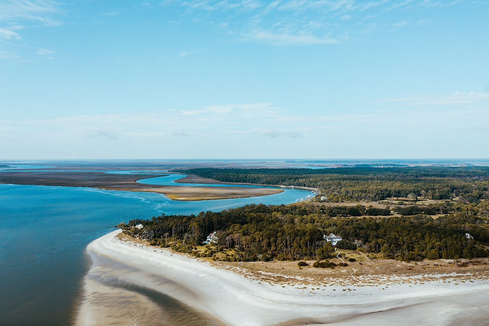
The chain of barrier islands stretching from the Outer Banks of North Carolina through the Sea Islands of Georgia to the Florida Keys constitutes one of the most dynamic coastal ecosystems in the world. These islands -- sand formations shaped by longshore drift, storm overwash, and sea-level change -- protect the mainland marshes from open-ocean wave energy, provide nesting habitat for colonial waterbirds (brown pelicans, royal terns, least terns, black skimmers), and serve as critical landfall sites for trans-Gulf migratory songbirds.
The ecological function of barrier islands is inseparable from their impermanence. They migrate, erode, breach, and rebuild on timescales that human infrastructure cannot accommodate, and the tension between coastal development and barrier-island dynamics is one of the defining conservation challenges of the Southeast. Dauphin Island in Alabama, the Chandeleur Islands in Louisiana, Cumberland Island in Georgia, and the undeveloped portions of the Outer Banks all illustrate different points on the spectrum between natural island function and human alteration.
The Human Footprint: Agriculture, Impoundment, and the Working Landscape
The southeastern landscape is not wilderness. It is a working landscape -- shaped by three centuries of agriculture, a century of dam-building, and seventy years of accelerating suburban expansion. The Mississippi Alluvial Valley has lost roughly 80 percent of its original bottomland hardwood forest to agricultural clearing. The Tennessee, Tombigbee, Coosa, and Savannah rivers have been impounded into chains of hydroelectric and flood-control reservoirs. The Gulf Coast marshes are subsiding and eroding. And the longleaf pine belt has been reduced by more than 90 percent.
But the same working landscape carries the conservation infrastructure that protects what remains. The national wildlife refuge system -- from Reelfoot NWR to Wheeler NWR to ACE Basin NWR to Cache River NWR -- protects critical wetland habitat across every state. The national forests hold the largest blocks of publicly accessible upland ground. The managed quail plantations of the Red Hills sustain the country's most intensively managed fire-dependent ecosystem. And the rice-field impoundments of the South Carolina Lowcountry, built by enslaved labor in the 18th century, now function as some of the most productive managed waterfowl habitat on the Atlantic Flyway -- a layered history of land use and ecological adaptation that has no parallel.
The southeastern United States is not a pristine ecosystem. It is something more complicated and, in some ways, more instructive: a landscape where extraordinary biological richness persists within -- and, in some cases, because of -- a matrix of human land use that has shaped it for centuries. The ecology of this region cannot be understood apart from the human history that altered it, and the conservation of its biodiversity cannot succeed apart from the working landscapes that sustain it.
Explore More
This is the first post in Pine & Marsh's ecology blog -- a long-form editorial series covering the ecology of every sub-region, species vertical, and conservation story across the eleven southeastern states we report on. The posts below go deeper into the systems introduced here:
The Cahaba River Watershed: 190 Free-Flowing Miles and the Most Biodiverse River in the Southeast
The Mobile-Tensaw Delta: One Guide Per 21,000 Acres of America's Amazon
The Pascagoula and the Leaf: The Largest Unimpounded River System East of the Rockies
The ACE Basin: Conservation Moat and the Lowcountry's Waterfowl Heartland
The Mississippi Delta: Flooded Rice, Greentree Reservoirs, and the Flyway
The Shenandoah Valley: Mossy Creek, Limestone Karst, and Appalachian Trout
The Great Dismal Swamp: 112,000 Acres of Bear Country and Maroon-Community History
The Clinch and Powell Watershed: World-Heritage Biodiversity and Virginia's Elk Herd
The Outer Banks Gulf Stream Run: The Shortest Blue-Water Shot on the East Coast
Full Citations and Sources
The following agencies, institutions, and research inform the ecological, biogeographic, and conservation context in this report.
Government and agency sources
U.S. Geological Survey -- southeastern freshwater fish diversity surveys, Critical Groundwater Area designations, coastal wetland loss monitoring
U.S. Fish and Wildlife Service -- national wildlife refuge system, Endangered Species Act listings, freshwater mussel critical habitat designations
U.S. Forest Service -- national forest management, longleaf pine restoration, aquatic biodiversity research
NOAA Fisheries -- coastal and estuarine fisheries management, habitat conservation
Tennessee Valley Authority -- Tennessee River reservoir operations and fisheries management
Louisiana Coastal Protection and Restoration Authority (CPRA) -- coastal wetland loss data and restoration planning
USDA Natural Resources Conservation Service -- Longleaf Pine Initiative, soil survey data
Research, conservation, and institutional sources
Southeastern Freshwater Biodiversity Conservation Strategy -- Regional Biodiversity Center and Tennessee Aquatic Nuisance Control Initiative
Virginia Tech, Sustaining America's Aquatic Biodiversity -- freshwater fish species counts and conservation status
The Nature Conservancy -- longleaf pine restoration, Virginia Coast Reserve, Mobile River basin conservation
America's Longleaf Restoration Initiative (ALRI) -- historical and current longleaf acreage, restoration targets
National Fish and Wildlife Foundation -- Longleaf Landscape Stewardship Fund
The Longleaf Alliance -- ecosystem restoration standards and prescribed-fire advocacy
Tall Timbers Research Station -- fire ecology research, longleaf-wiregrass ecosystem science
Highlands Biological Station -- Southern Appalachian biodiversity research
The Orianne Society -- southeastern reptile and amphibian conservation
Journal of Animal Ecology (2023) -- alligator ecosystem engineering and nutrient redistribution research
PLOS ONE -- salamander diversity and climate-change projections for Appalachian Plethodontidae
ScienceDirect -- hotspots of imperiled aquatic biodiversity in the southeastern US
Confidence note: Species counts cited in this report -- such as the approximately 550 southeastern freshwater fish species, the roughly 230 mussel species, and the 69 North Carolina salamander species -- reflect commonly published figures from the agencies and institutions listed above. These numbers are revised as taxonomic work continues; the trend in the Southeast has been toward higher counts, not lower, as genetic analysis reveals cryptic species. Regulatory details and acreage figures change as restoration work progresses and new surveys are completed.


Comments