
Wild Turkey of Alabama's Talladega and Bankhead National Forests

In mid-October the plateau woods of north Alabama start to sound different. On the broad ridges above the Sipsey Fork, a light wind is enough to knock acorns loose from the white oaks, and they rattle down through the drying canopy and tick off the rock bluffs below. Squirrels work the ground in the open. Somewhere back in the hardwoods a flock of turkeys is scratching through the leaf litter in a long, uneven line, leaving behind the overturned patches that hunters and biologists both learn to read. Two hours to the east, on the low mountains of the Talladega National Forest, the same story is playing out under a different mix of trees: chestnut oak and hickory on the dry ridges, pine coming back on the burned slopes, and longleaf where most visitors would never expect to find it.
These are Alabama's two upland national forests, and they hold a version of the eastern wild turkey story that the Coastal Plain does not tell. There is no flatwoods horizon here and no wiregrass. The country is folded and dissected, the forests are dominated by oaks and mixed pine, and the questions that matter for turkeys are about acorns, about how much sunlight reaches the forest floor, about fire, about a pine beetle epidemic that remade a forest, and about the feral pigs that keep turning up in places they should not be.
It is also a story without a clean villain. The U.S. Forest Service's most recent monitoring report says plainly that turkeys on Alabama's national forests are believed to be declining, that low female recruitment is the signal, and that the cause is not understood. That honesty is worth holding onto. What follows is an account of the habitat, the numbers, and the pressures, along with a clear line between what has been measured on these forests and what is borrowed from research elsewhere.
Two Forests, Two Provinces
The William B. Bankhead National Forest covers 181,988 acres in Lawrence, Winston, and Franklin counties, according to the Forest Service's National Forests in Alabama overview, last updated in June 2026. The agency describes its topography as moderately to strongly dissected, with broad, nearly level ridges, narrow and strongly sloping ridges, and steep gorges cut into rock bluffs. This is the southern end of the Appalachian Plateau, where streams have carved sandstone tablelands into a maze of canyons. Alabama's Wildlife and Freshwater Fisheries Division describes the plateau in its District 1 overview as dominated by upland oak and hickory and oak and pine forest, mixed with pasture and farm country.
Talladega National Forest is larger and less tidy. The Forest Service lists it at 394,960 acres in three ranger districts. Two of them, the Shoal Creek and Talladega districts, sit in the upland hills and low mountains of east-central Alabama, where slopes are predominantly moderately steep. This is the southern tail of the Appalachians, and it includes Cheaha Mountain in Cleburne County, which at 2,407 feet is the highest point in Alabama according to the U.S. Geological Survey. The third district, the Oakmulgee, lies east of Tuscaloosa in level to moderately sloping country. It belongs administratively to Talladega but ecologically to the upper Coastal Plain.
Those acreages are worth stating carefully because older figures still circulate. Talladega is not 392,000 acres or 480,000 acres, and Bankhead is not a round 181,000. The 394,960 and 181,988 figures are the whole forests. They are not the area of any wilderness, and they are not the area that any turkey survey covers. Alabama's 2025 Wild Turkey Report, for instance, credits the Shoal Creek and Talladega ranger districts with 233,500 acres of primarily forest habitat in its District 2. That number excludes the Oakmulgee and is a description of two districts, not the forest.
The Bird in Hardwood Country
The bird in question is the eastern wild turkey, Meleagris gallopavo silvestris, the subspecies that covers nearly all of the eastern United States. Its basic annual cycle is the same here as anywhere in the Southeast. Flocks gather in fall and winter around food. Gobbling and breeding begin as days lengthen in late winter and spring. Hens lay a clutch on the ground, incubate it alone, and lead their poults through a dangerous first month when the young birds cannot fly well and depend on insects for protein. By late summer, surviving broods merge into larger groups, and the cycle turns back toward fall.
What changes in hardwood and mixed pine country is the setting for each stage. In winter, the flocks follow acorns and other hard mast across ridges and hollows rather than working open pine savannas and field edges. In spring, nesting hens look for cover at ground level in forests that, on much of these two landscapes, are mature and shaded. In summer, broods need open, weedy, insect-rich ground cover, which is exactly the kind of habitat a closed hardwood forest tends to lack.
The Mast Ledger: Acorns, Hickory Nuts, and Winter Condition
Hard mast is the currency of the upland forest in fall and winter. Oaks drop acorns, hickories drop nuts, and an entire community of animals, from turkeys and deer to squirrels, mice, jays, and bears, organizes its fall around that supply. On these forests the important producers include white oak (Quercus alba), northern red oak (Quercus rubra) and other red oaks, chestnut oak (Quercus montana) on the drier ridges, and several hickories (Carya spp.).
The two great oak groups do not behave the same way. White oak acorns mature in a single growing season, so a good flowering spring can translate into a crop that fall. Red oak acorns take two growing seasons to mature, which means a failure one year can show up in the next year's crop rather than immediately. Because both groups are on these forests, and because individual species and trees vary widely from year to year, a ridge that is covered in acorns one fall can be nearly bare the next. Wildlife managers across the eastern hardwood region treat that boom-and-bust pattern as normal rather than exceptional.
For turkeys, the most direct effect of a mast year is on where flocks spend the fall and winter and how far they move. In a strong acorn year, birds can stay in the timber and feed on the ground for weeks. In a poor year, they range farther and lean harder on green forage, seeds, soft mast held over from summer, insects in the leaf litter, and whatever edges and openings exist.
Biologists have long suspected that winter food supply carries forward into the breeding season through hen body condition, since a hen enters nesting with whatever reserves the winter allowed her to build. That link is plausible and widely discussed, but it has not been measured on the Talladega or Bankhead, and no peer-reviewed work on mast failure and nesting on these two forests was located for this post. The honest summary is that the mast cycle sets the conditions turkeys face going into spring, and that a direct, quantified connection to poult production on these forests remains an open question.
Seeps, Branch Heads, and the Early Green-Up
Late winter is a lean season in any hardwood forest. The acorn crop is mostly eaten or rotting, the ground is brown, and insects are scarce. Turkeys in the mountains and on the plateau make use of the places that wake up first.
In this kind of country those places are often the wet ones: seeps where groundwater reaches the surface on a slope, small branch heads at the top of a drainage, and the margins of creeks in the hollows. Groundwater runs at a steadier temperature than the air, so these spots can stay soft and green when the ridges are frozen or dry, and they often hold sedges, grasses, and early forbs, along with the insects and other invertebrates that come with moist soil. On the Bankhead, the plateau's sandstone and shale layers produce exactly this kind of seepage along bluff lines and ravine heads.
Openings matter in the same season for the same reason. A south-facing road edge, a log landing, a wildlife opening, or a recently burned slope greens up quickly once days lengthen. Those patches carry turkeys through the gap between the end of the mast and the arrival of spring insects. They also become the places where gobbling and strutting concentrate, simply because that is where the birds already are.
The Successional Gap: Where the Brood Habitat Went
If there is one number that frames turkey habitat on Alabama's national forests, it is this one. In the Forest Service's 2024-2025 biennial monitoring evaluation report, early-successional habitat, defined as stands 0 to 10 years old, made up just 0.47 percent of total acreage in 2025. Mid-successional habitat covered about 31 percent of the landscape, and late-successional habitat about 68 percent. The agency describes early-successional habitat as well below desired conditions and notes that timber harvest continues to provide needed successional diversity.
Those figures cover all of the national forests in Alabama, not just the Talladega and Bankhead, and they describe stand age classes rather than canopy cover. Still, the picture is clear enough. Most of the forest is in middle and late stages of development, and the young, brushy, weedy stage that follows a disturbance is almost absent.
That matters for turkeys because the first weeks of a poult's life depend on two things that young and open habitats provide better than closed forest: a dense layer of herbaceous ground cover that hides small birds from predators while letting them move, and a large supply of insects to eat. Hens with broods tend to seek out exactly the habitats that this landscape is short on, such as recently disturbed stands, burned woodlands with a grassy floor, field edges, old log landings, and maintained openings.
The best published guide to what managers can do about this in mature hardwoods comes from outside Alabama. McCord, Harper, and Greenberg, writing in the Wildlife Society Bulletin in 2014, studied mature upland hardwoods in the Ridge and Valley of Tennessee from 2000 through 2009, comparing treatments that included canopy reduction and prescribed fire. Where understory conditions limited brood habitat, they recommended reducing canopy cover to 60 to 70 percent and using low-intensity fire every 3 to 5 years to improve the structure of the ground layer. They also reported that invertebrate biomass did not increase after the treatments, a reminder that improving cover and improving food are not automatically the same thing.
That recommendation is a useful reference point, not a measurement of these forests. No canopy-closure survey of the Talladega or Bankhead was located for this post, and no agency target for turkey canopy cover on these forests was found. What the monitoring data do establish is the direction of the problem: a forest made up overwhelmingly of mid- and late-successional stands, with very little of the young habitat that broods use most.
Bankhead: Plateau, Gorges, and a Forest Remade by Beetles
The Bankhead's modern forest was shaped in large part by an insect. Starting in the late 1990s, the southern pine beetle (Dendroctonus frontalis) swept through the forest's loblolly pine (Pinus taeda) stands. A 2002 Forest Service notice in the Federal Register described the outbreak as peaking in the summer of 2000 and continuing at very high levels through 2001, and estimated that about 21,000 acres of pine forest had been killed. Roughly 47,000 acres typed as loblolly remained on the Bankhead at that point.
Much of that loblolly had been planted on sites where it was not the native forest type, and the Forest Service used the outbreak as the starting point for a restoration program. The 2002 proposal laid out a five-year schedule to restore six native upland forest and woodland communities on about 29,100 acres of loblolly, including dry and very dry oak forest and woodland, moderately moist oak forest, oak-pine forest, shortleaf pine and bluestem woodland, pine-oak woodland, and longleaf and bluestem woodland. It called for intermediate thinning on about 21,800 acres, including about 13,200 acres aimed at upland oak forests.
The notice is notable for how directly it ties those community types to wildlife. It lists the eastern wild turkey among the species associated with mid- to late-successional deciduous forest, among the species finding suitable to optimal habitat in dry and very dry oak forests, and alongside bobwhite and white-tailed deer in shortleaf and bluestem woodlands and in longleaf and bluestem woodlands. In other words, the agency's restoration target for the Bankhead is, in large part, the kind of open oak and pine woodland that turkeys use for most of their life cycle.
Restoration has moved slowly. The 2025 longleaf table in the monitoring report credits the Bankhead with 4,858 acres of longleaf pine (Pinus palustris), or 2.6 percent of its landscape, against a forest plan objective of 7,400 acres. Shortleaf pine (Pinus echinata) and oak woodlands are the more important targets here. And the beetle has not gone away. The same report says southern pine beetle activity in fiscal year 2024 hit the Bankhead, Talladega, Shoal Creek, and Oakmulgee, with about 2,087 spots affecting an estimated 14,171 acres across those districts, and that the Bankhead experienced the highest impacts. Activity fell sharply in 2025. The report also notes that limited treatment left thousands of acres of dead pines needing assessment and regeneration, and that recent outbreaks affected young shortleaf and mixed stands as well as off-site loblolly.
For turkeys, beetle kill is a complicated disturbance. Dead pine stands open the canopy and can produce a flush of ground cover, which in principle helps broods. But they also produce heavy fuel loads, blowdowns, and blocked access, and they can grow back as dense thickets of hardwood sprouts and vines rather than open woodland unless they are thinned, burned, or replanted. Whether a beetle-killed stand becomes good turkey habitat or a tangle depends heavily on what managers do next.
The Sipsey Wilderness
At the heart of the Bankhead lies the Sipsey Wilderness, 25,002 acres of plateau canyons, waterfalls, and hardwood coves, according to the Forest Service's natural resources page. Congress created it with Public Law 93-622, approved January 3, 1975, which designated about twelve thousand acres of the Bankhead as the Sipsey Wilderness. A second law, Public Law 100-547, added more land in 1988. The Forest Service lists two other wildernesses in Alabama, Cheaha and Dugger Mountain, both on the Talladega National Forest, so Sipsey is the largest of three rather than the only one.
Wilderness status changes what managers can do. Commercial timber harvest and new roads are off the table, motorized and mechanical transport is restricted, and habitat work of the kind used elsewhere on the forest is largely unavailable. The Forest Service's 2024-2025 monitoring report notes that no authorizations for motorized or mechanical transport were issued in the Sipsey, Cheaha, or Dugger Mountain wildernesses during the period, and it describes wilderness conditions as stable. The forest's natural resources page notes a few scattered patches of virgin timber in the Sipsey.
That does not mean the Sipsey is untouched by management or by disturbance. The Bankhead extended its feral pig control program into the wilderness in 2022, and the monitoring report records pig sounders removed there in both 2024 and 2025. The report also notes that the Sipsey has had three fires within its boundaries in the last six years, the two largest being 997 acres along Cranal Road and 199 acres on Bunyan Hill. And it singles out the mature hardwood complex near the eastern Sipsey as important habitat for a monitored population of Cerulean warblers (Setophaga cerulea), a songbird of tall, mature deciduous forest.
That detail captures the tradeoff well. Mature, closed hardwood forest is valuable habitat for some species, and the Sipsey is one of the places in Alabama where that kind of forest can simply be allowed to keep growing. Turkeys use mature hardwoods for mast and roosting, but they rely more heavily on younger and more open habitats for nesting and brood rearing. No one has published a measurement of turkey habitat quality inside the Sipsey, and the monitoring report does not describe turkey habitat there as declining. The fairest statement is that the wilderness is managed for wildness rather than for any single game species, and that its turkey value will rise and fall with natural disturbance, such as fire and storms, more than with deliberate habitat work.
Talladega's Ridges: Mountain Longleaf and a Fire Mosaic
The Talladega and Shoal Creek districts look like Appalachian country, and in most respects they are, but they hold a surprise. Longleaf pine, the tree most people associate with sandy coastal flatwoods, grows here on rocky mountain ridges. The Forest Service's monitoring report describes the forest types of the area to include hardwood, hardwood-pine, shortleaf and longleaf pine, and mountain longleaf pine forest, and its 2025 longleaf table credits the Talladega Division with 49,751 acres of longleaf, about 22 percent of that landscape, against a long-term objective of 60,000 acres.
Mountain longleaf is a fire-adapted community. Where it is burned regularly, it tends toward an open, grassy woodland with scattered pines, oaks, and hickories, which is the kind of structure turkeys use well. Hens can nest in the grassy cover that comes back after a burn, broods can move and feed through the ground layer, and adult birds can see predators coming. Where fire is excluded, hardwoods and shrubs fill in, the ground layer thins, and the woodland closes. The wildlife district overview captures the broader mix: longleaf in the lower portions of District 2, loblolly and shortleaf more dominant to the north, and oak and hickory forests in drainages and on steep ridges throughout.
The Talladega National Forest also holds Alabama's other two wildernesses. Cheaha Wilderness, 7,275 acres according to the Forest Service, lies in the Talladega District around the state's highest mountain. Dugger Mountain Wilderness, in the Shoal Creek District, was designated by Public Law 106-156 on December 9, 1999, at approximately 9,200 acres, and takes its name from a mountain that rises to 2,140 feet. Both have seen fire. The monitoring report counts seven fires in the Dugger Wilderness and five in the Cheaha Wilderness over the last six years, mostly small.
This is also the forest that produces the most turkey harvest in the system. The Forest Service reports that Choccolocco Wildlife Management Area and Talladega National Forest produced the highest turkey harvests on Alabama's national forests in both 2023-2024 and 2024-2025. The report does not give the counts behind that ranking.
Oakmulgee: The Coastal Plain Corner of Talladega
The Oakmulgee Ranger District is part of Talladega National Forest on paper, but its ecology belongs with the rolling hills of the upper Coastal Plain rather than the mountains. The Forest Service describes it as level to moderately sloping. Its 2025 longleaf table shows 70,235 acres of longleaf, about 44 percent of the landscape, and the district's red-cockaded woodpecker (Dryobates borealis) population is part of the forest-wide recovery the monitoring report describes as increasing on all districts since 2013.
For turkeys, the Oakmulgee is closer to the longleaf and pine-hardwood systems of south Alabama than to the plateau woods of the Bankhead. It also shares one of the Bankhead's biggest problems. The monitoring report lists feral pig infestations as significant on both the Bankhead and the Oakmulgee, with USDA APHIS removing 244 pigs from the Oakmulgee in 2024 and 197 in 2025.
Fire, and Fewer Burned Acres
Prescribed fire is the main tool managers have for keeping pine and oak woodlands open, and it is the closest thing to a habitat engine for turkeys on these forests. Fire knocks back hardwood sprouts and shrubs, stimulates grasses and forbs, and resets the ground layer that nesting hens and broods use.
The monitoring report shows the scale of the program and its recent trend. Prescribed burning on the national forests in Alabama covered about 126,916 acres in 2024 and 77,402 acres in 2025, together 76,623 fewer acres than in 2022-2023, though still within the general range of the 2004 forest plan. The Forest Service's overview page lists 78,100 acres rehabilitated with prescribed fire in fiscal year 2025. Both figures apply to all four forests together, not to the Talladega or Bankhead alone, and no forest-by-forest burn totals were found for this post.
The report is direct about the risk. It warns that continued declines in annual burn acres and reduced growing-season burning may increase the risk of hardwood encroachment, and that hardwood encroachment in thinned woodlands cannot be controlled by fire alone. It also notes that invasive plants, including cogongrass, Chinese privet, and bicolor lespedeza, continue to affect early-seral communities, bottomlands, and roadsides, which are some of the same places turkeys use for brood habitat.
Nest Loss and the Predator Question
Most wild turkey nests in the Southeast fail, and most of those failures come from predation. That is true across the bird's range, and nothing about the mountains changes it. Which predators are responsible on any given landscape is a harder question, and on the Talladega and Bankhead it has not been studied directly.
The candidates are the familiar ones. Raccoons (Procyon lotor), opossums, skunks, gray foxes, crows, snakes, coyotes (Canis latrans), and bobcats (Lynx rufus) all occur in this part of Alabama, and all are known elsewhere to take turkey eggs, poults, or incubating hens. Feral pigs (Sus scrofa) are present in significant numbers on the Bankhead. But no published nest-camera study or predator-diet study from these two forests was found, and there is no basis for ranking these predators here or for claiming that the mountain predator community is fundamentally different from the Coastal Plain's.
Weather is the other variable everyone wants to blame. A large regional study led by Wesley Boone of North Carolina State University, published in The Journal of Wildlife Management in late 2023 and drawing on eight years of data from 715 nests across the southeastern United States, found that rainfall during nesting was not a good predictor of daily nest survival, contrary to a common assumption. Temperatures higher than historical averages during incubation were associated with higher daily nest survival. The study did not include these forests specifically, but it is one of the better guides available to how weather and nesting interact in the region.
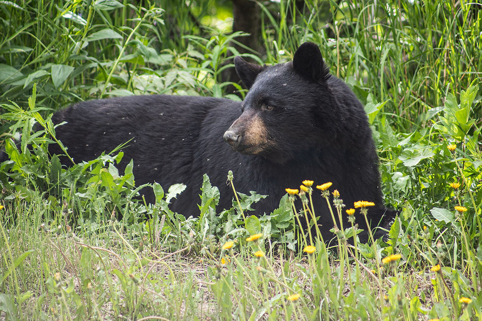
The black bear (Ursus americanus) is the predator most often mentioned in connection with the Talladega, and it deserves a careful look. The Alabama Department of Conservation and Natural Resources lists the black bear as rare and of highest conservation concern, and says bears in Alabama are found primarily in Baldwin, Mobile, and Washington counties in the southwest. The same species account also reports a small breeding population that has reestablished in the Talladega National Forest area of Calhoun and Cleburne counties, while describing many northeast sightings as probably transient bears from neighboring states. The agency notes that vegetation normally makes up more than 80 percent of a bear's diet. It does not mention turkeys or turkey eggs. Bears are opportunistic, and it would not be surprising if one occasionally found a nest, but there is no evidence that bears are an important factor in turkey nest loss on this forest, and they should not be described that way.
Feral Pigs on the Bankhead and Oakmulgee
Of all the pressures on these forests, feral pigs are the one with the clearest management record and some of the strongest turkey research behind it. The Forest Service's monitoring report says pig infestations remain significant on the Bankhead and Oakmulgee, with smaller populations on the Tuskegee and Shoal Creek districts. Trapping is carried out with USDA APHIS and Alabama's Wildlife and Freshwater Fisheries Division.
The Bankhead numbers show both the effort and the problem. In fiscal year 2024 the forest removed 379 pigs, including 20 whole sounders, 11 of them in the Sipsey Wilderness. In 2025 it removed 124 pigs, including 9 sounders, 3 of them in the wilderness. The report adds that pig damage continues in sensitive habitats such as glades and wetlands. Those are removal counts, not population estimates, and a drop in removals does not by itself prove the population fell.
Why it matters for turkeys comes from Alabama research. McDonough and colleagues, publishing in The Journal of Wildlife Management in 2024, used trail cameras to track turkeys and pigs at sites in central Alabama from 2018 through 2021, removing pigs from three sites and leaving a fourth as a control. As removals progressed, turkey detections increased, and the authors concluded that pig removal could benefit turkey populations in the Southeast. The mechanism is likely a mix of reduced competition for mast and other foods, reduced disturbance, and fewer nests destroyed, though the study measured turkey response rather than the specific cause.
That study was not done on the Bankhead, but it was done in the same state and in similar country, and it gives the Bankhead's trapping program a direct turkey rationale. On a forest where the cause of the turkey decline is officially not understood, removing a known competitor and nest destroyer is one of the few interventions with Alabama evidence behind it.
Reading the Numbers: Brood Indices and Harvest
Alabama measures turkey reproduction through a summer brood survey. Each year from June through August, agency staff and partners record the hens, gobblers, jakes, and poults they see, and biologists compute poults per hen. The 2025 Wild Turkey Report puts the statewide figure at 1.53 poults per hen and states that an average at or above 2.00 is what a sustainable population needs. The report says data collected since 2010 reveal a long-term decline in turkey reproduction statewide, and that the 2025 result suggests the decline continues. About 52 percent of hens observed statewide had poults.
There is no row for the Talladega or the Bankhead. The closest available figures are for the wildlife districts that contain them. District 1, the northwestern district that includes Lawrence, Winston, and Franklin counties, came in at 1.29 poults per hen from 146 observations. District 2, which includes the Shoal Creek and Talladega ranger districts, came in at 1.55 from 123 observations. The ecoregion rows that overlap this country range from 1.20 in the Piedmont and 1.33 in the Interior Plateau to 1.69 in both the Ridge and Valley and the Southwestern Appalachians. A row for federal land came in at 0.65, but from only 19 observations, too few to support any conclusion about national forests in general or these two in particular.
The same report carries a second signal from hunters. Cooperating hunters log what they see per hour in the woods, and since 2017 the trend in District 1 shows them seeing about 0.76 fewer hens per 100 hours hunted each year, and in District 2 about 0.98 fewer hens per 100 hours each year. Fewer hens seen over time is consistent with the brood data and with the Forest Service's own conclusion that low female recruitment is the core problem.
Harvest numbers point the same way. The Forest Service reports 458 turkeys harvested on the national forests in Alabama in 2023-2024 and 308 in 2024-2025, a drop of about a third, though harvest also reflects weather, hunter effort, and regulations. Statewide, Alabama's Game Check system recorded 17,049 gobblers in 2025, down 7 percent from 18,263 in 2024.
Range-wide research helps explain why low recruitment is so consequential. Londe and colleagues, in a 2023 review of eastern wild turkey vital rates in Ecology and Evolution, estimated a mean population growth rate of 0.91 from published data, with a confidence interval that spans stability. They found that adult hen survival had the greatest influence on population growth, but that reproduction, because it varies so much from year to year, explained a larger share of the variation in growth. In plain terms, populations need hens to survive and, just as importantly, need enough good nesting and brood years to make up for the bad ones. The Talladega and Bankhead numbers suggest the good years have been too rare.
The 2026-2027 Rules on Two Forests
Turkey regulations on national forests in Alabama follow ranger districts rather than county lines, which creates a few traps for anyone reading the rules quickly. The following reflects Alabama Administrative Code rule 220-2-.01 for the 2026-2027 seasons, as fetched in October 2026. Confirm current regulations with the Alabama Department of Conservation and Natural Resources before every hunt.
Statewide bag: gobblers only, one per day and four for the combined fall and spring seasons.
Bankhead Ranger District: youth hunt March 20, 2027, and disabled hunters' hunt March 26, 2027, both daylight to 1 p.m.; regular spring season March 27 through May 3, 2027, daylight to 1 p.m.; decoys allowed. The Bankhead shares this calendar with several other north Alabama wildlife areas that are not inside the forest.
Talladega, Shoal Creek, and Oakmulgee ranger districts: youth hunt March 13, 2027, and disabled hunters' hunt March 19, 2027, both daylight to 1 p.m.; regular spring season March 20 through May 3, 2027, daylight to 1 p.m.; decoys allowed.
District caps on national forest land: no more than two gobblers from any one wildlife management area, community hunting area, or national forest ranger district, and no more than one during the first 10 days of the season on that district. A bird taken on a wildlife management area inside a ranger district counts toward that district's cap.
Fall hunting: the ranger-district rules list spring dates only. Clay and Talladega counties are in private-land Zone 3, which has fall dates of November 14 through 22 and December 12 through 27, 2026, with decoys prohibited, but that county season should not be read as applying to the Talladega or Shoal Creek ranger districts. Confirm with ADCNR before planning any fall hunt on federal land.
Private land around the Bankhead: Franklin, Lawrence, and Winston counties are in Zone 2, with youth days March 20 and 21, 2027, a disabled hunters' day March 26, 2027, and a spring season March 27 through May 3, 2027. No fall season is listed for Zone 2.
Two clarifications prevent most of the confusion. First, turkey Zone 2 and Wildlife and Freshwater Fisheries District 2 are different things. Zone 2 is a regulatory area for private land that includes the Bankhead's counties, while District 2 is the northeastern brood-survey and management district that includes the Shoal Creek and Talladega ranger districts. Second, the forest acreages, the district brood ratios, and the wilderness acreages are three separate kinds of numbers. 394,960 and 181,988 acres describe whole forests, 1.29 and 1.55 describe wildlife districts, and 25,002 acres describes one wilderness.
What Recovery Would Look Like
It is tempting to end a post like this with a confident diagnosis. The Forest Service has declined to offer one, and that restraint is the right place to start. The monitoring report's answer to its own question about demand species is that turkeys are believed to be declining in Alabama, as indicated by low female recruitment, and that the cause is not understood. Statewide research is underway, and the forests have committed to supporting it.
What the evidence does support is a set of conditions that would give hens and broods a better chance. More young and open forest is the most obvious. With early-successional habitat at less than half of one percent of the national forests in Alabama, even a modest increase from timber harvest, beetle-kill regeneration, and woodland thinning would change the brood picture on many ridges. More frequent fire, especially in pine and oak woodlands that have already been thinned, would keep those openings from closing again. Continued pig removal on the Bankhead and Oakmulgee has Alabama research behind it as a turkey benefit. And restoration of shortleaf, longleaf, and oak woodlands, the very communities the Bankhead's restoration program set out to recreate after the beetle outbreak, is also the restoration of the habitat turkeys use for nearly every stage of their year.
The Sipsey will keep growing older and taller, and that is part of its purpose. The rest of these two forests have more room to change, and when they do, turkeys tend to respond faster than almost anything else in the woods.
Frequently Asked Questions
How many acres are Talladega National Forest and the William B. Bankhead National Forest?
The U.S. Forest Service lists Talladega National Forest at 394,960 acres across three ranger districts (Talladega, Shoal Creek, and Oakmulgee) and the William B. Bankhead National Forest at 181,988 acres in Lawrence, Winston, and Franklin counties. Together with the Conecuh and Tuskegee, Alabama's four national forests cover about 673,000 acres. Older figures of about 392,000 or 480,000 acres for Talladega and about 181,000 for Bankhead are out of date.
Is the Sipsey Wilderness the only wilderness on Alabama's national forests?
No. The Forest Service lists three wildernesses in Alabama. Sipsey, on the Bankhead, is 25,002 acres and was designated by Public Law 93-622 on January 3, 1975, then enlarged in 1988. Cheaha Wilderness (7,275 acres) and Dugger Mountain Wilderness (about 9,200 acres under its 1999 statute) are both on the Talladega National Forest.
When does spring turkey season open on the Bankhead Ranger District in 2027?
Under Alabama's 2026-2027 seasons rule, the Bankhead Ranger District has a youth hunt on March 20, 2027, a hunt for disabled hunters on March 26, and a regular spring season from March 27 through May 3, 2027, with hunting from daylight to 1 p.m. Confirm current regulations with the Alabama Department of Conservation and Natural Resources before you go.
Do the Talladega, Shoal Creek, and Oakmulgee districts open the same day as Bankhead?
No. In the 2026-2027 rule, the Talladega, Shoal Creek, and Oakmulgee ranger districts open a week earlier, with a youth hunt March 13, a disabled hunt March 19, and the regular season March 20 through May 3, 2027, daylight to 1 p.m. No more than two gobblers may come from any one ranger district, and only one during its first 10 days. Confirm current regulations with ADCNR.
Is there a Talladega or Bankhead poult-per-hen ratio in the 2025 state report?
No. Alabama's 2025 Wild Turkey Report gives 1.53 poults per hen statewide and reports results by wildlife district and ecoregion, not by national forest. District 1, which includes the Bankhead counties, was 1.29 from 146 observations, and District 2, which includes the Shoal Creek and Talladega districts, was 1.55 from 123 observations. The agency treats about 2.00 as the level a sustainable population needs.
How many turkeys were taken on Alabama's national forests in the 2023-2024 and 2024-2025 seasons?
The Forest Service's 2024-2025 monitoring report records 458 turkeys harvested in 2023-2024 and 308 in 2024-2025 across all of the national forests in Alabama. Choccolocco Wildlife Management Area and Talladega National Forest produced the highest harvests in both years. The report does not break those totals down by forest.
Does Talladega County's fall turkey season apply on the ranger district?
Not as written. Clay and Talladega counties are in Zone 3, which has fall dates on private land in November and December 2026, but the ranger-district block for the Talladega and Shoal Creek districts lists spring dates only. Read the national forest rule as spring-only and confirm with ADCNR before planning any fall hunt on federal land.
What is the Alabama gobbler bag limit in the 2026-2027 rule?
Alabama's 2026-2027 rule allows gobblers only, one per day and four for the combined fall and spring seasons. Ranger districts add their own caps of two per district and one during the first 10 days. Confirm current regulations with ADCNR, because season rules can change between publication and opening day.
Full Citations and Sources
Government and agency sources
U.S. Forest Service -- National Forests in Alabama: About the Area (updated June 10, 2026) -- https://www.fs.usda.gov/r08/alabama/about-area -- accessed October 2026
U.S. Forest Service -- National Forests in Alabama: Natural Resources -- https://www.fs.usda.gov/r08/alabama/natural-resources -- accessed October 2026
U.S. Forest Service -- National Forests in Alabama 2024-2025 Biennial Monitoring Evaluation Report -- https://www.fs.usda.gov/sites/nfs/files/r08/alabama/publication/2024-2025%20NFsAL%20BMER.pdf -- accessed October 2026
U.S. Forest Service -- National Forests in Alabama: Wilderness -- https://www.fs.usda.gov/r08/alabama/wilderness -- accessed October 2026
U.S. Forest Service -- National Forests in Alabama: Visitor Maps and Guides -- https://www.fs.usda.gov/r08/alabama/maps-guides -- accessed October 2026
Federal Register -- Bankhead National Forest Health and Restoration Project, notice of intent (Vol. 67, No. 101, May 24, 2002) -- https://www.govinfo.gov/content/pkg/FR-2002-05-24/html/02-13069.htm -- accessed October 2026
Alabama Department of Conservation and Natural Resources -- 2025 Alabama Wild Turkey Report -- https://outdooralabama.com/sites/default/files/2025%20Alabama%20Wild%20Turkey%20Report%20%28002%29%20ADA%20CHECK.pdf -- accessed October 2026
Alabama Department of Conservation and Natural Resources -- Black Bear species account -- https://outdooralabama.com/carnivores/black-bear -- accessed October 2026
Alabama Legislature -- Alabama Administrative Code 220-2-.01, 2026-2027 Hunting Seasons -- https://admincode.legislature.state.al.us/api/rule/220-2-.01 -- accessed October 2026
U.S. Geological Survey -- Highest and Lowest Elevations -- https://www.usgs.gov/educational-resources/highest-and-lowest-elevations -- accessed October 2026
U.S. Congress -- Public Law 93-622, Sipsey Wilderness (January 3, 1975) -- https://www.congress.gov/93/statute/STATUTE-88/STATUTE-88-Pg2096.pdf -- accessed October 2026
U.S. Government Publishing Office -- Public Law 106-156, Dugger Mountain Wilderness Act of 1999 -- https://www.govinfo.gov/content/pkg/PLAW-106publ156/html/PLAW-106publ156.htm -- accessed October 2026
Research, conservation, and institutional sources
Wildlife Society Bulletin -- McCord, Harper, and Greenberg (2014), Brood cover and food resources for wild turkeys following silvicultural treatments in mature upland hardwoods, 38(2):265-272 -- https://doi.org/10.1002/wsb.403 -- accessed October 2026
The Journal of Wildlife Management -- McDonough and colleagues (2024), population response of eastern wild turkeys to removal of wild pigs in Alabama -- https://doi.org/10.1002/jwmg.22662 -- accessed October 2026
The Wildlife Society -- JWM: Wild pig removal boosts turkey numbers -- https://wildlife.org/jwm-wild-pig-removal-boosts-turkey-numbers/ -- accessed October 2026
The Journal of Wildlife Management -- Boone and colleagues, weather and wild turkey nest survival in the southeastern United States -- https://doi.org/10.1002/jwmg.22524 -- accessed October 2026
North Carolina State University -- Overturning Conventional Wisdom on Turkey Nesting (December 2023) -- https://news.ncsu.edu/2023/12/overturning-conventional-wisdom-on-turkey-nesting/ -- accessed October 2026
Ecology and Evolution -- Londe and colleagues (2023), Review of range-wide vital rates quantifies eastern wild turkey population trajectory, 13(2):e9830 -- https://doi.org/10.1002/ece3.9830 -- accessed October 2026
Wilderness Connect (University of Montana) -- Sipsey Wilderness -- https://wilderness.net/visit-wilderness/?ID=556 -- accessed October 2026
Wilderness Connect (University of Montana) -- Dugger Mountain Wilderness -- https://wilderness.net/visit-wilderness/?ID=166 -- accessed October 2026


Comments