
Florida Big Bend Field Report: Seagrass Flats, Redfish and Seatrout, and the Nature Coast Inshore Tradition
Updated: 4 days ago
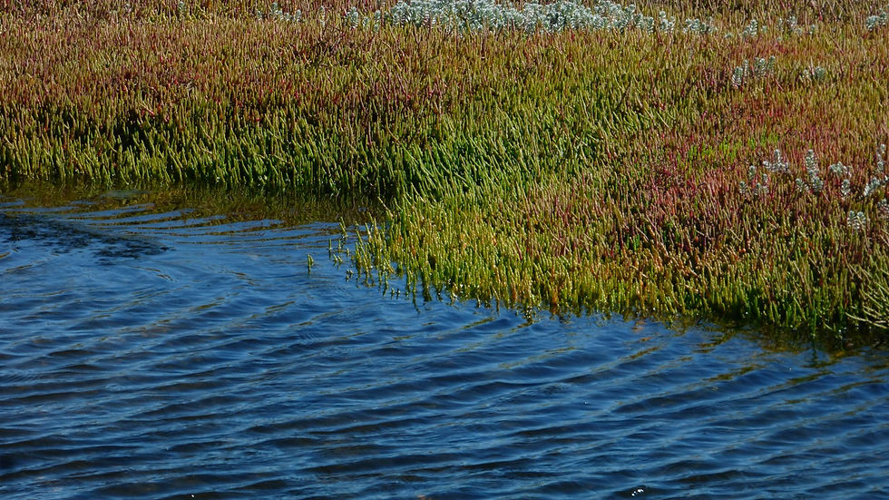
At first light in October, the Big Bend does not look like the Florida on postcards. There is no skyline, no line of high-rises, no beach crowded with umbrellas. There is a flat gray-green horizon, a fringe of black needlerush, a few cabbage palms leaning over a tidal creek, and a skiff idling out of the Steinhatchee River past stilt houses and a single fuel dock. A mile out, the water is two feet deep. Three miles out, it is still not much more. Under the hull, turtle grass and manatee grass bend with the tide, and a pod of redfish pushes a wake across the flat like a slow-moving shadow.
This is the coast the condos couldn't reach. Florida's Big Bend, the long elbow of shoreline where the Panhandle swings south into the peninsula, has almost no barrier islands, almost no sand beaches, and almost no deep water close to shore. What it has instead is a drowned limestone shelf carrying what Florida DEP calls the second largest contiguous area of seagrass habitat in the eastern Gulf of America, a string of spring-fed rivers pouring clear water out of the Floridan Aquifer, and a few small towns that never stopped making their living from the water. The U.S. Fish and Wildlife Service describes the Big Bend and Nature Coast as "one of the largest, undeveloped, mostly privately-held coastal areas in the nation."
South of Cedar Key and the Suwannee delta, the same low coast becomes the Nature Coast, where Crystal River, Homosassa, and the Chassahowitzka rise out of springs a few miles from the Gulf. The towns differ and the preserve lines change, but the ecology runs on: grass, springs, oyster bars, and marsh from Apalachee Bay to Hudson.
October is a good month to see it. The heat breaks, the scallop crowds are gone, and the redfish begin to school. Here is how the system works, what the 2026 rules say, and how to plan a trip that respects it.
An Ecology Snapshot: Seagrass Meadows, Spring-Fed Rivers, and an Undeveloped Shore
Start with the geology. Much of Florida's Gulf coast is fronted by barrier islands. The Big Bend has none to speak of. It sits on a broad, gently sloping karst shelf where wave energy is low and the bottom stays shallow for miles, so sunlight reaches the bottom across an enormous area. The result is a seagrass factory.
The Florida Department of Environmental Protection (DEP) manages the Big Bend Seagrasses Aquatic Preserve. Established in 1985, it covers 984,325 acres and is the largest aquatic preserve in Florida. Its 2015 management plan describes a boundary that runs about 150 miles from the St. Marks River and Apalachee Bay south to the Withlacoochee River, across Wakulla, Jefferson, Taylor, Dixie, and Levy counties, with roughly 1,232 miles of shoreline. Apalachicola lies west of the preserve, and Crystal River and Homosassa lie south of it.
How much of that is grass? DEP's current seagrass page, updated October 2, 2026, cites the state's Seagrass Integrated Mapping and Monitoring program at approximately 240,000 acres of seagrass in the Big Bend region. That program is now inactive, so treat the figure as the most recent mapped estimate, not a 2026 count.
South of the preserve, protection continues under separate names. The Nature Coast Aquatic Preserve, designated in 2020, covers 454,786 acres off Citrus, Hernando, and Pasco counties. The smaller St. Martins Marsh Aquatic Preserve, about 28,461 acres in Citrus County, runs from just south of the Crystal River to the Chassahowitzka refuge boundary. Each keeps its own boundaries and plan.
DEP's current page names five grasses: turtle grass (Thalassia testudinum), manatee grass (Syringodium filiforme), shoal grass (Halodule wrightii), widgeon grass (Ruppia maritima), and star grass (Halophila engelmannii). The 2015 plan adds paddle grass (Halophila decipiens) and notes that turtle grass and manatee grass make up the greatest coverage. Broad-bladed turtle grass dominates the clearer, slightly deeper beds, round-bladed manatee grass mixes across the flats, shoal grass takes the shallowest edges, and widgeon grass shows up where fresh water lowers the salinity.
The second piece is fresh water. Rivers fed by the Floridan Aquifer line the coast: the Wakulla and St. Marks in the north, then the Aucilla, Econfina, Fenholloway, Steinhatchee, and the Suwannee, whose basin the U.S. Geological Survey puts at nearly 9,950 square miles of north Florida and south Georgia. Farther south come the Withlacoochee near Yankeetown, the Crystal River out of Kings Bay, the Homosassa, the Chassahowitzka, and the Weeki Wachee. Spring water leaves the ground at a far steadier temperature than the shallow Gulf, which matters enormously when a winter front chills the flats.
The third piece is what is missing: no coastal highway hugging the shore, no seawall-lined canal city, no tower district. Large blocks of the shoreline are public land. St. Marks National Wildlife Refuge, established in 1931, covers over 86,000 acres in Wakulla, Jefferson, and Taylor counties and fronts about 43 miles of Gulf coast. Lower Suwannee National Wildlife Refuge, established in 1979, covers 52,935 acres in Dixie and Levy counties. The Big Bend Wildlife Management Area, Cedar Keys National Wildlife Refuge, and the Crystal River and Chassahowitzka refuges fill in much of the rest.
What the Interface Creates
The interesting part of the Big Bend is not any single habitat. It is the seams between them: where spring water meets salt water, where grass meets sand, where marsh creeks drain onto flats, and where oyster bars break the current. Those seams concentrate food, and food concentrates fish.
Seagrass productivity at full scale. DEP calls seagrass beds one of the most productive habitats found in the world. The blades slow water, trap sediment, and grow a film of algae and tiny invertebrates. Shrimp, crabs, pinfish, pigfish, silver perch, and juvenile fish of many species shelter in the grass. Bay scallops attach to the blades. That small-animal community is the forage base for red drum (Sciaenops ocellatus), spotted seatrout (Cynoscion nebulosus), Gulf flounder (Paralichthys albigutta), sheepshead, and the larger predators that cruise the grass edges. On the Big Bend, the forage base is spread across miles of shallow shelf rather than squeezed into a single bay, which is why fish here are as likely to be found three miles out in two feet of water as tight to the marsh.
Oyster bars and creek mouths. Where tidal creeks drain the marsh, oyster bars build up along the channel edges. On a falling tide, bait washes off the flats and out of the creeks, and redfish and trout set up on the downstream side of the bars to ambush it.
Spring plumes as thermal refuges. Spring-fed rivers carry water that holds steady while the shallow Gulf swings with the weather. When a winter cold front chills the flats, redfish, trout, snook near the northern edge of their range, and Florida manatees (Trichechus manatus latirostris) all move toward that warmth. In summer the same plumes run cooler, so the spring rivers act like thermostats for the coast.
The tarpon migration. Atlantic tarpon (Megalops atlanticus) move along the Gulf coast in the warm months. Off Homosassa, clear spring-influenced water, shallow grass flats, and a dependable run of fish built a storied tarpon fishery that anglers still talk about by name. A 2023 study in Marine Biology found that at the population level the fish migrate northward mainly in June and July and southward mainly from September through November.
Scallop season as a seagrass report card. The bay scallop (Argopecten irradians) lives about a year and depends on clean water and healthy grass, so its abundance swings with water quality and storms. That the Big Bend and Nature Coast still support a recreational season every summer, zone by zone, is a practical sign of how intact these meadows remain.
Cobia on the rays. Cobia (Rachycentron canadum) often follow cownose rays across the flats, feeding on what the rays flush, and the open, shallow grass makes them visible from a poling platform or tower.
Hurricanes and resilience. Three hurricanes came ashore here in barely thirteen months. According to National Hurricane Center reports, Idalia made landfall near Keaton Beach as a Category 3 on August 30, 2023. Debby came ashore as a Category 1 just west of Steinhatchee on the morning of August 5, 2024. Helene made landfall as a Category 4 about 10 nautical miles southwest of Perry at 11:10 p.m. EDT on September 26, 2024. The towns took the brunt of it. Below the waterline, the picture is more hopeful: after Idalia, preserve staff compared seagrass near Keaton Beach with August 2022 surveys and found no statistically significant change in abundance, density, or community composition. No comparable published survey exists yet for Debby or Helene, and DEP notes in general terms that storm fragmentation can take years to heal.
Migration and Timing Signals
The Big Bend calendar is driven by water temperature, daylight, and the spring rivers. Think vertical by vertical.
Redfish. Red drum are year-round residents, and FWC keeps the Big Bend region open all year. Fall is the peak, when they school in numbers along grass edges, oyster bars, and creek mouths as water cools. Winter concentrates them in deeper holes, creeks, and spring-influenced river mouths. Spring spreads them back across the flats, and summer pushes the best feeding into early morning and late afternoon.
Spotted seatrout. Trout follow a similar curve with some important differences. Fall and early winter are excellent as fish feed heavily on grass edges and in creeks. In the coldest stretches, trout seek deeper channels, river bends, and spring outflows. Spring warming brings strong topwater fishing on the flats. Summer heat drives big trout deeper during midday.
Snook. On this coast snook live near the northern edge of their range, and they lean hard on the spring rivers in cold weather. FWC's Big Bend snook season is closed December 1 through the end of February and May 1 through August 31, so the open windows are March and April, and September through November.
Tarpon. At the population level, tarpon push north mainly in June and July and return south mainly September through November. Local water temperature and bait drive the daily picture.
Cobia and scallops. Cobia show up around rays, markers, and floating structure as water warms, and FWC prints no Big Bend cobia season. Scallops settle on the grass as juveniles and reach harvestable size by summer, and FWC sets the season zone by zone each year.
Manatees. Manatees move into spring rivers when Gulf water cools in late fall. The U.S. Fish and Wildlife Service says over 600 manatees migrate to Kings Bay each winter, and its 2025 refuge fact sheet describes densities nearly reaching 1,000 on extremely cold days. Seven federal manatee sanctuaries in Kings Bay are in place from November through March.
Birds and butterflies. St. Marks NWR was established to provide wintering habitat for migratory birds and is recognized as a Globally Important Bird Area. In fall, a U.S. Fish and Wildlife Service story describes the refuge as the last rest stop for thousands of migrating monarch butterflies before they cross the Gulf.
On the Ground: Steinhatchee, Cedar Key, Crystal River, Homosassa, and Yankeetown
Steinhatchee. Steinhatchee sits at the mouth of the Steinhatchee River on the Taylor and Dixie county line, with the broad flats of Deadman Bay spread in front of it. It is the busiest scallop town on the coast in summer and a year-round inshore base. The river mouth holds trout and redfish in winter, the surrounding flats are productive all year. North along the coast, Keaton Beach took Idalia's landfall in 2023 and has been rebuilding since.
Horseshoe Beach and Suwannee. These two small Dixie County communities are the quiet back door to the lower Suwannee delta. The delta's maze of tidal creeks, oyster bars, and grass flats holds redfish and trout, and Lower Suwannee refuge lands surround much of it.
Cedar Key. Cedar Key is an island town of weathered wood buildings and docks, connected to the mainland by a causeway across marsh and shallow bays. After Florida's 1995 net ban, many local fishers moved into hard clam farming, and University of Florida IFAS reports that the Cedar Key area now provides more than 90 percent of the state's hard clam production. For visitors, Cedar Key offers inshore fishing on the surrounding flats and around the Cedar Keys refuge islands, plus an established paddling and eco-tour scene.
Yankeetown and Inglis. Where the Withlacoochee River reaches the Gulf, Yankeetown is a quiet riverside town at the southern end of the Big Bend preserve and the start of the Nature Coast. The river mouth and the surrounding marsh and oyster country hold redfish, trout, and seasonal tarpon.
Crystal River. Crystal River grew up around Kings Bay, fed by dozens of spring vents, including Three Sisters Springs. The U.S. Fish and Wildlife Service established Crystal River National Wildlife Refuge in 1983 as the only refuge created specifically to protect the threatened Florida manatee. Federal rules prohibit chasing, touching, riding, feeding, or separating manatees anywhere in Kings Bay. For anglers, the action is downstream: Crystal Bay and the Ozello flats, a shallow maze of islands, oyster bars, and grass where redfish tail in calm, skinny water.
Homosassa. Homosassa sits along the spring-fed Homosassa River, which runs from Homosassa Springs Wildlife State Park to the Gulf. The lower river and its creeks hold snook, redfish, and trout, and in the warm months the tarpon flats become the center of attention. Chassahowitzka, a few miles south, is wilder and more protected, with a national wildlife refuge covering much of its marsh and river.
Bayport, Aripeka, and Hudson. Farther south, these towns carry the same low coast toward Pasco County with a fraction of Tampa Bay's traffic. Check scallop rules carefully here. Bayport, in Hernando County, falls in the Levy, Citrus, and Hernando zone. Hudson sits in the Pasco zone, which FWC closed effective August 6, 2026, after the toxin-producing alga Pyrodinium bahamense exceeded the national shellfish safety threshold. Aripeka straddles the Hernando-Pasco line, so which rule applies depends on which side of it you are on.
Planning Your Trip, Season by Season
Plan around temperature, tide, and wind. The flats are shallow, the tides are modest, and a stiff wind can change water clarity in a hurry.
January through February: Cold-water season. Focus on spring-fed river mouths, deep creek bends, and channels for trout and redfish. The Steinhatchee River, the lower Suwannee, the Crystal and Homosassa rivers, and the creeks of St. Marks hold fish on cold mornings. Fish the warmest part of the day after a front passes. Big Bend snook are closed to harvest in this window. Manatee viewing in Kings Bay is at its peak.
March through April: Warming water spreads redfish and trout back onto the flats, and topwater trout fishing improves through the period. Big Bend snook reopen to harvest. Watch for cobia around rays and markers. Spring winds can be strong, so build flexible days into your plan.
May through June: Redfish and trout feed early and late. Big Bend snook close again on May 1. For 2026, FWC opened the Fenholloway through Suwannee scallop zone (Keaton Beach and Steinhatchee) on June 15, with a reduced opening-period bag of 1 gallon whole or 1 cup shucked per person through June 30. Tarpon begin to show on the southern flats, and afternoon thunderstorms start to build.
July through September: Scallop season dominates the coast. For 2026, FWC listed the Franklin through northwestern Taylor zone (including St. Marks) and the Levy, Citrus, and Hernando zone (Cedar Key, Crystal River, Homosassa) as July 1 through September 24, and the Fenholloway through Suwannee zone as June 15 through Labor Day (September 7). From July 1, the 2026 bag was 2 gallons whole or 1 pint of meat per person and 10 gallons whole or one-half gallon of meat per vessel. The Pasco zone closed August 6, 2026. Confirm current scallop regulations with FWC before you go. Early mornings remain good for redfish, trout, and tarpon. Watch for tropical weather.
October through December: Prime time for inshore fishing. Redfish school on grass edges and oyster bars, trout feed aggressively, and flounder stage near creek mouths in fall. Big Bend snook are open in October and November and close December 1. Crowds thin after scallop season. Monarchs move through St. Marks in fall, and waterfowl arrive with the first cold fronts.
Regulations to know. FWC manages the inshore fishery by region. The Big Bend red drum region runs from near Alligator Point east and south to Fred Howard Park; Apalachicola sits in the Panhandle region. As of October 2026, FWC lists Big Bend red drum as open year-round with an 18 to 27 inch slot, one fish per person, and four per vessel, with no harvest in federal waters. Under seatrout rules effective April 1, 2026, the Big Bend is open year-round with a 15 to 19 inch slot and a bag of five, which may include one fish over 19 inches per vessel, or per person from shore. The Panhandle closes in February with a bag of three, so do not carry those numbers to Steinhatchee or Crystal River.
Cobia fall under one Gulf and Atlantic rule: a 36-inch fork length minimum and one per person or two per vessel, whichever is less. Big Bend snook carry a 28 to 33 inch slot, a one-fish bag, the closed seasons above, and a snook permit requirement. Tarpon are catch-and-release only, and fish over 40 inches must stay in the water unless the angler holds a tarpon tag for a record attempt. All of these rules can change, so confirm current regulations with FWC before every trip.
Public versus private access. County and municipal ramps serve Steinhatchee, Horseshoe Beach, Suwannee, Cedar Key, Yankeetown, Crystal River, Homosassa, and the towns to the south. The refuges offer public access, but rules differ by refuge and season, so check each one before launching. Kayak anglers have excellent options on the creeks and spring runs. For most visitors, a licensed local guide is the safest way to learn water where running aground on a falling tide can mean a long wait.
Responsible practices. The fishery depends on the grass, so treat it that way.
Never run a prop through seagrass. Trim up, pole, or idle in marked channels, and learn to read light and dark bottom. DEP notes that repeated prop scars can prevent seagrass from recolonizing and often require restoration.
Do not anchor in dense grass. Use a stake-out pole on sand or in channels where possible.
Respect manatee protection zones and posted speed limits, especially in Kings Bay, the Homosassa, and spring runs in winter. Never chase, touch, or feed manatees.
Release fish fast. Keep oversized redfish and large tarpon in the water, use circle hooks with bait, and revive fish before letting go.
Bring scallop trash home or dispose of it properly, and follow FWC's bag, vessel, and dive-flag rules.
Check FWC and refuge sources for water quality, closures, and storm-related changes before you travel.
Key Takeaways
Florida DEP calls the Big Bend the second largest contiguous area of seagrass habitat in the eastern Gulf of America, with approximately 240,000 mapped acres of grass, anchored by the 984,325-acre Big Bend Seagrasses Aquatic Preserve.
A shallow limestone shelf, few barrier islands, and steady spring flow explain both the undeveloped shoreline and the productive inshore fishery.
Spring-fed rivers act as thermal refuges, pulling redfish, trout, snook, and over 600 wintering manatees toward their outflows in cold weather.
Under 2026 FWC rules, Big Bend redfish and seatrout are open year-round, while snook close December through February and May through August. Confirm current regulations with FWC.
Scallop seasons run by zone: Steinhatchee opened June 15 in 2026, Cedar Key and Crystal River July 1, and the Pasco zone closed in August.
After Idalia, DEP found no statistically significant change in Keaton Beach seagrass compared with 2022 surveys. Careful boat handling keeps it that way.
For the Operators
The Big Bend has a story that reads differently from the rest of Florida's coast. The inshore fishery here rests on a shallow shelf, a huge seagrass meadow, steady spring water, and a shoreline that stayed largely undeveloped. That is the ecological backbone of every inshore guide, fish camp, marina, scallop captain, and eco-tour operator working this water, and it is a stronger piece of positioning than any rate card.
Right now, much of that story is told by someone else. When a traveler searches for Steinhatchee scalloping, Cedar Key fishing, or Homosassa tarpon, or asks an AI assistant where to fish for redfish in Florida, the answers usually come from tourism bureaus, national booking platforms, and general travel sites. Booking aggregators sit between many local operators and the anglers looking for them, and they rarely explain the water. The operators who actually know where the trout stack on a January morning are often the ones with the thinnest online presence.
That gap is an opportunity. The seagrass, the spring rivers, the scallop zones, the cold-water thermal map, the tarpon history, and the storm recovery are exactly the subjects search engines and AI tools reward when they are explained clearly and accurately. An operator who publishes a plain explanation of the 2026 Big Bend seatrout rule, a current-year scallop zone guide, or an honest account of winter fishing in the spring rivers, becomes a source rather than a listing. Accuracy is the moat: the source that gets the boundaries and dates right is the one that gets quoted.
There is also a succession question on this coast. Many fish camps, marinas, and guide services have been run by the same families for decades, and the knowledge in those operations lives mostly in people's heads and in repeat-client phone lists. When a business changes hands without a digital record of what it offers and why it matters, the next owner starts from zero. Writing that knowledge down, in public and in your own voice, protects both the business and the tradition.
The Big Bend's inshore tradition has survived development pressure, the net ban, and three hurricanes in thirteen months.
What you've built deserves to be found.
Frequently Asked Questions
Where exactly is Florida's Big Bend coast?
The Big Bend is the curve of Florida's Gulf coast where the Panhandle meets the peninsula. The Big Bend Seagrasses Aquatic Preserve runs about 150 miles from the St. Marks River south to the Withlacoochee River, across Wakulla, Jefferson, Taylor, Dixie, and Levy counties. South of it, the Nature Coast continues through Crystal River, Homosassa, Bayport, Aripeka, and Hudson. Apalachicola sits to the west, on the Forgotten Coast, and is not part of this stretch.
How big is the Big Bend Seagrasses Aquatic Preserve, and how much grass does it hold?
Florida DEP lists the preserve at 984,325 acres, established in 1985, and the largest aquatic preserve in Florida. DEP's current seagrass page calls the Big Bend the second largest contiguous area of seagrass habitat in the eastern Gulf of America and cites state mapping of approximately 240,000 acres of seagrass in the region. That mapping program is no longer active, so treat the figure as the most recent available estimate, not a new survey.
What are the Big Bend redfish and seatrout limits right now?
As of October 2026, FWC lists Big Bend red drum as open year-round with an 18 to 27 inch slot, 1 fish per person, and 4 per vessel. Under rules effective April 1, 2026, Big Bend spotted seatrout are open year-round with a 15 to 19 inch slot and a bag of 5, including one fish over 19 inches per vessel, or per angler when fishing from shore. Confirm current regulations with FWC before every trip.
When is scallop season at Steinhatchee versus Cedar Key and Crystal River?
For 2026, FWC set the Fenholloway through Suwannee zone, which includes Keaton Beach and Steinhatchee, at June 15 through Labor Day. The Levy, Citrus, and Hernando zone, which includes Cedar Key, Crystal River, and Homosassa, ran July 1 through September 24. Hudson sits in the Pasco zone, which FWC closed effective August 6, 2026. Seasons change yearly, so confirm current regulations with FWC.
Can you fish for tarpon in the Big Bend?
Yes. Homosassa has a long tarpon tradition, and tarpon move along the southern Big Bend and Nature Coast in the warm months. A 2023 study in Marine Biology found tarpon migrate northward mainly in June and July and southward mainly September through November. FWC lists tarpon as catch-and-release only, and fish over 40 inches must stay in the water unless the angler holds a tarpon tag for a record attempt. Confirm current rules with FWC.
How did recent hurricanes affect the Big Bend seagrass?
Idalia came ashore near Keaton Beach as a Category 3 on August 30, 2023, Debby made landfall just west of Steinhatchee on August 5, 2024, and Helene came ashore southwest of Perry late on September 26, 2024. After Idalia, Florida DEP compared seagrass near Keaton Beach with 2022 surveys and found no statistically significant change. No comparable published survey exists yet for Debby or Helene, so call ahead about ramps, fuel, and lodging.
How many acres is St. Marks National Wildlife Refuge?
The U.S. Fish and Wildlife Service lists St. Marks National Wildlife Refuge at over 86,000 acres in Wakulla, Jefferson, and Taylor counties, with about 43 miles of Gulf coast. It was established in 1931 to provide wintering habitat for migratory birds. Lower Suwannee National Wildlife Refuge, to the south, covers 52,935 acres in Dixie and Levy counties.
What should anglers do to protect the seagrass?
Learn to read water depth, trim up or pole across shallow flats instead of running them, and never plow a prop through grass. Florida DEP notes that repeated prop scars can keep seagrass from recolonizing and often require restoration. Avoid anchoring in dense grass, follow manatee protection zones, and release out-of-slot fish quickly.
Citations and Sources
Florida Fish and Wildlife Conservation Commission -- Red Drum recreational regulations -- https://myfwc.com/fishing/saltwater/recreational/red-drum/ -- accessed October 2026
Florida Fish and Wildlife Conservation Commission -- Spotted Seatrout recreational regulations -- https://myfwc.com/fishing/saltwater/recreational/spotted-seatrout/ -- accessed October 2026
Florida Fish and Wildlife Conservation Commission -- New spotted seatrout regulations effective April 1, 2026 -- https://myfwc.com/news/all-news/spotted-seatrout-0226/ -- accessed October 2026
Florida Fish and Wildlife Conservation Commission -- Cobia recreational regulations -- https://myfwc.com/fishing/saltwater/recreational/cobia/ -- accessed October 2026
Florida Fish and Wildlife Conservation Commission -- Snook recreational regulations -- https://myfwc.com/fishing/saltwater/recreational/snook/ -- accessed October 2026
Florida Fish and Wildlife Conservation Commission -- Tarpon recreational regulations -- https://myfwc.com/fishing/saltwater/recreational/tarpon/ -- accessed October 2026
Florida Fish and Wildlife Conservation Commission -- Bay Scallops recreational season and zones -- https://myfwc.com/fishing/saltwater/recreational/bay-scallops/ -- accessed October 2026
Florida Fish and Wildlife Conservation Commission -- 2026 bay scallop season opener -- https://myfwc.com/news/all-news/scallop-0726/ -- accessed October 2026
Florida Fish and Wildlife Conservation Commission -- Seagrass Integrated Mapping and Monitoring reports -- https://myfwc.com/research/habitat/seagrasses/simm/simm-reports/ -- accessed October 2026
Florida Department of Environmental Protection -- Big Bend Seagrasses Aquatic Preserve Management Plan (October 2015) -- https://floridadep.gov/sites/default/files/Big-Bend-Seagrasses-AP-Management-Plan.pdf -- accessed October 2026
Florida Department of Environmental Protection -- Big Bend Seagrasses Aquatic Preserve: Management and Protection -- https://floridadep.gov/rcp/aquatic-preserve/content/big-bend-seagrasses-aquatic-preserve-management-and-protection -- accessed October 2026
Florida Aquatic Preserves -- Big Bend Seagrasses Aquatic Preserve -- https://floridaaquaticpreserves.org/managed-areas/aquatic-preserves/big-bend-seagrasses-aquatic-preserve -- accessed October 2026
Florida Department of Environmental Protection -- Nature Coast Aquatic Preserve Management Plan -- https://floridadep.gov/sites/default/files/Nature-Coast-AP-Management-Plan.pdf -- accessed October 2026
Florida Department of Environmental Protection -- St. Martins Marsh Aquatic Preserve Management Plan -- https://floridadep.gov/sites/default/files/St-Martins-Marsh-AP-Management-Plan-FINAL.pdf -- accessed October 2026
Florida Department of Environmental Protection -- Hurricane Idalia seagrass report (December 13, 2023) -- https://floridadep.gov/sites/default/files/Hurricane%20Idalia_FINAL_Report_December13_2023_0.pdf -- accessed October 2026
U.S. Fish and Wildlife Service -- St. Marks National Wildlife Refuge, About Us -- https://www.fws.gov/refuge/st-marks/about-us -- accessed October 2026
U.S. Fish and Wildlife Service -- Kaleidoscope: Monarch Migration at St. Marks (September 2024) -- https://www.fws.gov/story/2024-09/kaleidoscope-monarch-migration -- accessed October 2026
U.S. Fish and Wildlife Service -- Lower Suwannee National Wildlife Refuge General Information -- https://www.fws.gov/sites/default/files/documents/general-info-lower-suwannee-nwr.pdf -- accessed October 2026
U.S. Fish and Wildlife Service -- Crystal River National Wildlife Refuge, About Us -- https://www.fws.gov/refuge/crystal-river/about-us -- accessed October 2026
U.S. Fish and Wildlife Service -- Crystal River National Wildlife Refuge Tearsheet (April 2025) -- https://www.fws.gov/sites/default/files/documents/2025-04/crystal-river-tearsheet-2025_508.pdf -- accessed October 2026
NOAA National Hurricane Center -- Tropical Cyclone Report: Hurricane Idalia -- https://www.nhc.noaa.gov/data/tcr/AL102023_Idalia.pdf -- accessed October 2026
NOAA National Hurricane Center -- Tropical Cyclone Report: Hurricane Debby -- https://www.nhc.noaa.gov/data/tcr/AL042024_Debby.pdf -- accessed October 2026
NOAA National Hurricane Center -- Tropical Cyclone Report: Hurricane Helene -- https://www.nhc.noaa.gov/data/tcr/AL092024_Helene.pdf -- accessed October 2026
U.S. Geological Survey -- Scientific Investigations Report 2007-5031 (Suwannee River Basin) -- https://pubs.usgs.gov/publication/sir20075031 -- accessed October 2026
University of Florida IFAS -- Cedar Key Clam Production profile -- https://shellfish.ifas.ufl.edu/wp-content/uploads/Cedar-Key-Clam-Production_FINAL.pdf -- accessed October 2026
Griffin et al., Marine Biology (2023) -- Atlantic tarpon migration study -- https://www.fecpl.ca/wp-content/uploads/2023/09/s00227-023-04311-3.pdf -- accessed October 2026


Comments