
The Virginia Outdoor Field Report: The Eastern Shore, Chesapeake Tributaries, and the Blue Ridge Backcountry
Updated: 1 day ago
There is no honest way to write a single field report about Virginia because Virginia is not a single sporting landscape. It is at least four, stacked on the same map and bleeding into one another only at the seams. Drive east from the Allegheny spine to the Atlantic and you cross more sporting country than separates entire states elsewhere in the Southeast: wild brook-trout headwaters in national forest, limestone spring creeks in a karst valley, a 348-mile river that runs smallmouth, urban whitewater, and tidal blue catfish in a single watershed, a striped-bass estuary the size of a small sea, and a chain of seaside barrier islands where Atlantic brant raft on the same eelgrass flats that held them before the Commonwealth existed. Most states have a signature. Virginia has a portfolio.
That breadth is the central fact from which an operator, a guide, or anyone trying to understand the place has to start. A waterfowler poling a layout boat across the bayside flats of the Eastern Shore in January and a fly angler swinging for wild brookies in the George Washington and Jefferson National Forests in April are both, technically, in the Virginia outdoors. They share a state wildlife agency and almost nothing else - not a season, not a quarry, not a watershed, not a buyer. The Commonwealth runs from the Eastern Shore's seaside barrier islands and bayside flats, through the Chesapeake Bay tributaries - the James, the York, the Rappahannock, the Potomac - up across the Piedmont and the Blue Ridge, into the Shenandoah Valley and the Allegheny Highlands, and out to the far southwestern coalfields where the Clinch, the Powell, and the headwaters of the Big Sandy drain toward the Ohio. This report walks that gradient from salt to summit and reads what each piece of it actually offers.
It is also deliberately written as a report with the operator in mind. In our 2026-27 audit of 1,546 verified, private operators across 11 states, the 146 Virginia operators we audited averaged 5.08 out of 10 on digital health, about level with the 5.09 region-wide average and in the middle of the 11-state pack. Of the Virginia operators with a readable website, about 38% publish some FAQ content and only about 3% carry FAQPage schema, so there is plenty of room to tell this country's story in a way search and AI answer engines can read. Ecology comes first because it is what the booking is ultimately selling; marketing reality comes second because that is where the country is left on the table.
An Ecology Snapshot: Four Virginias and a Tidewater Hinge
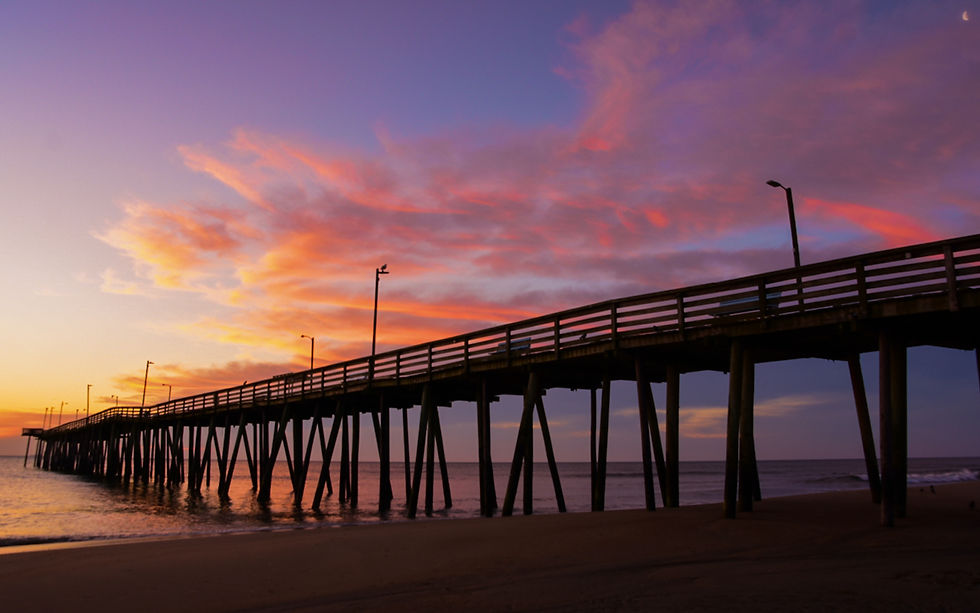
The cleanest way to hold Virginia in your head is as four ecological regions joined by one hinge. The first is the Eastern Shore and the outer coast - the Atlantic Flyway country of seaside barrier islands and bayside flats, of Back Bay National Wildlife Refuge and False Cape State Park near Virginia Beach at the southern end and the Eastern Shore of Virginia and Chincoteague refuges at the northern tip.
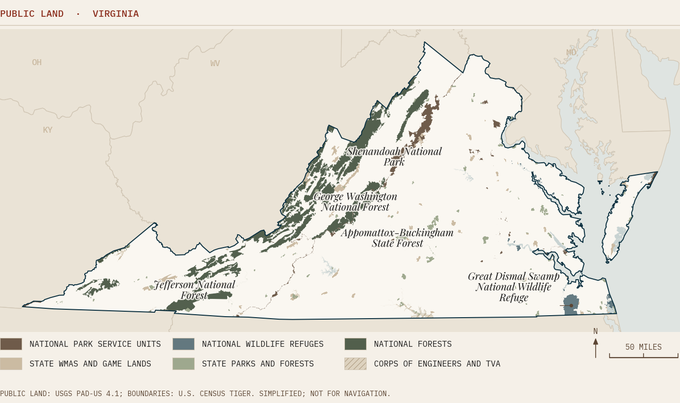
The second is the Chesapeake estuary and its great tidal tributaries - the striped bass, American shad, and invasive trophy blue catfish of the James, York, Rappahannock, and Potomac, plus the inshore speckled trout and red drum of sub-estuaries like Mobjack Bay. The third is the mountain cold-water world - the wild brook trout of the national forests, the Shenandoah River and its North and South Forks, the limestone spring creeks of the Valley, and the Jackson River and Cowpasture cold-water country of the Allegheny Highlands. The fourth is the Southside and southwestern interior - the blackwater Nottoway and Meherrin and the sandhill longleaf at its northern limit, the trophy whitetail belt south of the James, and the globally significant aquatic biodiversity of the Clinch and Powell.
The hinge is the Tidewater - Hampton Roads, the Lower Peninsula, and the mouth-of-the-Bay counties of Mathews and Gloucester - where the freshwater rivers meet the salt, and the four Virginias briefly touch. Stand at the mouth of the York in late October, and you are within a short run of cobia leaving the Bay, speckled trout staging in the grass, striped bass beginning to stack, and blue catfish holding in the river channel upstream. It is the most concentrated saltwater-to-freshwater transition in the Mid-Atlantic, and it is the one place where Virginia's portfolio reads as a single fishery rather than four.
What makes Virginia ecologically unusual is not any single one of these systems - other states have barrier islands, estuaries, mountains, and blackwater. It is the compression. The state is narrow enough north-to-south and long enough east-to-west that the full Atlantic-seaboard gradient, from sea-level salt marsh to 5,729-foot Mount Rogers, fits inside a single day's drive. That compression is why the Virginia Department of Wildlife Resources manages native brook trout and Atlantic Flyway sea ducks under the same roof, and why an honest account of the place has to move through it all.
What the Interface Creates
Each of the four Virginias is, in ecological terms, an interface - a place where two systems meet, and the meeting itself produces the abundance. On the Eastern Shore, the interface is the seaside-bayside divide, a habitat split rather than an official boundary. The seaside is a dynamic, ocean-fed lattice of barrier islands, inlets, and salt marsh - much of it held by The Nature Conservancy's Volgenau Virginia Coast Reserve, a long stretch of undeveloped barrier coast on the U.S. Atlantic - where Atlantic brant track the recovering eelgrass meadows of South, Spider Crab, Hog Island, and Cobb Island bays and sea ducks, scoters, and long-tailed ducks work the open water and the surf. The bayside is the quieter, shallower Chesapeake flats, where black ducks and dabblers feed in the marsh guts and the eelgrass beds. A single Eastern Shore guide may run a layout boat for sea ducks off the seaside in the morning and a marsh blind on the bayside in the afternoon. The divide is the product; the country is built on it.
In the Chesapeake tributaries, the interface is the salt wedge - the moving boundary where ocean salt meets river freshwater somewhere up each tidal river, shifting with rainfall and tide. Striped bass, the Bay's defining gamefish, stage and spawn up the freshwater reaches of the James, York, Rappahannock, and Potomac each spring before the migratory fish run north along the coast. American shad once ran those same rivers in tremendous numbers; their populations remain badly depressed, and Virginia has held a statewide moratorium on the possession of American shad since 2019, so the spring run is now a catch-and-release spectacle and a restoration story rather than a harvest fishery. Into the vacuum left by the shad and the river herring has moved the blue catfish - introduced to the tidal James, Rappahannock, and York in the 1970s and 1980s, now abundant, invasive, and the basis of a sought-after big-fish fishery that managers encourage anglers to harvest (creel rules on those tidal rivers have been changing, so confirm current VDWR limits).
In the Allegheny Highlands, the interface is dam and bedrock - the cold tailwater released from the bottom of a reservoir running over a freestone river. Below Gathright Dam in Alleghany County, the Jackson River pulls cold water out of Lake Moomaw - the reservoir straddles Bath and Alleghany counties - and runs one of Virginia's most popular tailwater trout fisheries through country that is otherwise too warm to hold trout in summer; special regulations govern stretches of it, and they are revised periodically (confirm current VDWR special regulations). Nearby, the Cowpasture remains one of the most undeveloped large rivers in the eastern United States, a free-flowing, low-gradient smallmouth and cool-water float that, in places, reads as it did a century ago. Above them both, in the headwater coves of the George Washington and Jefferson National Forests, the wild brook trout - Virginia's only native trout - hold in the small, cold, acidic streams that are the truest measure of mountain-water health in the Commonwealth.
In the Southside and the southwest, the interface is blackwater and sandhill. The Nottoway and Meherrin rivers drain the quiet coastal-plain country south of the James as classic blackwater systems - tannin-stained, slow, cypress-lined - and the well-drained sand ridges and fluvial terraces along their eastern banks carry the northernmost meaningful stands and restoration of longleaf pine in North America, the species' true northern limit. Virginia's longleaf is a fire-dependent sandhill and sandy-terrace upland savanna, not a bottomland forest, and it is ecologically continuous with the longleaf country of northeastern North Carolina. South of the James, the Southampton-Sussex-Greensville-Brunswick-Mecklenburg county belt is one of the Southeast's overlooked trophy whitetail regions, built on fertile farmland and bottomland hardwood. And in the far southwest, the Clinch and Powell rivers hold one of the richest assemblages of freshwater mussels and fish on Earth - a globally significant biodiversity hotspot, and one of high conservation concern, that the U.S. Fish and Wildlife Service and The Nature Conservancy treat as a priority of international rank, sitting improbably in the post-coal counties where Virginia has also rebuilt a wild elk herd.
Migration and Timing Signals
Virginia's sporting calendar is governed by four largely independent clocks, and reading them is the difference between arriving in the abundance and arriving a month off it. The first is the Atlantic Flyway waterfowl clock. Coastal Virginia sits at a flyway pinch point, and the migration builds through November and peaks in December and January, with wintering concentrations persisting into February and March - the coldest fronts pushing the largest rafts of brant and sea ducks onto the Eastern Shore's seaside bays and divers, dabblers, swans, and geese onto Back Bay and the bayside flats. Exact season dates, zones, and species limits are set annually by VDWR within the federal framework and must be confirmed each year before booking or hunting; remember that Back Bay National Wildlife Refuge is closed to waterfowl hunting.
The second clock is the anadromous spring run. As water temperatures climb through March, April, and May, striped bass move up the tidal tributaries to spawn, American shad and hickory shad push up behind them, and the rivers - the James above Richmond, the Rappahannock around Fredericksburg, the lower Mattaponi and Pamunkey of the York system - fill with fish on a predictable temperature trigger. The striped bass seasons that bracket this run are among the most tightly regulated fisheries on the coast, coordinated through the Atlantic States Marine Fisheries Commission and implemented by Virginia with a regulated spring season and a fall season, a one-fish daily limit, and a slot limit - Virginia discontinued its old spring 'trophy' season in 2019, and with a coastwide harvest reduction in effect for 2026 the specific dates and slot change year to year (confirm current VMRC and ASMFC regulations). The American shad run in Virginia is, again, catch-and-release.
The third clock is the cold-water window. Wild brook trout and stocked and holdover trout in the mountains fish best in the cool shoulders of the year - spring and fall - and become stressed and slow in the heat of summer, when only the deep tailwaters like the Jackson below Gathright Dam and the Smith River below Philpott Dam (the latter in Franklin and Henry counties, on the southern Blue Ridge front rather than the Alleghenies) stay cold enough to fish well. The fourth clock is the upland and big-game calendar: the dove opener in early September that marks the start of the season across Virginia, as it does across the Southeast; the fall archery-through-firearms deer progression; the spring gobbler season; and the late-season waterfowl that overlaps the rut. Each of these is set by VDWR and should be checked against the current regulations rather than assumed.
The operator lesson inside these four clocks is that Virginia is a year-round sporting state assembled from a series of short, sharp windows. The booking that captures a buyer is almost always the one that names the window precisely - the December diver push, the April striper run, the October speckled-trout bite in Mobjack Bay, the late-May smallmouth float on the James - rather than the one that advertises 'fishing' or 'hunting' in the abstract. The country rewards specificity because the country is specific.
On the Ground: The Basecamps
Virginia's sporting country centers on a handful of basecamp towns, each the natural hub of one of the four regions. On the Eastern Shore, Chincoteague anchors the northern end near the Chincoteague and Eastern Shore of Virginia refuges and the Virginia end of Assateague Island - where the U.S. Fish and Wildlife Service manages Chincoteague National Wildlife Refuge across the state's portion of the island and the National Park Service operates only the recreational beach within the refuge, while the Maryland district to the north is the Assateague Island National Seashore; Onancock and Cape Charles anchor the bayside and the lower Shore, within reach of the seaside barrier-island fleet out of Wachapreague.
On the western shore and the tributaries, Tappahannock sits on the Rappahannock as a tidal-river hub for striper and blue catfish, while the Northern Neck towns - Reedville, the old menhaden port, and the Smith Point area - anchor the rockfish charter fleet at the mouth of the Potomac and the open Bay. Richmond is the unlikely urban basecamp of the James River corridor, a rare place in the eastern United States where a guide can run whitewater through downtown and float to smallmouth above the fall line and tidal blue catfish below it within the city limits. The Tidewater hub of Hampton Roads, with the mouth-of-the-Bay counties of Mathews and Gloucester just up the Bay, anchors the cobia, speckled-trout, and red-drum inshore fishery and the Mobjack Bay sub-estuary.
Inland, Roanoke serves as the gateway to the southern Blue Ridge, Smith Mountain Lake, and the upper Dan and Smith River country; Bristol and the far-southwest towns anchor the New River Valley, the Clinch and Powell, the Big Sandy headwaters, Mount Rogers National Recreation Area, and Grayson Highlands. And in the Allegheny Highlands, Hot Springs and Bath County - home to the Omni Homestead resort, which has hosted sportsmen since the eighteenth century - anchor the Jackson River, the Cowpasture, and Lake Moomaw. Each basecamp is a different Virginia; the buyer who books one is rarely the buyer who books another.
Planning Your Trip, Vertical by Vertical
What follows is a working breakdown by vertical - the season window, the primary waters or country, and what to know before you go. Every season reference is a planning guide only; Virginia sets its dates annually, and they must be confirmed against current VDWR and VMRC regulations before any trip.
Coastal and Eastern Shore Waterfowl (peaks Dec-Jan). The seaside barrier islands and bayside flats of the Eastern Shore, where hunting is possible only on permitted private, leased or otherwise open ground. On the seaside, Atlantic brant and sea ducks dominate over the eelgrass and open water; on the bayside, the birds run to black ducks and dabblers, tundra swans, and snow and Canada geese. One legal note: the U.S. Fish and Wildlife Service states that waterfowl hunting is prohibited on all Back Bay National Wildlife Refuge lands and in the waters within its Presidential Proclamation Boundary, so Back Bay is a wildlife-viewing destination, not a hunting one. The seaside-bayside divide can let a guide on permitted ground run two distinct hunts in a day, and this is the most weather-dependent product in the state - the big push follows the cold fronts. Sea duck regulations and the Special Sea Duck Area are set annually; confirm the current VDWR rules.
Tidewater Inshore: Speckled Trout, Red Drum, Cobia (summer-fall). Mobjack Bay, the lower York and James, the mouth-of-the-Bay grass flats off Mathews and Gloucester, and the Chesapeake Bay Bridge-Tunnel structure. Speckled trout and red drum run the inshore grass and structure - note that speckled trout have been subject to recent harvest closures after cold-stun events, so confirm current VMRC seasons. Cobia is a prized summer sight-cast and chumming fishery in the lower Bay, open in a limited summer season with a large minimum size and tight per-vessel limits; confirm current VMRC rules, including any permit requirement, and note that a Virginia saltwater license still applies. Mobjack in particular holds a fall speckled-trout fishery that anglers travel for.
Striped Bass / Rockfish (regulated spring + fall). The open Bay off the Northern Neck and Smith Point, the tidal James, York, Rappahannock, and Potomac, and the landlocked striper fisheries of Smith Mountain Lake, Lake Anna, Buggs Island/Kerr Reservoir, and Lake Gaston. Coastal rockfish are managed through ASMFC with a spring and a fall season, a one-fish limit, and a slot; Virginia ended its spring 'trophy' season in 2019, and 2026 carries a coastwide harvest reduction, so dates and slot change annually. The landlocked lake fisheries run on their own state regulations - Lake Anna's nuclear-warmed side, for instance, fishes through the winter when the tidal bite slows. Confirm current seasons before booking.
Tidal Trophy Blue Catfish (year-round). The tidal James, Rappahannock, York, and the lower Potomac. An invasive species that has become a sought-after big-fish fishery, and one that managers encourage anglers to harvest; creel rules on the tidal James, Rappahannock, and York have been changing, so confirm current VDWR limits. It is a keep-your-catch charter product that fishes hardest in the cold months when other bites slow.
Smallmouth Float Fishing (roughly May-Oct). The James above Richmond, the upper Rappahannock, the Shenandoah and its North and South Forks, the New River, and the Dan. Virginia is a well-regarded smallmouth float state, and the New - often described as one of the oldest rivers in the world, flowing north - also supports a notable fly-rod muskie fishery. Wadeable and floatable, and family-accessible.
Mountain Trout (spring + fall; tailwaters year-round). Wild brook trout in the George Washington and Jefferson National Forests and the Shenandoah headwaters; the limestone spring creeks of the Shenandoah Valley around Mossy Creek; and the cold tailwaters of the Jackson below Gathright Dam and the Smith below Philpott Dam. The wild-brookie season is a cool-shoulder game; the tailwaters extend it through summer. Special regulations apply to many of these waters - confirm before you fish.
Whitetail Deer and Wild Turkey (fall deer; spring gobbler). The Southside trophy belt south of the James, the Piedmont hunt country of the northern Virginia counties, the bottomland farms of the coastal plain, and the big public ground of the national forests. Southside, in particular, combines fertile farmland, bottomland hardwood, and private land access into trophy whitetail potential. Chronic wasting disease management zones affect parts of the state; check current VDWR CWD regulations for the county you hunt.
Upland, Dove, and the Elk Story (Sept dove opener; elk viewing). The early-September dove opener anchors the upland calendar across the farm country. In the far southwest, Virginia's reintroduced elk herd - rebuilt by VDWR and partners on the reclaimed coalfield benches of Buchanan, Dickenson, and Wise counties - has become a wildlife-viewing and limited-draw hunting story unique in the Southeast, and a recreation-economy anchor for the post-coal counties around the Clinch and Powell.
Key Takeaways
Virginia is four sporting states stacked on one map - Eastern Shore and coastal waterfowl, the Chesapeake tributary estuary, the mountain cold-water world, and the Southside and southwestern interior - joined by the Tidewater hinge where they briefly meet. No single editorial can cover it because no single buyer covers it.
The state's abundance lives at interfaces: the seaside-bayside divide on the Eastern Shore, the salt wedge in the tidal rivers, the dam-and-bedrock tailwaters of the Alleghenies, and the blackwater-and-sandhill country of the Southside. Each interface produces a distinct, short, weather- or temperature-triggered window, and the booking that wins names the window precisely.
Two of Virginia's signature fisheries are stories of inversion: the American shad, once the Bay's great spring harvest, now under a statewide possession moratorium and fished only catch-and-release, and the invasive blue catfish, now the trophy keep-your-catch product managers want anglers to remove. Both are under-told online relative to their value.
Virginia sits in the middle of the Southeast on operator digital health, and most of its operators still have room to publish the structured, search- and AI-legible content that tells the story. The country is world-class; telling it well online is the opportunity.
For the Operators
Virginia's operator landscape splits along the same seams as its ecology, and each segment faces a different digital dynamic. The Tidewater charter fleet - rockfish, cobia, and the inshore species out of Hampton Roads and the lower Bay - competes with booking platforms and directories for named-species and named-water searches. The fix is the one that the best charter operations everywhere are already making: own the species-by-season content and the structured data that a directory page cannot replicate on a per-captain basis.
The Eastern Shore waterfowl outfitters are, in many cases, multigenerational lodges with deep country, and for a business that has run on reputation and a phone for decades, an easy-to-find website with clear season and species pages is a natural succession-planning step. The Northern Neck rockfish guides work a fishery whose regulations tighten and whose buyers increasingly start their search online. The Southside blackwater and trophy-whitetail operations pair excellent biology and private-land access with an opportunity to publish more about what they offer. And the Allegheny Highlands and southwest trout, smallmouth, and elk-country guides work across a vast, lightly populated landscape, where a state-level voice can go further than a single trail-town listing.
Across all of these segments, the pattern is the same: the asset is real, and the first operator in each corridor to publish deep, structured, honestly localized content is well placed to own the search and the AI answer. Our 2026-27 audit found that only about 3% of audited Virginia operators carry FAQPage schema and about 38% publish any FAQ content, so the bar is low. If you run an operation on any of this water and want a direct read on where it sits against this playbook, that conversation is a short call away.
Frequently Asked Questions
Can you keep American shad in Virginia?
No. Virginia has held a statewide moratorium on the possession of American shad since 2019; it is illegal to keep them, and the spring run on rivers like the James and Rappahannock is a catch-and-release fishery and an active restoration story. (Hickory shad is a separate species with its own limited rules.) Always confirm current Virginia Marine Resources Commission and VDWR regulations, which can change from season to season.
Why are blue catfish such a big deal in the Chesapeake tributaries?
Blue catfish were introduced to the tidal James, Rappahannock, and York in the 1970s and 1980s and have since become extraordinarily abundant - and invasive, preying on native shad, river herring, and blue crab. Managers now encourage harvest, and the fish has become a sought-after big-fish fishery. Creel rules on those tidal rivers have been changing, so confirm current VDWR limits. It is a year-round, keep-your-catch product that fishes hardest in the cold months.
When does Atlantic Flyway waterfowl hunting peak on the Virginia Eastern Shore?
Coastal Virginia sits at an Atlantic Flyway pinch point. Waterfowl build through November and peak in December and January, with wintering concentrations persisting into February and March. Atlantic brant and sea ducks favor the Eastern Shore's seaside eelgrass bays, while Back Bay and the bayside hold black ducks and dabblers, tundra swans, and geese. Note that the U.S. Fish and Wildlife Service prohibits waterfowl hunting on Back Bay National Wildlife Refuge lands and within its proclamation boundary waters. Specific season dates, zones, and species limits are set annually by VDWR within the federal framework and must be confirmed each year.
What is the difference between the seaside and bayside of Virginia's Eastern Shore?
The seaside is the Atlantic-facing lattice of barrier islands, inlets, and salt marsh - much of it within The Nature Conservancy's Volgenau Virginia Coast Reserve - where Atlantic brant track the recovering eelgrass and sea ducks and scoters work open water and surf. The bayside is the shallower Chesapeake side, with marsh guts and eelgrass flats favored by black ducks and dabblers. It is a habitat divide, not an official boundary, and it lets a single guide run two distinct hunts in one day.
Where can you fish for trout in Virginia in the summer?
Wild brook trout in the mountains fish best in the cool shoulder seasons and become stressed in summer heat. The reliable summer trout water is the cold tailwaters: the Jackson River below Gathright Dam in Alleghany County and the Smith River below Philpott Dam in Franklin and Henry counties, both of which pull cold water from the bottom of a reservoir and stay fishable when freestone streams warm. Many of these waters are subject to special regulations - confirm the current VDWR rules.
Is there really longleaf pine in Virginia?
Yes - southeastern Virginia, in the blackwater country of the Nottoway and Blackwater rivers around Zuni, marks the true northern limit of longleaf pine and holds the northernmost meaningful longleaf restoration in North America. It is a fire-dependent sandhill and sandy-terrace upland savanna, not a bottomland forest, and it is ecologically continuous with the longleaf forests of northeastern North Carolina.
What makes the Clinch and Powell rivers significant?
The Clinch and Powell rivers in far southwestern Virginia hold one of the most diverse assemblages of freshwater mussels and fish on Earth, including numerous federally listed species, and are treated by the U.S. Fish and Wildlife Service and The Nature Conservancy as a globally significant aquatic biodiversity hotspot - and one of high conservation concern, since many of those populations are imperiled. The same post-coal counties also host Virginia's reintroduced elk herd.
How does Virginia compare on operator digital health?
In our 2026-27 audit, the 146 Virginia operators we audited averaged 5.08 out of 10 on digital health, about level with the 5.09 average across all 11 states. About 38% of audited Virginia operators with a readable website publish some FAQ content and about 3% carry FAQPage schema, so the deep, structured content that tells each region's story is still largely unpublished by operators themselves.
Citations and Sources
The ecological, regulatory, and conservation context in this report draws on the following agencies and institutions. Season dates, limits, and harvest rules change annually and should be verified directly with the managing agency before any trip.
Government and agency sources
Virginia Department of Wildlife Resources (VDWR), formerly the Department of Game and Inland Fisheries - waterfowl, deer, turkey, dove, and inland-fisheries seasons and regulations; brook-trout and tailwater special regulations; chronic wasting disease management zones; the southwestern elk restoration program.
Virginia Marine Resources Commission (VMRC) - striped bass, cobia, speckled trout, red drum, and American shad regulations and seasons in Virginia tidal and coastal waters.
Atlantic States Marine Fisheries Commission (ASMFC) - coastwide striped bass and migratory-species stock assessment and the 2026 harvest-reduction framework.
U.S. Fish and Wildlife Service - Back Bay, Chincoteague, Eastern Shore of Virginia, Rappahannock River Valley, and Great Dismal Swamp National Wildlife Refuges; Clinch and Powell aquatic-biodiversity and listed-species conservation; elk restoration partnership.
National Park Service - Assateague Island National Seashore (in Maryland; in Virginia, the island is the USFWS-managed Chincoteague NWR, with an NPS-operated recreational beach).
U.S. Forest Service - George Washington and Jefferson National Forests (roughly 1.8 million acres across Virginia, West Virginia, and Kentucky), including Mount Rogers National Recreation Area; native brook-trout headwater management.
Research, conservation, and institutional sources
Virginia Institute of Marine Science (VIMS), William & Mary - Chesapeake fisheries science, striped bass and shad research, sea-duck ecology, and eelgrass-restoration monitoring.
Chesapeake Bay Foundation - Bay water-quality, oyster, and habitat-restoration context.
The Nature Conservancy in Virginia - the Volgenau Virginia Coast Reserve barrier-island system on the Eastern Shore; the Clinch Valley and southwestern Virginia conservation program; Virginia longleaf restoration at Piney Grove and Big Woods.
Coastal Conservation Association Virginia, the Virginia Council of Trout Unlimited, and Ducks Unlimited (Virginia operations) - recreational-fishery and waterfowl-habitat advocacy and stewardship context; Virginia Department of Forestry and Virginia DCR Natural Heritage for the longleaf-pine sandhill communities.
Explore More
This field report is the pillar for Pine & Marsh's Virginia coverage. The corridor and sub-regional briefs below go deeper on each piece of the map.


Comments