
Louisiana Coastal Marsh Field Report: Redfish, Marsh Erosion, and the Working Estuary of the Central Flyway
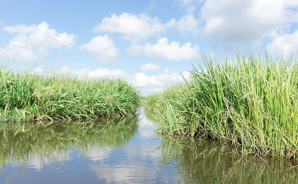
There is no better fishing and no harder truth in the American outdoors than Louisiana's coastal marsh. From the bull reds tailing on a Biloxi Marsh flat to the duck blinds of Pointe-aux-Chenes to the tuna fleet running south out of Venice, the Louisiana coast is, mile for mile, the most productive sporting estuary in North America: roughly three million acres of bays, bayous, and grass that grow some of the best redfish and speckled trout fishing on earth and that winter more ducks than any other region on the continent. And it is disappearing. The same marsh that produces all of this has been dissolving into the Gulf for nearly a century, losing on the order of two thousand square miles of land since 1932. This field report walks the working, vanishing marsh: the estuary chemistry that makes the fishing and the hunting so good, the land-loss crisis and the bruising politics of trying to fix it, the redfish and the ducks, and what all of it means for the guides, captains, and lodges who make their living on water that may not be there for their grandchildren.
Ecology Snapshot: A Working Estuary That Is Coming Apart
Louisiana's coastal zone holds roughly three million acres of wetlands, something close to forty percent of the coastal and tidal marshes in the lower forty-eight states. They were built over thousands of years by the Mississippi River, which wandered across the coast, depositing the sediment that became the delta. The marsh is a salinity gradient from the salt of the Gulf to the fresh of the upper basins, and that gradient is the engine of the fishing: redfish (red drum) and speckled trout (spotted seatrout) thrive in the brackish bays and bayous near the coast, while the fresher upper marsh holds largemouth bass and bream, so a guide can run from saltwater reds to freshwater bass in the same broad system. The marsh grasses, spartina and saltgrass, and the freshwater bullwhip and roseau, feed a food web that supports staggering numbers of fish, shrimp, crabs, and wintering birds.
The crisis is that the engine has been switched off. When the Mississippi was leveeed for flood control and navigation, the river was walled away from the marsh it had always fed, and the sediment that once rebuilt the delta now shoots off the end of the Birdsfoot Delta into the deep Gulf instead. Starved of new sediment, the existing marsh is sinking (subsidence) and drowning (sea-level rise), while oil-and-gas canals and saltwater intrusion cut it apart from within. The result is one of the great environmental losses in North American history: Louisiana has lost roughly 2,000 square miles of coastal land since 1932, about a quarter of what existed, and it accounts for the overwhelming majority of the nation's coastal wetland loss. The famous shorthand, a football field of marsh lost at regular intervals, is real, though the rate has slowed from its 1970s peak: at recent rates, the loss is closer to a football field every hundred minutes than the every-hour or every-half-hour figures often repeated. There is one bright counterpoint: at the Atchafalaya Bay and the Wax Lake Outlet to the west, where a distributary is allowed to carry sediment freely, a new delta is actively building, proof of what a reconnected river can still do.
What the Interface Creates: Redfish, Ducks, and a Restoration Fight
What the marsh creates, first, is the fishery. The Louisiana coast is widely regarded as one of the best inshore red drum and speckled trout fisheries anywhere in North America, with redfish available essentially year-round across a vast, lightly pressured marsh, plus flounder, black drum, sheepshead, and a summer tarpon run. Out of ports like Venice and Grand Isle, that inshore marsh sits a short run from near-shore oil rigs and the blue water beyond, so a captain can fish redfish in the morning and tuna in the afternoon. Second, the marsh creates the waterfowl. Coastal Louisiana is one of the single most important duck-wintering grounds on the continent, holding in a typical year on the order of half of all the ducks in the Mississippi Flyway, which is why Ducks Unlimited calls it America's Marsh; more ducks winter here than in any other region of North America. The state lies mainly within the Mississippi Flyway, but the southwest Louisiana Chenier Plain around Cameron Parish also draws Central Flyway birds.
Third, the interface creates a restoration fight, and it is worth understanding honestly because it has just taken a dramatic turn. Louisiana's response to the land-loss crisis is the Coastal Master Plan, run by the state's Coastal Protection and Restoration Authority (CPRA): a roughly fifty-year, fifty-billion-dollar program of marsh creation, barrier-island rebuilding, ridge restoration, levees, and, most controversially, sediment diversions, which would cut the river levee and let the Mississippi rebuild marsh the way it once did. The flagship of that strategy was the Mid-Barataria Sediment Diversion. But after costs ballooned from under a billion dollars to roughly three billion, and amid fierce opposition from fishing and oyster communities worried about the freshwater flood, the project was suspended in 2025 and then canceled outright, with the state declaring it no longer viable. The cancellation of the single largest planned restoration project in the country is a genuine inflection point: the science of diversions is sound, but the politics and economics have, for now, won. Federal and state restoration continues through the Master Plan and the long-running Coastal Wetlands Planning, Protection and Restoration Act (the 1990 Breaux Act) task force, but the path forward is more contested than ever.
Migration and Timing Signals
The fishing runs all year, but it has its rhythms. Redfish are catchable twelve months a year in the marsh, with the famous fall bull-red run, when the big breeding fish stack up near the passes, as the marquee event; speckled trout are strongest from spring through fall, moving with the salinity and the bait. The tarpon, the silver kings, are a summer fishery: they move through the Mississippi River passes and west toward Grand Isle from roughly June into September, with the peak in the heat of late July and August, the season of the Grand Isle International Tarpon Rodeo, the oldest fishing tournament in the United States, running since 1928.
The waterfowl calendar is the other clock. The first dabblers (pintail, then gadwall, wigeon, and teal) push into the coast in October, and wintering abundance peaks roughly November through January, aligning with the coastal-zone duck season. Gadwall and green-winged teal are typically the most abundant ducks in the marsh, with blue-winged teal, pintail, and wigeon close behind; the resident mottled duck is present year-round; and diving ducks like scaup and redhead are on the open bays. For the trip planner, the through-line is simple: fall and winter stack the bull reds and the ducks together, late summer is tarpon time, and spring and fall are the prime speckled trout windows, with redfish a constant underneath all of it.
On the Ground: The Basecamps
The marsh is worked from a string of legendary ports. Venice, at the very end of Louisiana Highway 23 in lower Plaquemines Parish, is the southernmost town on the Mississippi reachable by road and the famous Tuna Town, the base for the Birdsfoot Delta, the bull reds, and the offshore fleet; just downriver is the LDWF's Pass-a-Loutre Wildlife Management Area at the river's mouth. Grand Isle, Louisiana's only inhabited barrier island, sits at the end of Highway 1 with Barataria Bay behind it and the open Gulf in front, a base for marsh reds, the rigs, and the tarpon rodeo. To the west, in Terrebonne Parish, Houma is the inland hub, and the down-the-bayou ports of Cocodrie and Dularge run into Terrebonne Bay, Caillou Bay, Lake Pelto, and Lake Boudreaux, with the Pointe-aux-Chenes WMA nearby. Farther west still, the marsh and bays around Vermilion Bay and the building Atchafalaya delta open the central coast. Each port is a doorway into a slightly different piece of the same vast, vanishing estuary.
Planning Your Trip: A Vertical-by-Vertical Breakdown
Louisiana's coast supports inshore, offshore, and waterfowl verticals within a single marsh. Note that Louisiana tightened its redfish and speckled trout rules in 2023-2024 — always confirm the current LDWF regulations, seasons, and limits before a trip.
Marsh Redfish. Target: red drum (redfish), the signature fishery, on sight-cast flats and marsh ponds. Peak: year-round, with the fall bull-red run near the passes as the showpiece. Where: the marsh from the Biloxi Marsh and Barataria to Terrebonne and the central coast. Current LDWF rule: 18-27 inch slot, 4 fish per day, no harvest of bull reds over 27 inches (confirm current regs).
Speckled Trout. Target: speckled trout (spotted seatrout), often alongside reds. Peak: spring through fall, moving with salinity and bait. Where: the brackish bays, bayous, and shorelines across the coast. Current LDWF rule (new since late 2023): 13-20 inch slot, 15 fish per day, only 2 over 20 inches (confirm current regs). Note: the limit was cut sharply from the old 25-fish rule.
Nearshore and Offshore (Venice, Grand Isle). Target: tuna (yellowfin), mangrove and red snapper, cobia, and the summer tarpon run. Peak: tuna largely year-round off the deep rigs; tarpon June-September (peak late July-August). Where: the near-shore rigs and blue water out of Venice and Grand Isle, a short run from the marsh. Note: federal and state seasons (snapper, tuna) are tightly regulated; confirm dates.
Marsh Waterfowl. Target: gadwall, green-winged and blue-winged teal, pintail, wigeon, mottled duck, and divers (scaup, redhead). Peak: November-January, the coastal-zone duck season. Where: the marsh ponds, bays, and managed impoundments (private leases and camps, plus public WMAs). Note: a continental-flyway concentration; confirm season splits and zones with LDWF.
Upper-Marsh Bass. Target: largemouth bass and bream in the fresher upper marsh and the Atchafalaya fringe. Peak: spring spawn and fall. Where: the freshwater bayous, canals, and ponds above the salt line, often a short run from redfish water. Note: the salinity gradient means bass and reds can share a single day's run in the right marsh.
Key Takeaways
Louisiana's coastal marsh is roughly three million acres of estuarine and freshwater wetlands, close to forty percent of the lower forty-eight's coastal marsh, built by the Mississippi River and arranged as a salinity gradient that supports redfish and speckled trout in the brackish bays and largemouth bass in the fresher upper marsh. It is one of the most productive inshore fisheries in North America and one of the continent's most important duck-wintering grounds, holding in a typical year on the order of half the Mississippi Flyway's ducks (with Central Flyway birds in the southwest Chenier Plain).
The marsh is also disappearing: leveeing of the Mississippi cut off the sediment that built it, and with subsidence, sea-level rise, canals, and saltwater intrusion, Louisiana has lost roughly 2,000 square miles of coastal land since 1932 (about a quarter of it) and accounts for most of the nation's coastal wetland loss. The loss rate has slowed from its 1970s peak to roughly a football field every 100 minutes. The state's fifty-year, fifty-billion-dollar CPRA Coastal Master Plan is the response, but its flagship sediment diversion, Mid-Barataria, was canceled in 2025 after costs tripled and fishing communities fought it, a major setback for the diversion strategy. The Atchafalaya and Wax Lake deltas, by contrast, are actively building new land.
Timing: redfish year-round (fall bull-red run at the passes), speckled trout spring through fall, tarpon June-September (peak late July-August, the Grand Isle Tarpon Rodeo), and waterfowl November through January. Current Louisiana regulations are tighter than they used to be: redfish are in an 18-27-inch slot at 4 per day, with no harvest over 27 inches (since 2024), and speckled trout are in a 13-20-inch slot at 15 per day (since late 2023). These changed recently and may change again — confirm current LDWF rules before fishing.
Basecamps: Venice (Tuna Town, end of Highway 23, the Birdsfoot Delta and the offshore fleet); Grand Isle (Louisiana's only inhabited barrier island, Barataria Bay and the tarpon rodeo); Houma, Cocodrie, and Dularge (Terrebonne Parish, the central marsh, Terrebonne and Caillou bays); and the Vermilion Bay and Atchafalaya coast to the west. Public lands include Pass-a-Loutre and Pointe-aux-Chenes WMAs and the Delta, Sabine, and Cameron Prairie National Wildlife Refuges. All seasons and limits change — confirm with LDWF before a trip.
For the Operators
The Louisiana coast is the most aggregator-saturated inshore market on the Gulf. Venice, Houma, Cocodrie, and Grand Isle each support dense fleets of charter captains, and the booking marketplaces have built thick, well-optimized inventory for all of them: a search for a Venice or Houma charter returns FishingBooker and Captain Experiences landing pages before it returns any individual captain, and the platforms own the research phase by default. For the working guide, the competition is not really the boat at the next dock; it is the marketplace that intercepts the client before the client ever learns the captain's name. Differentiation and direct discovery are the entire game, and almost no one is winning it on their own ground.
The waterfowl side has a different problem. The Louisiana duck-lease and lodge tradition is deep and multi-generational, marshes hunted by the same families for sixty years and more, but that world is largely invisible online, and as the founding generation ages out, a great deal of hard-won local knowledge sits on properties with no digital presence at all. That is a succession risk and an opportunity at once: the operation that finally publishes its story, its marsh, its history, its hunts, can own a category that its older, quieter competitors have left completely open. The same is true across the inshore market, where the editorial whitespace is wide for any guide willing to actually tell the story of the water.
And then there is the story no operator on this coast should ignore: the marsh is disappearing, and that is, however painful, an extraordinary piece of positioning. An operator who tells the honest truth about this place, that it is the best fishing in America and that it is going away, that you should come witness it and fish it while it is here, holds a narrative no aggregator can touch and no other region can claim.
Done with respect rather than gimmickry, the disappearing-coast story turns a guide into a witness and an advocate, the kind of authentic, place-rooted voice that search engines and AI answers increasingly surface and that clients increasingly seek. That accurate, local, deeply-rooted editorial layer, the fishery, the seasons, the regulations, and the fight to hold the coast, is exactly what Pine & Marsh builds for operators working water this rich and this threatened.
Citations and Sources
This field report draws on the federal and state agencies, research bodies, and conservation organizations below. Regulations, seasons, limits, and restoration-project status change frequently in coastal Louisiana — verify current details with the relevant agency before a trip.
Agencies and science
The Louisiana Department of Wildlife and Fisheries (LDWF) for fishing and waterfowl seasons and the current redfish and speckled trout regulations; the Coastal Protection and Restoration Authority of Louisiana (CPRA) for the Coastal Master Plan and the status of the Mid-Barataria Sediment Diversion; the U.S. Geological Survey (USGS) for coastal land-change data; the U.S. Army Corps of Engineers New Orleans District; and the U.S. Fish and Wildlife Service for the Delta, Sabine, and Cameron Prairie National Wildlife Refuges.
Conservation and research partners
The Restore the Mississippi River Delta coalition, The Nature Conservancy in Louisiana, the Coastal Conservation Association of Louisiana (CCA Louisiana), Ducks Unlimited (which brands the coast America's Marsh), Audubon Delta (the National Audubon Society's Louisiana-Mississippi-Alabama regional office), and The Water Institute (the Baton Rouge coastal-science nonprofit, formerly the Water Institute of the Gulf).
Confidence note: Louisiana holds ~3 million acres of coastal wetlands, roughly 40% of the lower 48's coastal/tidal marsh (range ~30-45% by definition), and accounts for ~80% of the nation's coastal wetland loss. Cumulative loss is ~2,000 square miles since 1932 (about 25% of the 1932 land; the often-cited 1,900 sq mi is the 1932-2010 figure). The CURRENT loss rate has SLOWED from the 1970s peak (~a football field every 34 minutes then) to roughly a football field every 100 minutes (~10.8 sq mi/yr, 2010-2016, per USGS) — do NOT state 'a football field an hour' as current. The Mid-Barataria Sediment Diversion was SUSPENDED in spring 2025 and then CANCELLED in mid-2025 (cost had risen from under $1B to ~$3.1B; the state declared it no longer viable) — it is NOT under construction. The Atchafalaya/Wax Lake delta is actively building land. CURRENT LDWF regs: speckled trout 13-20 inch slot, 15/day, 2 over 20 inches (effective late 2023, replacing 12-inch/25-fish; set to sunset Jan 1, 2028); red drum 18-27 inch slot, 4/day, no harvest over 27 inches, no for-hire crew retention (effective June 20, 2024). Tarpon run roughly June-September, peak late July-August (NOT April-May). Coastal Louisiana winters roughly half the Mississippi Flyway's ducks / more than any other region in North America (the 'more than any state east of California' phrasing is imprecise). Confirm all current rules and project status with the cited agencies.
Explore More
This field report is part of Pine & Marsh's coverage of the Southeastern sporting corridors. The companion pieces below go deeper into the Louisiana coast, its ports, the redfish and waterfowl, and the operators who work the disappearing marsh.


Comments