
The Virginia Outdoor Field Report: The Eastern Shore, Chesapeake Tributaries, and the Blue Ridge Backcountry
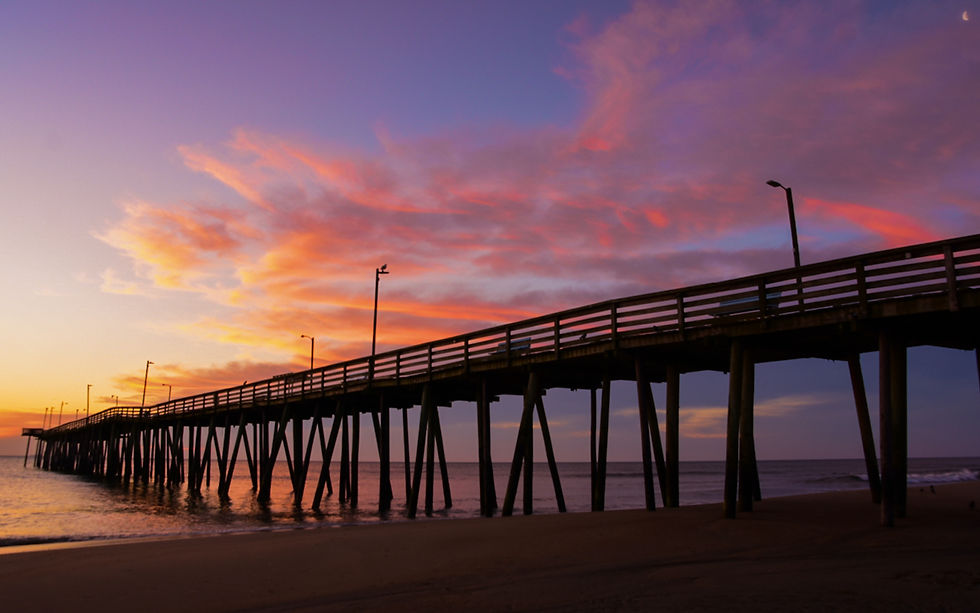
Drive east to west across Virginia, and you cross more sporting country than most hunters and anglers will see in a region, let alone a single state. The morning can start on a seaside barrier island off the Eastern Shore, where Atlantic Flyway brant trade over the bayside flats and the Atlantic Ocean breaks a few hundred yards behind the blind. By afternoon, you can be standing in the tidal James below Richmond, where striped bass push shad against the current and blue catfish the size of a leg hold on the channel edges. And by the next morning, you can be knee-deep in a wild brook trout stream in the George Washington and Jefferson National Forests, where the water runs cold off the Blue Ridge, and the nearest cell signal is a ridgeline away.
Virginia is, functionally, four sporting states stacked on one map. It carries the southern end of the Atlantic Flyway, the largest estuary in North America in the Chesapeake Bay, roughly 1.8 million acres of national forest in its western mountains, and a Southside blackwater-and-longleaf country that reads more like coastal North Carolina than the Tidewater an hour east of it. Few states ask an operator -- or a traveling sportsman -- to hold so many different landscapes in mind at once.
This Field Report walks the whole range: the Eastern Shore seaside-bayside divide, the Chesapeake tributaries and their striped bass and trophy blue catfish, the Allegheny Highlands cold-water trout fisheries, and the Southside blackwater rivers that tie Virginia to the longleaf-pine bottomland tradition of the Carolinas. It is built for the traveling hunter or angler planning a season, and for the operator trying to understand where they sit in a market that almost no single guide can describe on their own. As always, specific regulations, season dates, and bag limits change year to year—confirm everything with the Virginia Department of Wildlife Resources and the relevant federal agency before you go.
Ecology Snapshot: Four Sporting States on One Map
Virginia's diversity is a function of its geography. The state runs from the Atlantic barrier islands across the Coastal Plain, up through the rolling Piedmont, over the Blue Ridge, and down into the Ridge-and-Valley and Appalachian Plateau country of the far southwest. Each of those physiographic provinces carries its own water, its own game, and its own sporting culture. The Virginia Department of Wildlife Resources (VDWR) manages this entire spread, from coastal waterfowl to mountain brook trout, and the federal footprint -- multiple national wildlife refuges, two national forests administered together, and a stretch of National Park Service seashore -- layers public access across nearly every region.
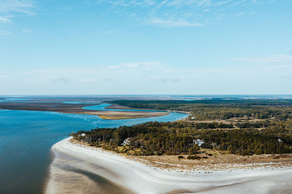
The Eastern Shore seaside-bayside divide. Virginia's Eastern Shore is the southern tip of the Delmarva Peninsula, a narrow finger of land with the Atlantic on one side and the Chesapeake Bay on the other. That single geographic fact creates two different fisheries and two different waterfowl worlds within a few miles of each other. The seaside is a chain of undeveloped barrier islands and salt marsh -- much of it protected within the Eastern Shore of Virginia and Chincoteague National Wildlife Refuges and, to the north, the National Park Service's Assateague Island National Seashore. The bayside is a quieter system of tidal creeks and shallow flats. Atlantic Flyway brant, black ducks, and sea ducks all use this corridor, and the seaside-bay split shapes where and how operators run.
The Chesapeake tributaries. The four great rivers of the Virginia Tidewater -- the James, the York, the Rappahannock, and the Potomac -- drain into the Chesapeake Bay and form the backbone of the state's saltwater and tidal-river fishing. These are striped bass rivers (locals call the fish rockfish), shad rivers in spring, and increasingly trophy blue catfish rivers, with the tidal James producing some of the largest blue cats on the East Coast. The Virginia Institute of Marine Science (VIMS) and the Chesapeake Bay Foundation (CBF) both track the health of this estuary, and the Bay's striped bass stock is one of the most closely watched fisheries on the Atlantic coast.
The Allegheny Highlands cold-water country. West of the Blue Ridge, Virginia turns cold and high. The Jackson River and the Cowpasture come together to form the James; the Smith River below Philpott Dam runs as a tailwater; the Shenandoah River system braids north through the valley; and hundreds of small mountain streams in the George Washington and Jefferson National Forests hold wild and native brook trout. Trout Unlimited's Virginia chapters, including work in the Allegheny Highlands, have long focused on these headwaters and the brook trout that depend on them.
The Southside blackwater bottomlands. In the state's southeast corner, below the James River and along the North Carolina line, Virginia takes on an entirely different character. The Nottoway, the Meherrin, and the Blackwater rivers run dark and slow through cypress and longleaf-pine bottomland -- an ecology that belongs as much to the Carolina coastal plain as to Virginia. This is whitetail and turkey country, with a working-timber backdrop and a blackwater fishing tradition, and it connects the state's sporting identity southward into the longleaf forest belt.
Tying these four worlds together is the Tidewater interface -- the broad, low Coastal Plain where the rivers go tidal, the Great Dismal Swamp straddles the Virginia-North Carolina border, and the Hampton Roads charter fleet works the lower Bay and the nearshore Atlantic for striped bass, cobia, and red drum. It is the seam where the freshwater and saltwater states meet.
What the Interface Creates
Sporting quality in Virginia is mostly a story about edges -- the places where two systems meet and concentrate fish, birds, and game. Four of those interfaces define the state.
The Chesapeake estuary
The Chesapeake Bay is the largest estuary in North America, and its productivity comes from the mixing of fresh river water and salt tide across an enormous, shallow, grass-lined basin. That mixing drives the food web that supports striped bass, the Bay's signature gamefish. Migratory stripers stage and move through the lower Bay and its tributary mouths, while resident fish hold in the rivers; the spring spawning runs up the James, the York, the Rappahannock, and the Potomac are a defining event of the Virginia fishing calendar. The same estuary supports a spring American shad and hickory shad run, summer cobia in the lower Bay, speckled trout and red drum in the tidal creeks, and a growing population of invasive blue catfish that has turned the tidal James and Rappahannock into nationally known trophy catfish destinations. VIMS conducts the long-running surveys that inform how this fishery is managed, and the Chesapeake Bay Foundation has spent decades on the water-quality and grass-restoration work the whole system depends on.
The barrier island marsh
Along the Eastern Shore, the barrier islands and salt marshes form one of the least-developed stretches of coast on the Atlantic seaboard, much of it conserved by The Nature Conservancy's Virginia Coast Reserve and the federal refuges. For waterfowl, this is Atlantic Flyway wintering ground -- brant working the eelgrass and sea lettuce of the bayside, black ducks in the marsh guts, and sea ducks off the inlets. For inshore anglers, the same flats and sloughs hold red drum, speckled trout, and flounder, and the deeper water off the islands draws sight-casters chasing cobia in summer. The crossover between waterfowl ground and inshore fishing ground on the Eastern Shore is one of the most distinctive features of Virginia's sporting map.
The Allegheny cold-water seam
In the western mountains, elevation and geology create cold water in a southern state. Limestone springs feed famous spring creeks like Mossy Creek in the Shenandoah Valley; dam releases create tailwaters such as the Smith River; and the high-gradient headwater streams of the George Washington and Jefferson National Forests hold native brook trout, Virginia's only native trout. The interface here is between cold, clean mountain water and the warmer valley rivers below -- the Jackson, the Cowpasture, the upper James, the Shenandoah, and the New all transition from trout water to smallmouth water as they descend. The New River, one of the oldest rivers on Earth, is renowned for smallmouth bass and has become the East's premier fly-rod muskie water.
The Southside blackwater
In the Southside, the interface is between upland longleaf-pine forest and the dark, acidic water of the Nottoway, Meherrin, and Blackwater rivers. These slow blackwater systems run through bottomland hardwood and pine, supporting bowfin, longnose gar, redbreast sunfish, and chain pickerel, while the surrounding woods are home to whitetail and Eastern wild turkey. It is the quietest of Virginia's four sporting worlds and the one most closely tied to the Carolina coastal-forest tradition.
Migration and Timing Signals
Because Virginia holds so many ecologies, its sporting calendar is unusually full -- there is a peak window somewhere in the state in almost every month. The key is matching the trip to the season, and confirming current dates and limits with VDWR and the relevant federal agency before committing.
Atlantic Flyway waterfowl (roughly November-January). Virginia's duck and goose seasons fall within the federal Atlantic Flyway framework, with the coldest weeks of late December and January typically pushing the most birds into the Eastern Shore and Back Bay marshes. Brant, black ducks, and sea ducks key on the Eastern Shore; puddle ducks and divers use Back Bay National Wildlife Refuge and the False Cape area at the state's southeast corner; and the Chesapeake tributaries hold birds through the season. Ducks Unlimited's Virginia office and VDWR are the authorities on framework dates and habitat conditions.
Spring rockfish and shad runs (roughly March-May). As water warms in spring, striped bass and shad move up the Chesapeake tributaries to spawn. The trophy spring striped bass season in the Bay and the shad runs on the James, the Rappahannock, and the Potomac are timed events that draw anglers from across the Mid-Atlantic. Regulations on the spring striped bass fishery are adjusted frequently in response to coastwide stock assessments, so this is a fishery where checking the current VDWR rules matters more than almost any other.
Wild trout cold-water windows (spring and fall). The mountain trout fishing peaks in the cooler months. Spring brings hatches and high, cold water to the Allegheny Highlands streams, the Smith River tailwater, and Mossy Creek; fall offers low, clear conditions and aggressive brook trout in the national forest headwaters. Midsummer heat pushes the freestone trout streams to their thermal limits, which is when the limestone spring creeks and tailwaters carry the fishery.
Smallmouth and warmwater (summer). Summer is prime time on the New River, the upper James, the Shenandoah, and the Clinch and Powell systems, when smallmouth bass are active, and the rivers are at comfortable wading and floating levels. The New River muskie fishery and the tidal James blue catfish fishery both fish well into the warm months as well.
Cobia and inshore saltwater (summer). The lower Chesapeake and the Eastern Shore seaside light up in summer, when cobia move into the Bay and red drum, speckled trout, and flounder fill the inshore creeks and flats. The Hampton Roads and Eastern Shore charter fleets operate at their busiest from late spring through early fall. Coastal Conservation Association Virginia is the lead advocacy voice on these inshore stocks.
Deer, turkey, and the dove opener (fall). Virginia's fall hunting calendar runs from the early September dove opener through archery, muzzleloader, and firearms deer seasons into winter, with the spring turkey season following in April and May. The Southside, the Piedmont hunt country, and the national forest backcountry each carry distinct deer-hunting traditions, ranging from managed private land to vast public ground in the George Washington and Jefferson National Forests.
On the Ground: Basecamps Across the State
No single town anchors Virginia's sporting country the way a delta hub might anchor a duck state. The geography is too spread out for that. Instead, a handful of base camps open different regions.
Chincoteague and Onancock (Eastern Shore). Chincoteague, beside Chincoteague National Wildlife Refuge and Assateague Island, is the northern gateway to the seaside barrier-island country -- waterfowl, inshore flats, and the surf. Onancock, on the bayside, opens the quieter creek-and-flats system and the bay-to-seaside crossover that defines Eastern Shore guiding.
Tappahannock and the Northern Neck. Tappahannock sits on the Rappahannock, and the Northern Neck -- the peninsula between the Rappahannock and the Potomac -- is rockfish and menhaden country, home to a long-running charter tradition working the lower rivers and the Bay. It is also where the charter fleet's aging and consolidation are most visible.
Richmond (the waterfront and the tidal James). Few state capitals offer Class IV whitewater and trophy fishing inside the city limits, but Richmond does. The James runs through downtown over a fall line of ledges and rapids, and below the city, the tidal river holds striped bass, shad in spring, and blue catfish that rank among the largest in the country. Richmond is the natural base camp for the James River corridor.
Roanoke and Smith Mountain Lake. Roanoke anchors the southwestern Piedmont and the Blue Ridge foothills, with Smith Mountain Lake -- Virginia's inland striped bass reservoir -- and the upper James smallmouth water within easy reach. Lake Anna, closer to the central Piedmont, fills a similar role as a landlocked striper and bass fishery.
Bristol and the far southwest. In the state's mountainous tail, Bristol opens the Clinch and Powell watersheds -- some of the most biologically diverse rivers in North America -- the Big Sandy headwaters, Mount Rogers National Recreation Area, the Grayson Highlands, and Virginia's reintroduced elk herd in the old coalfields. This is the wildest, least-marketed sporting country in the state.
Hot Springs and Bath County. In the Allegheny Highlands, Hot Springs and surrounding Bath County put an angler within reach of the Jackson River tailwater, the Cowpasture, Lake Moomaw, and a network of wild trout streams in high, quiet country.
Planning Your Virginia Trip
The table below is a high-level orientation, not a regulation guide. Always confirm seasons, limits, and access rules with the Virginia Department of Wildlife Resources and the managing federal agency before you travel.
Pursuit | Where | Peak Window | Notes |
Atlantic Flyway waterfowl | Eastern Shore, Back Bay, Chesapeake tributaries | Nov-Jan | Brant, black ducks, sea ducks on the coast; framework dates via VDWR |
Striped bass (rockfish) | Chesapeake Bay + James/York/Rappahannock/Potomac | Spring + fall | Spring trophy run; regulations adjusted frequently |
Shad | Tidal James, Rappahannock, Potomac | Mar-May | American and hickory shad spawning runs |
Trophy blue catfish | Tidal James + Rappahannock | Year-round, warm months strong | Invasive species; among the largest blue cats on the East Coast |
Wild + native brook trout | George Washington + Jefferson NFs, Mossy Creek, Smith River | Spring + fall | Native brook trout in headwaters; limestone creeks and tailwaters carry summer |
Smallmouth bass | New River, upper James, Shenandoah, Clinch/Powell | Summer | New River also premier fly-rod muskie water |
Inland striped bass | Smith Mountain Lake, Lake Anna, Buggs Island (Kerr) | Spring + fall | Landlocked reservoir striper fisheries |
Cobia + inshore saltwater | Lower Chesapeake, Eastern Shore seaside, Hampton Roads | Summer | Cobia sight-casting; red drum, speckled trout, flounder |
Deer + turkey | Southside, Piedmont, GW + Jefferson NFs | Fall + spring | Dove opener early Sept; spring turkey Apr-May |
Key Takeaways
Virginia is four sporting states stacked on one map. The Eastern Shore, the Chesapeake tributaries, the Allegheny Highlands, and the Southside blackwater each carry their own water, game, and culture -- and almost no single operator can describe the whole thing.
The Chesapeake estuary is the engine. The largest estuary in North America supports the striped bass, shad, and blue catfish fisheries, as well as inshore fisheries that define Tidewater Virginia, which are tracked by VIMS and the Chesapeake Bay Foundation.
Cold water in a southern state. Limestone spring creeks, tailwaters, and high national forest headwaters give Virginia a genuine wild and native brook trout fishery, concentrated in the George Washington and Jefferson National Forests.
The Eastern Shore crossover is rare. Few places put Atlantic Flyway waterfowl grounds and productive inshore flats within the same few miles, split between a wild seaside and a quiet bayside.
The Southside connects Virginia to the Carolinas. The Nottoway, Meherrin, and Blackwater rivers and their longleaf-pine bottomlands read more like coastal North Carolina than the Tidewater, and they are the least-marketed sporting country in the state.
Timing is everything. With a peak window somewhere in the state nearly every month, Virginia rewards trips planned around the season -- and around current VDWR and federal regulations.
For the Operators
Virginia's operator landscape is as fragmented as its geography, and each segment faces a different digital reality. Naming those realities honestly is the first step toward fixing them.
The Tidewater charter fleet -- the rockfish, cobia, and menhaden guides working Hampton Roads and the lower Bay -- competes for visibility against booking aggregators and marina directories. When a traveling angler searches for a Chesapeake charter, platforms often rank above the captains themselves, meaning an operator's own brand and story get buried beneath a listing they don't control.
The Eastern Shore waterfowl outfitters are frequently multi-generational lodges with deep local knowledge and thin digital presence. That combination is a succession cliff: when the founding generation steps back, the brand equity that lived in word-of-mouth and repeat clients has nothing online to inherit it. A lodge with fifty years of history can be nearly invisible to the hunter planning a first Atlantic Flyway trip.
The Northern Neck rockfish guides face a charter cliff of their own -- a consolidating fleet of aging operators on the Rappahannock and the Potomac, where the next generation of captains is thinner than the last, and the digital footprint has not kept pace with the fishery's reputation.
The Southside blackwater operations are, in search terms, nearly operator-invisible. The Nottoway, Meherrin, and Blackwater country has a genuine sporting tradition and almost no online presence describing it—which is whitespace for any operator willing to tell that story.
The Allegheny Highlands trout and turkey guides are fragmented across a vast backdrop of public land. The fishery is world-class in places -- Mossy Creek, the Jackson River, the Smith River tailwater -- but the guiding is scattered, and a clear, well-sourced regional brand can stand out quickly in a field of part-time operators.
The common thread across all five segments is that the editorial authority -- the deep, accurate, place-based content that AI search engines and traveling sportsmen both reward -- largely does not yet exist. The operators who build it first will own their stretch of water and woods in search for years. What you've built deserves to be found.
The Four Tributaries, River by River
The Chesapeake side of Virginia is best understood one river at a time. The James, the York, the Rappahannock, and the Potomac each drain a different slice of the state, and each carries a slightly different mix of fish and access -- but together they form the tidal spine of Virginia's saltwater and warmwater fishing.
The James. The longest river contained entirely within Virginia, the James runs from the Allegheny Highlands -- where the Jackson and the Cowpasture join -- across the Piedmont, over the fall line at Richmond, and down a long tidal reach to the Chesapeake at Hampton Roads. That single river is a smallmouth fishery in its upper and middle stretches, a whitewater fishery through Richmond, a nationally significant trophy blue catfish fishery in the tidal middle river, and a striped bass and shad fishery near its mouth. No other Virginia river compresses so many fisheries into one corridor, which is why the James anchors so much of the state's angling identity.
The York. Formed by the Pamunkey and the Mattaponi above West Point, the York is the shortest of the four major tributaries and one of the most ecologically intact. Its tributaries are historically important shad and herring spawning rivers, and the system supports striped bass, blue catfish, and a productive lower-river inshore fishery. The York drainage is also tied to some of the oldest Native nations in the Tidewater, the Pamunkey and Mattaponi, whose river stewardship long predates the state agencies that manage it today.
The Rappahannock. The Rappahannock runs from the Blue Ridge through Fredericksburg and out across the Northern Neck and Middle Peninsula to the Bay. Above the fall line at Fredericksburg, it is a smallmouth river; below it, the tidal Rappahannock is rockfish, shad, and trophy blue catfish water, and its mouth opens onto the charter grounds of the Northern Neck. The U.S. Fish and Wildlife Service's Rappahannock River Valley NWR protects a string of marshes and bottomlands along the tidal river.
The Potomac. Virginia shares the Potomac with Maryland and the District of Columbia, and the river forms the state's northern border for much of its length. The tidal Potomac is a renowned largemouth bass fishery as well as a striped bass and shad river, and its Virginia-side creeks and the broad Mobjack and Northern Neck waters connect it to the larger Bay system. Management of the Potomac is shared across jurisdictions, which makes confirming current rules especially important here.
The Blue Catfish Story
One of the most consequential ecological changes in the Virginia Tidewater over the past half-century has been the explosion of blue catfish. Introduced to the tidal rivers decades ago, blue catfish have become enormously abundant in the James, the Rappahannock, and the York, where they now make up a large share of the fish biomass in some reaches. For anglers, the result is a genuinely world-class trophy fishery -- the tidal James in particular produces blue cats among the largest on the East Coast, and a guide industry has grown up around them. For the estuary, the picture is more complicated: as an introduced predator, the blue catfish eats native shad, herring, and blue crabs, and agencies including VIMS and the Chesapeake Bay Foundation have flagged the species as a management concern even as they acknowledge its value to anglers. It is a rare case where a trophy fishery and a conservation problem are the same fish -- an honest tension worth naming rather than glossing.
The Southwest: Biodiversity and the Elk Comeback
Virginia's far southwest is its least-known sporting country and, by some measures, its most extraordinary. The Clinch and Powell rivers, draining the Appalachian Plateau toward the Tennessee system, are among the most biologically diverse freshwater rivers in North America, holding globally significant assemblages of freshwater mussels and fish -- a richness recognized by conservation scientists and The Nature Conservancy alike. For anglers, the same clean, high-gradient water means strong smallmouth bass and a backcountry character that has all but disappeared elsewhere in the East.
Layered on top of that biodiversity is one of the Southeast's signature wildlife-restoration stories: the return of elk to the Virginia coalfields. Working with partners, VDWR established a managed elk population in the old mining counties of the southwest, and the herd has grown into a regional draw -- both for the limited, highly sought-after elk-hunting opportunity and for wildlife viewing that has become an economic anchor for post-coal communities. The elk zone, the Russell Fork and Big Sandy headwaters, and the Hatfield-McCoy backcountry together make the far southwest a sporting region on the rise, even as it remains nearly invisible in online search.
The Great Dismal Swamp and the Coastal Plain Backcountry
Straddling the Virginia-North Carolina line south of Norfolk, the Great Dismal Swamp is one of the largest remaining forested wetlands in the eastern United States, protected as a national wildlife refuge covering roughly 112,000 acres. It is black bear country -- the refuge holds one of the densest bear populations in the region -- and it carries a layered human history, including its role as a refuge for self-emancipated people in the antebellum South's maroon communities. For hunters, the Dismal Swamp and the surrounding Coastal Plain offer bear and deer opportunity on a wild, difficult landscape; for the broader sporting traveler, it is a piece of country with a story almost no operator currently tells. The same is true of the Southside blackwater rivers to the west, where the Nottoway, the Meherrin, and the Blackwater run through longleaf-pine bottomland that ties Virginia's sporting identity directly into the Carolina coastal forest belt.
Upland and Small Game: The Quiet Tradition
Virginia's hunting identity leans on deer, turkey, and waterfowl, but the state also has a quieter upland and small-game tradition worth knowing about. The early-September dove opener is a social event across the Piedmont and Southside, where managed fields draw the season's first hunters. Bobwhite quail, once abundant across the Piedmont and Coastal Plain, have declined sharply with the loss of early-successional habitat -- a pattern VDWR and conservation partners are working to reverse through habitat programs, mirroring the broader Southeast bobwhite story. Rabbit, squirrel, and grouse hunting persist on the vast public ground of the George Washington and Jefferson National Forests, where ruffed grouse hold in the higher-elevation young forest. None of these is a marquee commercial fishery or a trophy hunt, but together they round out a sporting calendar that genuinely runs year-round.
Full Citations and Sources
The following agencies, institutions, and conservation organizations inform the ecological, regulatory, and habitat context in this report. Specific seasons, limits, and access rules change frequently -- always confirm current details with the managing agency before planning a trip.
Government and agency sources
Virginia Department of Wildlife Resources (VDWR) -- hunting and freshwater fishing regulations, waterfowl frameworks, trout and warmwater management, deer and turkey seasons.
Virginia Marine Resources Commission -- saltwater and Chesapeake fishery regulations (striped bass, cobia, red drum, speckled trout, flounder).
U.S. Fish and Wildlife Service -- Eastern Shore of Virginia NWR, Chincoteague NWR, Back Bay NWR, Great Dismal Swamp NWR, and Rappahannock River Valley NWR.
National Park Service -- Assateague Island National Seashore.
U.S. Forest Service -- George Washington and Jefferson National Forests (administered together), Mount Rogers National Recreation Area.
Virginia Institute of Marine Science (VIMS) -- Chesapeake Bay fisheries surveys and stock-assessment science.
U.S. Fish and Wildlife Service Migratory Bird Program -- Atlantic Flyway waterfowl frameworks and surveys.
Research, conservation, and institutional sources
Chesapeake Bay Foundation -- Bay water quality, submerged aquatic vegetation, and estuary restoration.
The Nature Conservancy in Virginia -- Virginia Coast Reserve and Eastern Shore barrier-island conservation.
Coastal Conservation Association Virginia -- inshore and Chesapeake recreational fishery advocacy.
Trout Unlimited (Virginia chapters, including Allegheny Highlands work) -- brook trout and cold-water habitat.
Ducks Unlimited Virginia state office -- waterfowl habitat and Atlantic Flyway conditions.
Confidence note: Figures cited in general terms in this report -- such as the approximately 1.8 million acres of the George Washington and Jefferson National Forests and the 112,000-acre scale of the Great Dismal Swamp -- reflect commonly published agency figures and are used here for orientation. Regulatory details, season dates, and bag limits are deliberately kept general; confirm all specifics with VDWR, the Virginia Marine Resources Commission, and the managing federal agency before you go.
Explore More
Pine & Marsh covers the Virginia region by region. These companion pieces go deeper on the places named above:
Marketing a Sporting Operation in Virginia: The Full State Guide
The Chesapeake Bay Tributaries and Mobjack Bay's Speckled Trout
The James River Corridor: Smallmouth, Urban Class IV, and Tidal Trophy Blue Catfish
The Shenandoah Valley: Mossy Creek, Limestone Karst, and the Brand Canopy
Virginia's Eastern Shore: Barrier Islands, Cobia Sight-Cast, and the Aggregator Risk
Virginia's Northern Neck: Rockfish Country, Menhaden Country, and the Charter Cliff
Virginia Piedmont Hunt Country: The Steepest Digital Cliff in the Southeast
The Alleghany Highlands and Lake Moomaw: The Quiet High Country
Virginia's Western Mountains: George Washington and Jefferson National Forests
Southside Virginia's Blackwater Rivers: The Nottoway, the Blackwater, and Big Woods Longleaf
The Clinch and Powell Watershed: World-Heritage Biodiversity and Virginia's Elk Herd
The New River Valley: One of the Oldest Rivers on Earth and the East's Premier Fly-Rod Muskie Water
Marketing Back Bay NWR and False Cape: VA's Atlantic Flyway Waterfowl and Inshore Crossover
The Great Dismal Swamp: 112,000 Acres of Bear Country and Operator Silence
Marketing a Striped Bass Guide on Smith Mountain Lake or Lake Anna

Comments