
Waterfowl Ecology of Louisiana's Delta NWR and Plaquemines Parish
Updated: 12 hours ago

There is a place on the map of Louisiana where the road simply stops. Highway 23 runs south along the west bank of the Mississippi River through Buras and Boothville until it ends at Venice, and beyond that the only way forward is by boat. Cross the river from the Venice marinas on a cold January morning and you enter a landscape that does not hold still. Channels that were open water a decade ago are now mudflats furred with arrowhead. Bays that once held rafts of ducks have deepened into open water. Cane walls that stood twelve feet tall have collapsed into brown stubble. Everything here is either being built or being taken apart, and often both at once within a few hundred yards.
This is Delta National Wildlife Refuge, 48,799 acres of marsh, ponds, and mudflats at the end of the Mississippi River in Plaquemines Parish, according to the U.S. Fish and Wildlife Service's 2008 Comprehensive Conservation Plan. It was established by Executive Order 7229 on November 19, 1935, from land purchased from Joseph Leiter and the Delta Duck Club, because ducks and geese gathered here in numbers that seemed almost geological. They still come. In the U.S. Fish and Wildlife Service's January 2025 midwinter aerial survey of Southeastern refuges, Delta NWR held an estimated 156,817 waterfowl. Next door, the Louisiana Department of Wildlife and Fisheries manages Pass-a-Loutre Wildlife Management Area, about 115,000 more acres of the same young, river-built marsh.
But the bird's-foot delta is also the most precarious duck habitat in the Mississippi Flyway. It is perched on soft sediment that compacts and sinks every year. It faces the open Gulf on three sides. It depends on a river that has been leveed, channeled, and dredged for navigation for well over a century. And it sits squarely in a hurricane corridor. To understand waterfowl at the bottom of the flyway, you have to understand a landscape that is, in the most literal sense, shifting underfoot.
A River That Refuses a Single Mouth
The Mississippi River does not enter the Gulf through one channel. Below Venice, at a junction known as Head of Passes, it splits into a fan of distributaries: Southwest Pass, maintained by the U.S. Army Corps of Engineers as the deep-draft navigation channel; South Pass; and Pass-a-Loutre, which gives the state WMA its name. From the air, the passes splay outward like the toes of a bird, hence the name bird's-foot delta.
Each pass carries its own load of fresh water and suspended sediment. Along their banks, the river builds low natural levees from the coarsest material it drops when it slows. Behind those levees lie shallow interdistributary bays, ponds, and marsh. Delta NWR occupies the eastern side of this fan, bounded and crossed by smaller passes with names like Main, Raphael, Octave, Women, and Flatboat, while Pass-a-Loutre WMA covers much of the land between the larger passes to the south and east.
What makes this geography so important to waterfowl is the salinity gradient it produces. The refuge's conservation plan describes marshes that range from fresh where the river reaches them to brackish nearer the Gulf and Breton Sound, and it places roughly 60 percent of the refuge in the fresh marsh zone. That is unusual for a coastal refuge that faces open salt water, and it is the direct result of the river pushing fresh water and nutrients across the whole landscape.
The same plan makes a point that sets Delta NWR apart from nearly every other waterfowl refuge in the Southeast: it is an open system with no water-control structures. There are no impoundments to draw down in summer and flood in fall, no pumps, no gates. Wintering duck numbers depend on whatever food the river and tides produce. Readers who know the flyway mainly through managed moist-soil units in the Mississippi Alluvial Valley should set that model aside here. On the bird's-foot, the river is the manager. People can only nudge it.
Cubits Gap and the Birth of New Marsh
Delta NWR exists because a levee broke. According to the conservation plan, in 1862 a breach opened through a narrow section of the Mississippi's natural levee well below New Orleans. Local tradition credits the cut to the daughters of a man named Cubit, who opened it to reach a large open bay and draw fish into their nets. Whatever its origin, the breach became known as Cubits Gap. Sediment poured through it into the bay, and over the following decades that sediment built broad vegetated deposits, the land base on which most of the refuge now stands.
That kind of break is called a crevasse, and the fan of sediment it builds is called a splay. Over successive flood seasons, the deposit rises toward the water surface. Once it is shallow enough, plants colonize it, their stems slow the water further, and the deposit accelerates its own growth. A splay is a delta in miniature, built in years rather than centuries.
The waterfowl response to this process can be enormous, as the history of Cubits Gap itself shows below. Young splays are shallow, nutrient-rich, and dominated by fast-growing plants that produce the seeds and tubers ducks seek out. They behave, in effect, like a moist-soil unit that the river refreshes every spring without a single pump.
Crevasses remain the delta's signature restoration tool. Under the Coastal Wetlands Planning, Protection and Restoration Act (CWPPRA, also called the Breaux Act), the Delta Wide Crevasses project (MR-09), led by NOAA's National Marine Fisheries Service, cuts and maintains crevasses across Delta NWR, Pass-a-Loutre WMA, and Grand Pass so that shallow open water can fill and convert to fresh and intermediate marsh. The project's CWPPRA status report lists construction completion on May 1, 2005, and 2,386 net acres benefitted. The state's own page for Pass-a-Loutre says much the same thing in plainer language: habitat work there is mainly crevasses that divert sediment-laden water into open bays.
The Delta Lobe Cycle: Building Here, Sinking There
To see where the bird's-foot delta is going, look east. Breton National Wildlife Refuge, established in 1904 under Theodore Roosevelt and one of the oldest refuges in the national system, protects Breton Island and the Chandeleur Islands, a thin arc of sand in the Gulf off Plaquemines and St. Bernard parishes. The joint conservation plan for Delta and Breton explains that these islands are remnants of the St. Bernard delta complex, an earlier lobe the Mississippi built and then abandoned when the river shifted to a new course roughly two thousand years ago.
When a river abandons a delta lobe, sediment supply stops but subsidence does not. The soft deltaic muds keep compacting, the land sinks, the Gulf works inward, and marsh fragments into ponds and then open bays. Eventually only the sand that waves have sorted and pushed into barrier islands remains. Breton Sound, the shallow water between the bird's-foot delta and the Chandeleurs, is in many places the drowned interior of that older delta.
This is the deltaic cycle that built all of coastal southeast Louisiana: a lobe grows for centuries, the river shifts to a shorter route, and the old lobe slowly founders. The bird's-foot delta is the newest lobe, and it is unusual because it has been pushed far out toward the edge of the continental shelf, into deep water, where much of its sediment is carried off rather than staying to build land. Levees and channel maintenance have held the river in this position for more than a century.
For waterfowl, the result is a landscape with two clocks running at once. Near active passes and crevasses, the clock runs forward and new marsh forms. In bays cut off from river flow, it runs backward, and marsh converts to open water. The statewide land-loss story is told elsewhere in this series; what makes the bird's-foot different is that the raw material to rebuild still flows past every day.
The Spring Flood Pulse
The engine that drives both land building and food production on the delta is the spring flood pulse. Snowmelt and rain across the Mississippi and Ohio basins swell the lower river from late winter into early summer. High stages raise the water surface above the bays behind the natural levees, force water through crevasses and low spots, and carry the heaviest sediment loads of the year.
Three things happen during the pulse that matter to ducks the following winter. First, sediment arrives, raising splay surfaces and burying older deposits with fresh mineral soil. Second, nutrients arrive. River water drains the agricultural interior of the continent and carries nitrogen and phosphorus that, on the delta, fuel heavy plant growth through a long growing season. Third, fresh water pushes salt water back. A strong spring pulse freshens the marsh and favors the fresh-marsh plant community that produces the duck foods discussed below.
The pulse is also a disturbance. The conservation plan reports that mottled duck nesting on the refuge is boom or bust depending on spring river stages. High water at the wrong moment can flood nests, while a low-water spring can leave the marsh saltier and less productive. The same river that gives also takes.
Reading the Habitat Mosaic
Delta NWR is not one habitat. It is a patchwork that changes over a few hundred yards and over a few years. The conservation plan describes a fresh marsh zone nearest the main distributaries, mostly on mineral soil and to a limited extent on flotant (floating mats of vegetation), and a brackish zone nearest the Gulf. Within and between those zones lie shallow ponds, tidal mudflats, splays at every stage of development, deep pass channels, and small stands of black willow on the highest natural levee ground.
Ducks use this mosaic in predictable ways. Dabbling ducks, which feed by tipping up in shallow water, concentrate on splays, pond edges, and freshly flooded flats. The plan notes that the fresh marsh is tidally flooded from a few inches to about a foot, almost exactly the depth band in which dabblers forage most efficiently. Diving ducks such as lesser scaup (Aythya affinis) use the deeper ponds, pass edges, and open bays. Geese favor broad, open marsh and recently formed splays where they can grub for roots and tubers.
The tidal mudflats deserve special mention. The refuge's own description notes that thousands of shorebirds use the tidal mudflats and deltaic splays, and those same flats are where teal, pintail, and other dabblers feed when water is low. A north wind behind a cold front can push water out of the shallow bays and expose wide flats overnight. On a refuge with no gates, wind and tide do the work that pumps do elsewhere.
Counting Ducks: History Versus the Present
Delta NWR carries a famous number, and it is worth handling carefully. The 2008 conservation plan's history section records peaks of 400,000 ducks and 500,000 geese as the Cubits Gap subdelta grew. Those figures describe a young, rapidly building subdelta at its most productive. They are history, not a modern census.
The same plan, in its wildlife section, reports what surveys in the years before 2008 found: 80,000 to 150,000 ducks and 30,000 to 50,000 snow geese, with use building through fall and peaking in mid-December and January. That band is the more honest baseline for the modern refuge, and it reflects a landscape that has lost older marsh even as crevasses built new splays.
The most recent published refuge count comes from the U.S. Fish and Wildlife Service's midwinter aerial waterfowl survey of Southeastern refuges, flown January 1 through 30, 2025. That report estimated 95,615 dabbling ducks, 42,209 diving ducks, and 18,993 geese on Delta NWR, for 156,817 total waterfowl. A migration-curve model in the same report put the refuge's seasonal peak near 198,778 waterfowl, a modeled estimate rather than a second head count. Delta was one of eight refuges in that report that met or exceeded its waterfowl abundance objective. A comparable report for January 2026 had not been published as of this writing.
Read together, the three figures tell a coherent story: the bird's-foot no longer produces the concentrations of its youth, but in a single January it can still hold well over a hundred thousand ducks.
The Wintering Dabbling Duck Assemblage
The conservation plan is direct about which species dominate the delta in winter. It lists gadwall, northern pintail, American wigeon, and green-winged teal, along with snow geese, as the most common species observed. The 2025 survey's split, with dabblers outnumbering divers by more than two to one, fits that picture.
Gadwall (Mareca strepera) are the signature duck of Louisiana's coastal marsh, and the delta is no exception. They feed more heavily on vegetation than most dabblers, taking leaves, stems, and shoots of submerged and floating aquatic plants, which makes them well suited to the delta's ponds and the shallow edges of older splays.
American wigeon (Mareca americana) share that vegetarian habit and often mix with gadwall on the same ponds.
Northern pintail (Anas acuta) favor broad, shallow water and open flats. They feed heavily on seeds and invertebrates and are among the most mobile of ducks, shifting between the delta, the coastal marshes to the west, and the rice country of southwest Louisiana as water and food conditions change. For the 2026-27 season, LDWF lists a daily limit of 3 pintails, no more than 1 of them female; confirm current regulations with LDWF before hunting.
Green-winged teal (Anas crecca) are the smallest dabblers on the delta and among the earliest cold-season arrivals. They work the edges of mudflats and the shallowest water, picking seeds and small invertebrates from wet mud, and they respond almost instantly when a wind tide exposes new flats.
Blue-winged teal (Spatula discors) tell a different story. They are early-fall and spring migrants that pass through in large numbers on their way to and from wintering grounds that extend into Central and South America. In September, the delta's warm, shallow, invertebrate-rich flats are important staging habitat on the Gulf Coast. By the time the regular duck season opens, most bluewings have moved on, though some winter in coastal Louisiana.
Food Plants: Delta Duck Potato, the Seed Bank, and Widgeongrass Offshore
What draws ducks to the delta is food, and the conservation plan names the predominant plants of the fresh marsh zone: delta duck potato, elephant ear, wild millet, and three-square. Each plays a different role.
Delta duck potato, also called delta arrowhead (Sagittaria platyphylla), is a broad-leaved emergent plant native to the lower Mississippi and Gulf drainages. Like other duck potatoes, it produces starchy underground tubers that ducks, geese, and nutria dig out in winter. It is also one of the first plants to colonize new splays, which is a large part of why young splays draw ducks so quickly. A crevasse that fills a pond with fresh sediment one spring can be a field of arrowhead by the next summer and a feeding ground by the following winter.
Wild millet (Echinochloa spp.) is a classic moist-soil seed producer. Its dense seed heads drop into shallow water in fall and become a staple for pintail, teal, and mallards. Three-square bulrushes (Schoenoplectus spp.) produce hard seeds eaten by many dabblers and roots and rhizomes that geese pull from the mud. Elephant ear (Colocasia esculenta), an introduced plant, adds dense broad-leaved structure to the fresh marsh edges.
Widgeongrass (Ruppia maritima) is often listed as a primary delta duck food, and it is a valuable one along much of the Gulf Coast. But the conservation plan does not place it among the dominant plants of Delta NWR's fresh marsh. It lists widgeongrass with manateegrass, shoalgrass, and turtlegrass in the shallow bay waters around Breton NWR. That placement makes ecological sense. Widgeongrass is a submerged plant that tolerates a wide range of salinity and needs light, so it does best in clearer, saltier water away from the turbid river plume. The delta therefore splits its menu along a gradient: turbid, river-fed water builds land and grows emergent plants like arrowhead, while clearer brackish bays grow submerged plants like widgeongrass. Gadwall and wigeon move between both.
Invertebrates round out the diet. Midge larvae, amphipods, snails, and small crustaceans thrive in the organic muds of splays and flats and supply the protein that teal and pre-laying mottled ducks need. The conservation plan calls for partnering with universities to study invertebrate use at crevasse and splay sites, a recognition that the invertebrate response to new sediment is still poorly measured.
Geese on the Delta
The delta's goose story is dominated by lesser snow geese (Anser caerulescens). The conservation plan reports 30,000 to 50,000 snow geese in the surveys preceding its 2008 publication and lists the species among the refuge's most common. Snow geese are grubbers. Rather than grazing tops, they dig out roots, rhizomes, and tubers, and on the delta that means bulrush rhizomes and arrowhead tubers on splays and in fresh marsh. The plan raises an intriguing possibility: that the snow geese wintering on the Mississippi River delta may be a somewhat distinct subpopulation that stays partly isolated from the larger continental population. The plan presents this as a question for research rather than a settled finding.
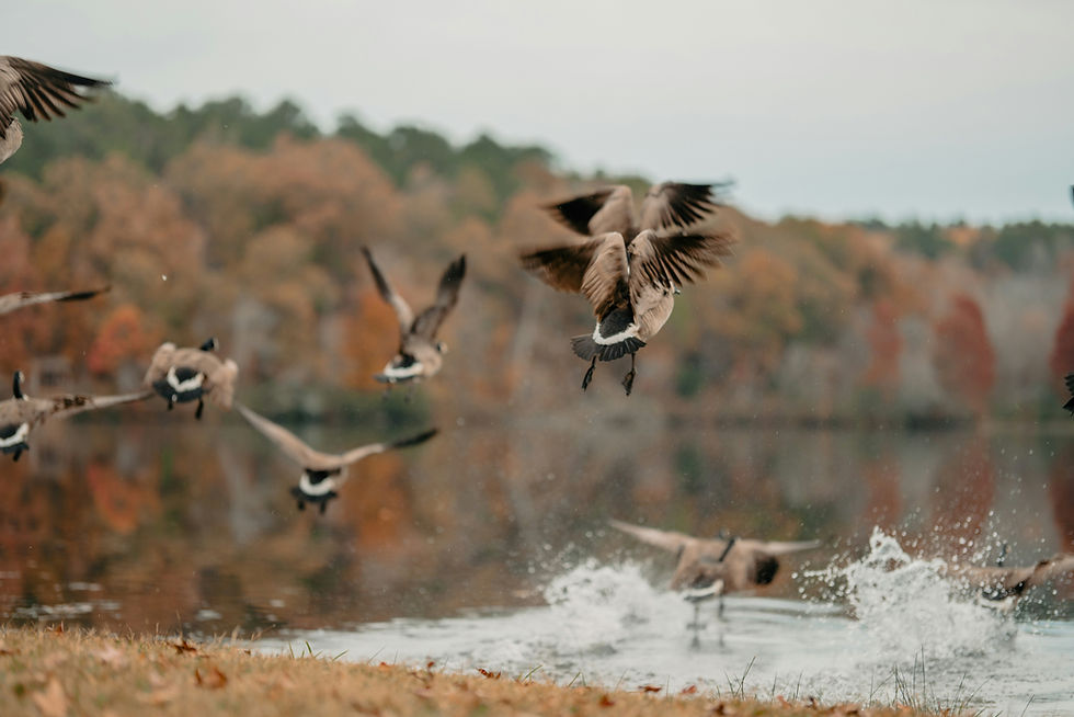
Greater white-fronted geese (Anser albifrons), the specklebellies familiar to Louisiana hunters, occur on the delta during migration, but the core of Louisiana's white-front wintering population sits on the rice and coastal prairies of southwest Louisiana. On the bird's-foot they are best thought of as a migration-period presence. The 2025 refuge survey's 18,993 geese, against more than 138,000 ducks, reflects how much the modern delta has become a duck landscape first.
The Mottled Duck: A Year-Round Sentinel
The mottled duck (Anas fulvigula) is the one species in this story that stays. It is a non-migratory resident of Gulf Coast marshes, closely related to the mallard and the American black duck, and the conservation plan identifies Delta NWR as an important area for mottled ducks in the eastern half of Louisiana.
Mottled ducks nest on the ground in dense grass and emergent vegetation from late winter through spring, often on slightly elevated ridges, spoil banks, or levee crowns where nests are less likely to flood. On the delta, high ground is scarce, and the plan observes that although mottled ducks are common on the refuge in summer, few nests have been documented. It calls for improving nesting habitat by managing vegetation on spoil banks and dredged-material sites, using dredged sediment to create nesting, brood-rearing, and molting habitat, working with LDWF to survey and band mottled ducks, and protecting nests from predators. Raccoons are major nest predators in Gulf Coast marshes, and American alligators (Alligator mississippiensis) take ducklings in fresh and brackish ponds.
Because the mottled duck cannot move north when Louisiana marsh degrades, it is a sentinel species, a direct readout of whether the coast can still support breeding waterfowl. That is why its harvest is handled conservatively. For the 2026-27 season, LDWF's East Zone rules close mottled duck harvest for the first 15 days of the regular season and allow 1 per day after that. Confirm current mottled duck regulations with LDWF before every season, because those rules are reviewed year to year.
Shorebirds on the Splays and Flats
The same mudflats that teal and pintail work in winter are crowded with shorebirds during spring and fall migration. The refuge describes thousands of shorebirds using its tidal mudflats and deltaic splays, and the conservation plan describes large concentrations sometimes seen feeding on refuge flats.
The delta's position makes it a critical stopover. The plan calls Delta NWR one of the first and last landforms available to trans-Gulf migrants, a description usually applied to songbirds that fits shorebirds crossing to and from Central and South America just as well. Species that use the delta and the Breton area include dunlin (Calidris alpina), western sandpiper (Calidris mauri), least sandpiper (Calidris minutilla), short-billed and long-billed dowitchers (Limnodromus spp.), and sanderling (Calidris alba). The threatened piping plover (Charadrius melodus) winters on the sand beaches of Breton NWR.
Shorebirds feed on the same invertebrate pulse that fuels teal. Western sandpipers and dunlin probe soft mud for worms, small clams, and crustaceans. Dowitchers stitch rapidly in slightly deeper water. On a delta with no water-control structures, the availability of this habitat depends entirely on wind, tide, and river stage.
Brown Pelicans, Breton NWR, and Menhaden
The brown pelican (Pelecanus occidentalis) is Louisiana's state bird, and its recovery is one of the best-known conservation stories in American wildlife management. Pesticide contamination, especially DDT compounds that thinned eggshells, eliminated brown pelicans from Louisiana by the 1960s. The conservation plan notes that the species was later reintroduced at Louisiana sites including North Island in the Chandeleurs, and that the state's population grew rapidly afterward, with Breton NWR becoming one of its most important nesting areas. The U.S. Fish and Wildlife Service removed the brown pelican from the endangered species list in 2009. It remains protected under the Migratory Bird Treaty Act.
Breton also shows how fragile that recovery is on a sinking coast. According to the 2008 plan, brown pelican nests on Breton averaged 6,000 to 8,000 before Hurricane Katrina and fell to about 2,500 in the seasons after the storm, as the islands lost much of the elevated ground that pelicans need to nest safely above the tides.
Pelicans connect to the delta through food. Brown pelicans are plunge-divers that feed mainly on schooling fish, and Gulf menhaden (Brevoortia patronus) are a key prey species along with mullet and other small fish. Gulf menhaden spawn offshore in winter, and their larvae and juveniles ride currents into estuaries such as Breton Sound and the delta marshes, where they grow on plankton fueled by river nutrients. The plan describes the Mississippi River delta as one of the largest and most productive estuaries in the world and an important nursery for fish, crabs, and shrimp. The same nutrient pulse that grows arrowhead on a new splay ultimately feeds pelicans nesting on islands miles offshore.
Roseau Cane: Backbone and Casualty
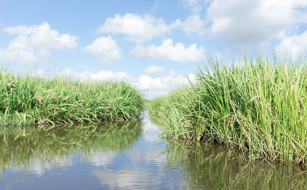
The tall reed that lines the passes and channels of the lower delta is roseau cane, the Louisiana name for common reed (Phragmites australis). On the bird's-foot delta, roseau cane has long been the dominant emergent plant on natural levees and along the outer marsh edge. Its dense rhizomes bind soft sediment and buffer waves, and its tall stands shelter ducks and marsh birds from wind.
In spring 2017, stands of roseau cane across the lower delta drew alarm as they browned and collapsed. A U.S. Geological Survey story published August 23, 2017, reported that preliminary estimates put the affected area at about 100,000 acres, including parts of Delta NWR and Pass-a-Loutre WMA. That figure was an early estimate, not a measured total. The same USGS work, drawing on satellite imagery analyzed in Open-File Report 2017-1098, found that the decline began in summer 2015, more than a year before the alarm, with a partial recovery during the 2016 growing season and a second decline from fall 2016 into April 2017.
Meanwhile, researchers had found something new in the dying stands. Knight and colleagues, writing in Biological Invasions in 2018, reported that a non-native scale insect from Asia, Nipponaclerda biwakoensis, now called the roseau cane scale, was found at high densities in dying stands in fall 2016, the first established population documented in North America. The paper identified the insect and its association with die-back; it did not measure the acreage affected. Because the satellite record shows decline starting before the scale was detected, USGS cautioned that the insect may not be the only cause, and the die-back is best understood as a problem with more than one stressor.
For waterfowl, cane die-back cuts both ways. Losing cane on exposed shorelines can let waves erode marsh edges faster and convert emergent marsh to open water, a long-term loss. In some interior areas, collapsed cane opens space that annual plants such as wild millet and arrowhead can colonize, at least for a while. How the delta's cane stands recover over the long run remains one of its biggest research gaps.
Managing a Landscape With No Water-Control Structures
Most Southeastern refuges manage waterfowl habitat with impoundments and pumps: draw down in summer to germinate moist-soil plants, flood in fall to make seeds available. Delta NWR cannot. With no water-control structures, every management action on the refuge targets the land itself, or the people using it, rather than the water level. The tools fall into four categories.
Crevasses are the first and most important. The conservation plan proposes new crevasses where levees or spoil banks have cut ponds and bays off from sediment-laden water, and it proposes restoring flow to existing crevasses, calling splays critical habitat for migratory waterfowl. The CWPPRA Delta Wide Crevasses project described earlier is the long-running vehicle for that work.
Beneficial use of dredged material is the second. The Corps of Engineers dredges large volumes of sediment to keep the river navigable. The plan proposes placing some of that material in open bays on the refuge, stacked high enough that it will not compact back underwater, and planting it where needed. Dredged sediment is also the plan's main tool for creating the elevated ground mottled ducks lack.
Terracing is sometimes described as a Delta NWR tool, but the refuge plan does not list it there. The nearest terrace work is upriver. The CWPPRA Delta Management at Fort St. Philip project (BS-11), led by the U.S. Fish and Wildlife Service, sits on the east bank of Plaquemines Parish across from Fort Jackson. It built six artificial crevasses and linear earthen terraces in a receiving bay to trap sediment and cut wave energy, with construction completed December 14, 2006, and 267 net acres benefitted, according to its CWPPRA status report. That project shows how terraces and crevasses can work together, but it is not water-level management, and it is not on the bird's-foot refuge.
Protection is the fourth tool. The plan commits the refuge to monthly waterfowl surveys in winter plus the midwinter survey, cooperative mottled duck banding with LDWF, and predator control to protect nesting birds. The refuge's 2026-2027 public use brochure keeps a large disturbance-free core: all public entry is prohibited between Main Pass and Raphael Pass from November 1 through the end of February, year-round access is limited to Main, Raphael, Octave, Women, and Flatboat passes, and the land and water of Main Pass are closed to waterfowl, goose, and dove hunting. Waterfowl hunting, including teal, coots, geese, and the light goose conservation season, is allowed only northwest of Main Pass and south of Raphael Pass, on Wednesdays, Thursdays, Saturdays, and Sundays until 2 p.m. The refuge applies the same days, hours, and areas to its 2026 black-bellied whistling duck season. Those afternoon closures and rest days give feeding birds long undisturbed stretches on the flats. Confirm current refuge rules with the U.S. Fish and Wildlife Service before any visit.
Those refuge rules sit inside the state framework. Plaquemines Parish lies in LDWF's East Zone, whose boundary the Louisiana Wildlife and Fisheries Commission adopted in August 2025 for the 2026-27 through 2029-30 seasons. For 2026-27, LDWF lists the East Zone regular duck season as November 21 through December 6 and December 19 through January 31, with youth and veterans days on November 14 and February 6, and a daily duck limit of 6 with species sublimits. Confirm current regulations with LDWF before hunting.
One Storm Away: Hurricanes and the Exposed Delta
No part of Louisiana is more exposed to the Gulf than the bird's-foot delta. The conservation plan lists tropical storms, subsidence, sea-level rise, and oil and gas development among the major threats driving land loss on Delta and Breton refuges, and it names a series of twentieth- and early twenty-first-century hurricanes, including Camille in 1969 and Katrina and Rita in 2005, as storms that caused notable vegetation and land loss.
Hurricane Katrina came ashore in lower Plaquemines Parish on August 29, 2005. The 2008 plan includes before-and-after imagery of the refuge and makes clear that the storm reshaped it, but it also states that the exact wetland loss on Delta NWR was not calculated. That restraint is worth respecting: there is no reliable refuge-wide acreage figure for Katrina's damage. Breton NWR was hit harder still. The plan reports that some estimates put the loss of the islands' existing landform as high as 70 percent, which is why its pelican colonies collapsed.
Hurricane Ida in 2021 delivered another blow to the region. The National Hurricane Center records Ida making landfall near Port Fourchon as a Category 4 storm on August 29, 2021, and lower Plaquemines Parish took severe surge. A comprehensive assessment of Ida's effects on Delta NWR vegetation has not been published.
The plan draws a sobering conclusion from this history: the most critical issue facing the refuge is land loss from subsidence, erosion, major storms, sea-level rise, and saltwater intrusion, together with the possibility that the current delta could be given up in favor of restoration closer to New Orleans. A refuge built by a single crevasse can be rearranged by a single storm.
The Bohemia Spillway and the Sediment Question
Upriver from the bird's-foot, on the east bank of Plaquemines Parish, lies a landscape that answers a question restoration scientists argue about: what happens if you simply let the river overflow? The Bohemia Spillway begins about 40 river miles below New Orleans and runs 11.8 miles along the east bank, about 3 miles wide, according to a 2014 study by Lopez, Henkel, and colleagues in the Gulf Coast Association of Geological Societies Journal. The state authorized the spillway in 1924, and the artificial river levees there were removed in 1926 as a flood-relief outlet. Since then, high river stages have periodically crossed the natural levee and spread over the wetlands behind it, much as the river behaved before levees. The same study measured a peak overbank flow of 30,000 to 50,000 cubic feet per second during the 2011 flood.
What happened to the land is the interesting part. The 2014 paper mapped most of the spillway's land loss between 1932 and 1975 and described land-loss rates in its record through 2010 as negligible, tying that stability to the fresh water, nutrients, and sediment the area receives in high river events. The Pontchartrain Conservancy summarizes the same history as low land-loss rates since 1975 and credits pulsed river flow since 1926 with helping the marshes. Neither source is a 2026 survey, but together they make Bohemia a natural experiment in sediment delivery that has now run for a century.
That experiment matters for the bird's-foot because it points to the variable that decides the delta's future. Every tool that has kept duck habitat alive at the river's mouth, from Cubits Gap to modern crevasse cuts to the beneficial use of dredged sediment, comes down to the same thing: getting river mud onto marsh instead of past it. The conservation plan saw this tension years ago. It flagged the possible abandonment of the bird's-foot in favor of diversions and other restoration upriver as an emerging threat, and asked that the refuge's resource values be mitigated if they were lost to upstream decisions.
The Mississippi Flyway funnels birds from prairie potholes, boreal forest, and Arctic tundra down the river's valley to the Gulf. Delta NWR and Pass-a-Loutre WMA are where that funnel finally empties. The ducks that winter here depend on the same process that drew them in the 1930s: a river actively building shallow, productive marsh. The bird's-foot delta is a reminder that the most productive habitat in the flyway can also be the most temporary, and that whether the end of the road at Venice still opens onto a landscape that holds a hundred thousand ducks will be decided by how much of the Mississippi's sediment is allowed to keep doing what it has always done.
Frequently Asked Questions
How big is Delta National Wildlife Refuge, and can you drive to it?
The U.S. Fish and Wildlife Service's 2008 Comprehensive Conservation Plan lists Delta NWR at 48,799 acres in Plaquemines Parish, and the 2026-2027 refuge brochure rounds that to about 48,800. You cannot drive to it. The refuge sits at the mouth of the Mississippi River below Venice, where the road ends, and it is reachable only by boat.
What ducks are most common at Delta NWR in winter?
The refuge's 2008 plan names gadwall, northern pintail, American wigeon, and green-winged teal as the most common species, along with snow geese, and says use peaks in mid-December and January. The most recent published refuge count, flown in January 2025, estimated 156,817 waterfowl on Delta NWR, including 95,615 dabbling ducks. Blue-winged teal pass through in fall and spring, and mottled ducks live on the delta year-round.
Is the refuge managed with levees and water-control structures?
No. The 2008 plan describes Delta NWR as an open system with no water-control structures, which sets it apart from refuges built around moist-soil impoundments and pumps. Management works on the land instead, mainly by cutting and maintaining crevasses that let sediment-laden river water build new marsh, and by placing dredged material in open bays.
What plants do ducks eat on the fresh marsh at the mouth of the river?
The 2008 plan names delta duck potato, elephant ear, wild millet, and three-square as the predominant plants of the refuge's fresh marsh. Ducks and geese dig duck potato tubers and bulrush roots, and dabblers strip seeds from millet and three-square. Widgeongrass, often cited as a delta duck food, is listed in the plan with the seagrasses of the shallow bays around Breton NWR rather than the refuge's fresh marsh.
What is the roseau cane scale, and what did the 2018 study actually show?
The roseau cane scale, Nipponaclerda biwakoensis, is a non-native insect from Asia. A 2018 paper in Biological Invasions reported that it was found in fall 2016 at high densities in dying roseau cane stands in the lower delta, the first established population in North America. The paper did not measure a die-back acreage, and USGS satellite work found that cane decline began in summer 2015, before the insect was detected.
When is duck season in Plaquemines Parish for 2026-27, and which days can you hunt on Delta NWR?
Plaquemines is in LDWF's East Zone, where the 2026-27 regular duck season runs November 21 through December 6 and December 19 through January 31, with youth and veterans days on November 14 and February 6. The 2026-2027 refuge brochure allows waterfowl hunting on Delta NWR on Wednesdays, Thursdays, Saturdays, and Sundays until 2 p.m., only northwest of Main Pass and south of Raphael Pass. Confirm current regulations with LDWF and the U.S. Fish and Wildlife Service before you go.
What is the difference between Delta NWR and Pass-a-Loutre WMA?
Delta NWR is a federal refuge of 48,799 acres managed by the U.S. Fish and Wildlife Service. Pass-a-Loutre is a state wildlife management area of about 115,000 acres run by the Louisiana Department of Wildlife and Fisheries, roughly 10 miles south of Venice. Both are boat-only, both sit on the bird's-foot delta, and both rely on crevasses to build marsh, but each has its own rules.
How did Hurricane Katrina affect Delta NWR?
Katrina struck lower Plaquemines Parish on August 29, 2005. The refuge's 2008 plan says exact wetland loss on Delta NWR was not calculated, though its before-and-after imagery shows substantial change. On neighboring Breton NWR, some estimates put island landform loss as high as 70 percent, and brown pelican nests fell from a pre-storm average of 6,000 to 8,000 to about 2,500.
Full Citations and Sources
Government and agency sources
U.S. Fish and Wildlife Service -- Delta and Breton National Wildlife Refuges Comprehensive Conservation Plan (2008) -- https://www.fws.gov/sites/default/files/documents/DeltaBreton_2008_CCP.pdf -- accessed October 2026
U.S. Fish and Wildlife Service -- Delta National Wildlife Refuge -- https://www.fws.gov/refuge/delta -- accessed October 2026
U.S. Fish and Wildlife Service -- Southeast Louisiana Refuges Complex Annual User Brochure, 2026-2027 -- https://www.fws.gov/sites/default/files/documents/2026-09/se-la-hunt-regs-2026_sept2026web.pdf -- accessed October 2026
U.S. Fish and Wildlife Service -- Marty and others, Midwinter Aerial Waterfowl Surveys on National Wildlife Refuges in the Southeast, 2025 -- https://iris.fws.gov/APPS/ServCat/DownloadFile/274023 -- accessed October 2026
U.S. Fish and Wildlife Service -- Brown Pelican Populations Recovered, Removed from Endangered Species List (2009) -- https://www.fws.gov/press-release/2009-11/brown-pelican-populations-recovered-removed-endangered-species-list -- accessed October 2026
U.S. Geological Survey -- Invasive Pest May Not Be Only Cause of Recent Louisiana Marsh Die-off (August 23, 2017) -- https://www.usgs.gov/news/featured-story/invasive-pest-may-not-be-only-cause-recent-louisiana-marsh-die -- accessed October 2026
U.S. Geological Survey -- Ramsey and Rangoonwala, Open-File Report 2017-1098 -- https://pubs.usgs.gov/of/2017/1098/ -- accessed October 2026
Louisiana Department of Wildlife and Fisheries -- Seasons and Regulations -- https://www.wlf.louisiana.gov/page/seasons-and-regulations -- accessed October 2026
Louisiana Department of Wildlife and Fisheries -- LWFC Adopts Two-Zone East/West Boundary for 2026-30 Waterfowl Hunting Seasons (August 7, 2025) -- https://www.wlf.louisiana.gov/news/lwfc-adopts-twozone-eastwest-boundary-for-202630-waterfowl-hunting-seasons -- accessed October 2026
Louisiana Department of Wildlife and Fisheries -- Pass-a-Loutre Wildlife Management Area -- https://www.wlf.louisiana.gov/page/passaloutre -- accessed October 2026
CWPPRA (LaCoast) -- Delta Wide Crevasses (MR-09) project status report -- https://lacoast.gov/new/Pubs/reports/manager.aspx?projectNumber=MR-09 -- accessed October 2026
CWPPRA (LaCoast) -- Delta Management at Fort St. Philip (BS-11) project status report -- https://lacoast.gov/new/Pubs/reports/manager.aspx?projectNumber=BS-11 -- accessed October 2026
National Hurricane Center -- Tropical Cyclone Report: Hurricane Ida (AL092021) -- https://www.nhc.noaa.gov/data/tcr/AL092021_Ida.pdf -- accessed October 2026
Research sources
Knight, I.A., Wilson, B.E., Gill, M., Aveles, L., Cronin, J.T., Nyman, J.A., Schneider, S.A., and Diaz, R. -- Invasion of Nipponaclerda biwakoensis and Phragmites australis die-back in southern Louisiana, Biological Invasions 20:2739-2744 (2018) -- https://doi.org/10.1007/s10530-018-1749-5 -- accessed October 2026
Lopez, J.A., Henkel, T.M., and others -- Deltaic processes of Mississippi River outlets, Caernarvon Delta and Bohemia Spillway, Gulf Coast Association of Geological Societies Journal 3:79-93 (2014) -- https://gcags.org/Journal/2014.gcags.journal/GCAGS.Journal.2014.vol3.p79-93.Lopez.et.al.pdf -- accessed October 2026
Pontchartrain Conservancy -- Bohemia Spillway -- https://scienceforourcoast.org/bohemia-spillway -- accessed October 2026

Comments