
Wild Hog Ecology Across Louisiana's North Coastal Prairie

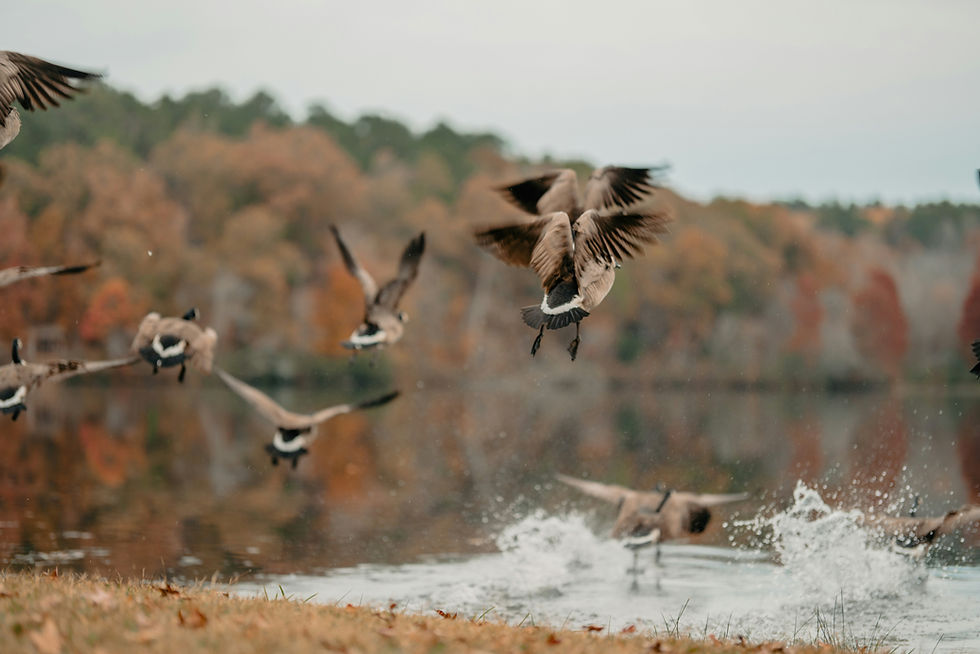
Drive south out of Crowley or Jennings on a winter morning and the landscape reads like a single continuous sheet of water and stubble, rice checks flooded for waterfowl stretching toward a horizon where the last low ridges of oak and hackberry -- the cheniers that give this coast its name -- mark the beginning of marsh. Snow geese lift off distant fields in white sheets. Pintails work the flooded stubble. It is one of the great wintering grounds of the Mississippi Flyway, built on a working partnership between rice farmers and the birds that glean their fields. Feral hogs do not respect the line between the two systems. A sounder that roots through a rice levee in Jefferson Davis Parish tonight may be wallowing in a brackish marsh pond in Cameron Parish within the week, moving along the same canal network that carries irrigation water to the fields and drainage water to the Gulf. Louisiana's North Coastal Prairie -- the rice-farming belt of Vermilion, Cameron, Calcasieu, and Jefferson Davis parishes and the Chenier Plain marshes that fringe it -- is a landscape where feral swine exploit both an agricultural economy and a wetland ecosystem simultaneously, and where the damage in one system compounds the vulnerability of the other.
A Rice Economy Built for Waterfowl -- and Vulnerable to Hogs
Southwest Louisiana's rice belt, centered on Vermilion, Acadia, Calcasieu, and Jefferson Davis parishes, is among the most concentrated rice-production landscapes in North America, and Louisiana is consistently ranked among the top three rice-producing states nationally, according to USDA National Agricultural Statistics Service data. The crop is grown on a levee-and-flood-irrigation platform: fields are enclosed by earthen levees, typically 18 to 24 inches high, that hold floodwater through the growing season and, after harvest, are re-flooded across large acreages specifically to attract wintering waterfowl to feed on waste grain. That post-harvest flooding is not incidental habitat -- it is a deliberate, decades-old management practice that has made the rice prairie a secondary wintering complex for the Mississippi Flyway, functioning alongside the Chenier Plain's natural marshes to support pintails, snow geese, greater white-fronted geese, and a long list of dabbling ducks through the winter months.
Feral hogs interact with this system at nearly every stage of the agricultural calendar, and the same levee-and-flood infrastructure that makes the prairie valuable to waterfowl is what makes it vulnerable to hogs. LSU AgCenter research published in 2022 put Louisiana's total annual feral hog damage to agriculture at $91.1 million statewide -- $66.2 million in direct crop losses and $24.9 million in additional costs including labor, equipment, and structural repair -- with rice consistently named among the crops sustaining the greatest losses. A precise, parish-level breakdown of that figure specific to the rice-and-marsh coastal prairie has not been published, so any narrower dollar estimate for this sub-region should be treated as an approximation drawn from the broader statewide damage literature rather than a confirmed figure.
What is well documented is the mechanism: hogs use the canal-and-levee grid that keeps rice fields flooded and drained as a travel corridor, moving between fields, crawfish ponds, and marsh edges with the seasons. That mobility, combined with the crop's susceptibility at nearly every growth stage, is what elevates rice-belt hog damage above the more contained, single-season damage patterns typical of row-crop agriculture elsewhere in the Southeast.
Part of what makes the canal network so central to hog movement here is basic physiology. Feral swine lack functional sweat glands and depend on wallowing in mud or water to shed metabolic heat through Louisiana's long, humid summers, which concentrates animals near canals, crawfish ponds, and rice-field edges throughout the warmer months and shapes both their daily activity windows and their willingness to cross open ground between habitat patches. Sounders in this zone tend to compress activity into the pre-dawn and post-sunset hours during peak summer heat, spending midday wallowing near permanent water -- a pattern that also happens to coincide with the nocturnal field-entry behavior that makes rice-belt hogs so difficult for farmers to observe directly, even as the damage accumulates.
Levee Breaches, Seedbed Losses, and the Waste-Grain Problem
Levee rooting is the most operationally disruptive form of hog damage on the rice prairie. Hogs root through the earthen berms seeking soil invertebrates, earthworms, and moisture-retained roots and tubers, and a single compromised levee section can drain the floodwater a field depends on within hours, often forcing emergency repair before a stand failure becomes total. Because rice fields are typically organized into connected irrigation units, one breach can cascade into water loss across several fields tied to the same system -- a single night's rooting can become a multi-field problem by morning.
The crop is also acutely exposed during germination and early tillering. A sounder of ten to fifteen animals can devastate several acres of newly planted rice in one nocturnal visit, rooting up seed before it establishes. This window of maximum vulnerability -- April through May for the spring-planted main crop, July through August for the ratoon crop that many Louisiana producers take off the same fields a second time -- lines up closely with the period when sows are farrowing and juvenile hogs from the spring litters are mobile and calorically demanding, a coincidence of timing that intensifies pressure on the crop precisely when the animals need the most food.
Late in the season, the threat shifts to direct grain consumption. Rice in the dough-to-mature stage, typically August through September for the main crop, is eaten outright by hogs entering fields at night, and concentrated feeding can render a paddy commercially worthless before harvest. This is also the stage that matters most to wintering waterfowl, since post-harvest waste grain in flooded stubble is a primary food source for pintails and geese through the winter. Grain a sounder consumes before harvest is grain that never becomes waste grain in a flooded winter field -- a direct, if hard to quantify, subtraction from the food base that the rice-waterfowl partnership depends on.
The rice-crawfish rotation common across the coastal prairie, in which the same field cycles between flooded rice production and crawfish pond function within a single agricultural year, compounds the exposure. Hogs wallowing in shallow crawfish ponds generate turbidity that stresses crawfish during sensitive periods and damage the same pond levees and ditch banks that rice-season infrastructure depends on, meaning a single sounder's activity can degrade both halves of a rotational operation rather than just one crop.
The Chenier Plain: A Marsh System Already Losing Ground
South and west of the rice prairie, the Chenier Plain -- named for the low, oak-and-hackberry-covered beach ridges (cheniers, from the French for oak) that rise a few feet above the surrounding wetlands -- forms one of the largest expanses of coastal marsh remaining on the Gulf Coast, spanning fresh, intermediate, brackish, and saline marsh zones between the rice belt and the open Gulf. Public and conservation lands including Sabine National Wildlife Refuge, Cameron Prairie National Wildlife Refuge, and the boat-access Marsh Island State Wildlife Management Area anchor the system, and it functions as a secondary but ecologically significant wintering complex for Mississippi Flyway waterfowl alongside the rice prairie to its north.
This marsh system is already under sustained pressure from subsidence, historical canal dredging, and relative sea-level rise, and coastal Louisiana as a whole has lost wetland acreage at rates that have made it one of the most studied land-loss landscapes in the country over recent decades. Feral hog expansion into the intermediate and fresh marsh zones of the Chenier Plain adds a further disturbance to a system that has little ecological slack left to absorb one. Hog rooting on tidal flats and marsh edges destabilizes the root mats of Spartina alterniflora and Spartina patens, the dominant salt- and brackish-marsh grasses of the Louisiana coast, accelerating the kind of edge erosion and bank failure the marsh is already experiencing from other causes.
The impact extends to the emergent freshwater vegetation communities that impoundment managers cultivate specifically for waterfowl food production. Rooting exposes and damages the rhizome networks of plants like arrowhead (Sagittaria spp.), spatterdock (Nuphar advena), and cattail (Typha spp.), which provide both food and nesting structure. Where impoundment management depends on maintaining these plant communities to support wintering ducks, hog rooting works directly against the investment.
Mottled ducks (Anas fulvigula), a nonmigratory dabbling duck largely restricted to Gulf Coast marshes and one of the signature breeding waterfowl of the Chenier Plain, nest on the ground in marsh vegetation and are vulnerable to the same opportunistic nest predation that feral hogs inflict on other ground-nesting birds across the Southeast. Research elsewhere in the region has documented feral swine involved in a meaningful share of nest-predation events on ground-nesting gamebirds, and the marsh-nesting mottled duck faces a comparable exposure wherever hog activity overlaps its nesting habitat, though marsh-specific predation-rate data for mottled ducks has not been published at the resolution this dossier could confirm.
Cameron Parish: Saltwater Intrusion and a Landscape Still Rebuilding
Cameron Parish, Louisiana's southernmost coastal parish, occupies the front line of this system, fronting the Gulf of Mexico directly and absorbing the worst of the marsh loss, storm damage, and saltwater intrusion documented across the Chenier Plain. The parish took direct hits from Hurricane Rita in 2005 and Hurricane Laura in 2020, and the compounding effect of repeated storms on an already-subsiding coastline has pushed saline water further inland in places, converting stands of fresh and intermediate marsh toward brackish and saline plant communities less able to support the dense, food-rich vegetation that waterfowl and other marsh wildlife depend on.
Feral hog rooting interacts with this conversion process in a way that works against natural recovery. Where saltwater intrusion opens up bare or thinly vegetated ground, native fresh-marsh grasses like Spartina patens and maidencane (Panicum hemitomon) need stable, undisturbed root mats to recolonize and hold that ground against further erosion. Hog rooting in these same transition zones disturbs the soil and root structure at the precise locations where recolonization would otherwise be most likely, making it harder for the marsh to reclaim ground even where hydrological conditions might allow it. This is not a mechanism unique to hogs -- storm damage, subsidence, and altered hydrology are the primary drivers of Chenier Plain marsh loss -- but it is an additional, human-manageable disturbance layered onto a landscape with very little redundancy left.
The remote, often boat-access character of much of the Cameron Parish marsh interior limits both the hunting and removal pressure applied to hogs there and the scientific documentation of their specific impacts, a monitoring gap that several source assessments of this coastal zone flag directly. What is established with more confidence is the general pattern: feral swine follow water and food resources along canal and marsh-edge corridors, and the canal network built over decades for oil and gas access, navigation, and drainage across the Chenier Plain gives them ready corridors into marsh habitat that would otherwise be difficult to reach on foot.
Reproduction, Sounders, and the Limits of Removal
Feral swine are among the most reproductively prolific large mammals in North America, and that biology is a central reason the coastal-prairie hog problem persists despite Louisiana's permissive removal framework. Sows in high-resource environments can reach sexual maturity as early as eight to ten months of age, gestation runs about 114 days, and sows in productive habitat can average roughly one and a half litters per year, with litters typically ranging from four to eight piglets. Population growth modeling for the species consistently shows that annual removal rates below roughly two-thirds to seventy percent of a local population still allow net growth the following year -- a threshold that recreational hunting, trapping, and professional removal combined have not been shown to consistently exceed anywhere in the state.
The coastal prairie's food resources make this dynamic especially acute. Sounders here -- typically matrilineal groups of two to three sows and their offspring, ranging from roughly four to twenty animals -- have access to spatially predictable, high-calorie food in the form of rice at multiple growth stages, crawfish ponds, and canal-margin invertebrates nearly year-round, which supports smaller home ranges and higher local density than the more dispersed, seasonally variable food base available to hogs in Louisiana's forested interior. That density is precisely what makes whole-sounder trapping, rather than incidental hunting, the operationally necessary tool for meaningful damage reduction on rice farms and marsh edges alike: removing a few animals from a sounder without capturing the group leaves the reproductive core intact and can teach survivors, particularly the lead sow, to avoid the next trap deployment for months.
Managing Hogs Across an Open, Two-Habitat Landscape
The flat, largely treeless topography of the rice prairie and open marsh gives wildlife managers one advantage feral hog populations rarely offer elsewhere in the Southeast: unobstructed sight lines. Helicopter gunning -- a rifleman or shotgunner working from a low-flying helicopter -- is among the most effective single-event removal tools available to professional damage-management programs, and the open field architecture of the Cajun Prairie and adjoining marsh is one of the more suitable landscapes in Louisiana for this method, subject to airspace and safety constraints. USDA APHIS Wildlife Services maintains regional helicopter teams operating on a cooperative-agreement basis across the Southeast, and Louisiana's coastal prairie parishes sit within reach of that program.
That same open terrain becomes a liability in the marsh interior, where dense emergent vegetation, soft substrate, and limited road access make aerial spotting and ground pursuit far harder than in a mowed rice field -- a contrast that mirrors the operational difficulty USDA and LDWF crews face in Louisiana's swamp habitats generally. Whole-sounder corral trapping, using systems such as suspended-drop traps with camera confirmation or corral-style enclosures, is the primary recommended method for the marsh fringe and for rice-farm damage control alike, since it removes an entire matrilineal family group in one event rather than educating survivors to avoid future capture.
The Louisiana Department of Wildlife and Fisheries (LDWF) classifies feral hogs as an invasive species under the state's outlaw-quadruped statute, removing them from game-species protections entirely -- no closed season, no bag limit, and permitted night hunting on private land, a regulatory posture consistent with treating hog removal as a public good rather than a managed hunt. LDWF coordinates with USDA APHIS Wildlife Services on state Wildlife Management Areas and cooperates with private landowners through agreements that bring professional trapping and aerial removal to rice farms and marsh properties alike. USDA NRCS's Feral Swine Eradication and Control Pilot Program, authorized under the 2018 Farm Bill, has directed cost-share funding to landowners in high-damage areas, and the rice-belt parishes are a natural priority given the concentration of agricultural loss documented there. The LSU AgCenter cooperative extension network remains the primary channel through which damage-control guidance reaches individual rice farmers, connecting parish agents directly to the producers experiencing levee and seedbed losses in real time.
Landowner cooperative agreements are the practical backbone of removal work on a landscape this fragmented between agricultural and marsh ownership. Because the coastal prairie has no public-land hog hunting equivalent to a national forest, effective removal depends on farmers and marsh landowners granting access to USDA Wildlife Services crews, LDWF-cooperating trappers, or private operators, and on those parties sharing information about sounder movement between properties. Operators and landowners who field-dress or handle large numbers of animals as part of sustained removal work should also treat routine precautions as standard occupational practice: Brucella suis, which causes brucellosis, is enzootic in Louisiana's feral swine population, and exposure occurs primarily through contact with blood or reproductive fluids during field dressing, making gloves, eye protection, and thorough handwashing basic safeguards for anyone regularly processing removed animals in this region.
Key Takeaways
Louisiana's rice prairie and the Chenier Plain marshes function as one connected wintering system for Mississippi Flyway waterfowl, and feral hogs move freely between both halves of it, exploiting rice-field infrastructure and marsh habitat on the same seasonal rounds.
Rice agriculture is vulnerable to hog damage across its entire growing season -- levee breaches that drain floodwater, seedbed rooting at planting, and direct grain consumption before harvest -- with statewide feral hog damage to Louisiana agriculture estimated at $91.1 million annually by LSU AgCenter, of which rice is consistently named among the highest-loss crops, though a rice-specific dollar figure for the coastal prairie sub-region has not been separately published.
In the Chenier Plain, hog rooting on marsh edges and fresh-marsh transition zones adds disturbance to a coastline already losing ground to subsidence, historical canal construction, and storm damage from hurricanes including Rita and Laura, working against the natural recolonization of Spartina and Panicum marsh grasses in areas where saltwater has pushed inland.
Citations and Sources
This article draws on LDWF regulatory and species-management materials, LSU AgCenter agricultural damage research, USDA APHIS feral swine program documentation, and peer-reviewed wildlife literature on Sus scrofa ecology; readers should confirm current population figures, regulations, and program status directly with the cited agencies before relying on them for operational decisions.
Agencies and research
Primary agency sources include the Louisiana Department of Wildlife and Fisheries (LDWF), which classifies feral hogs as outlaw quadrupeds and administers the state's wildlife and Wildlife Management Area programs including Marsh Island State WMA; the U.S. Fish and Wildlife Service, which manages Sabine National Wildlife Refuge and Cameron Prairie National Wildlife Refuge within the Chenier Plain; USDA APHIS Wildlife Services and the National Feral Swine Damage Management Program, which coordinate trapping and aerial removal operations in Louisiana; USDA NRCS, which administers the Feral Swine Eradication and Control Pilot Program; and the LSU AgCenter, whose cooperative extension network and published damage research anchor the agricultural-loss figures cited here.
Peer-reviewed literature
Referenced research includes LSU AgCenter's 2022 statewide feral hog agricultural damage assessment; USDA APHIS documentation on feral swine impacts to water quality and wetland systems; general wild pig diet and foraging-ecology literature (including Ballari and Barrios-Garcia's review of Sus scrofa diet selection); reproductive-biology research on invasive wild pigs (Chinn et al., Journal of Wildlife Management, 2022); and the broader body of USDA and university extension literature on feral swine impacts to ground-nesting birds and wetland vegetation communities that informs the marsh-ecology sections above.
Confidence note: The statewide Louisiana feral hog damage figure ($91.1 million annually, LSU AgCenter 2022) is well sourced, but no published breakdown allocates a specific dollar figure to the rice-belt or coastal-prairie sub-region alone, so any narrower cost estimate in this piece is presented as an approximation drawn from that statewide figure rather than a confirmed sub-regional number. Louisiana's statewide feral hog population estimate (roughly 700,000 to 900,000 animals per recent LDWF-informed figures, up from an earlier 600,000 to 700,000 range) is a state-level figure, not a parish-level count, and no parish-specific density survey for the coastal prairie was identified in source research. Claims about hog impacts on mottled duck nest predation and on Chenier Plain marsh vegetation recovery are grounded in general feral swine ecology literature and documented marsh-loss dynamics rather than site-specific coastal-prairie studies, since dedicated research on hog impacts within this exact marsh system is limited; these points are framed accordingly as plausible extensions of established patterns. The characterization of Chenier Plain wetland loss reflects the well-documented, multi-decade trend of Louisiana coastal land loss driven primarily by subsidence, historical canal dredging, and sea-level rise, with hog rooting described as an additional, secondary disturbance rather than a primary driver.
Explore More
For related reading on the ecology connecting this landscape to the wider Southeast and the Mississippi Flyway, see the following Pine & Marsh field reports.

Comments